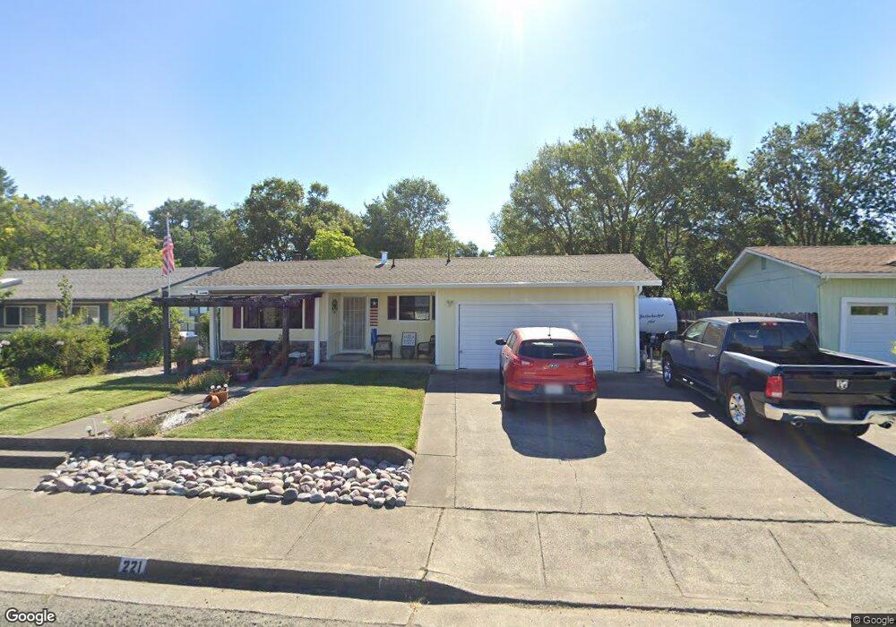
221 Bonnie Ln Willits, CA 95490
Estimated Value: $301,000 - $374,000
--
Bed
--
Bath
--
Sq Ft
5,837
Sq Ft Lot
About This Home
This home is located at 221 Bonnie Ln, Willits, CA 95490 and is currently estimated at $341,461. 221 Bonnie Ln is a home located in Mendocino County with nearby schools including Blosser Lane Elementary School, Brookside Elementary School, and Baechtel Grove Middle School.
Ownership History
Date
Name
Owned For
Owner Type
Purchase Details
Closed on
Jul 28, 2022
Sold by
Mcclelland Dennis E
Bought by
Dennis E Mcclelland Family Trust
Current Estimated Value
Purchase Details
Closed on
Jul 24, 2020
Sold by
Mcclelland Virginia G
Bought by
Mcclelland Dennis E
Home Financials for this Owner
Home Financials are based on the most recent Mortgage that was taken out on this home.
Original Mortgage
$123,000
Interest Rate
3.2%
Mortgage Type
New Conventional
Purchase Details
Closed on
Jul 10, 2020
Sold by
Mcclelland Virginia G and Mcclelland Virginia G
Bought by
Mcclelland Dennis E
Home Financials for this Owner
Home Financials are based on the most recent Mortgage that was taken out on this home.
Original Mortgage
$123,000
Interest Rate
3.2%
Mortgage Type
New Conventional
Create a Home Valuation Report for This Property
The Home Valuation Report is an in-depth analysis detailing your home's value as well as a comparison with similar homes in the area
Home Values in the Area
Average Home Value in this Area
Purchase History
| Date | Buyer | Sale Price | Title Company |
|---|---|---|---|
| Dennis E Mcclelland Family Trust | -- | None Listed On Document | |
| Mcclelland Dennis E | -- | -- | |
| Mcclelland Dennis E | -- | Placer Title Company |
Source: Public Records
Mortgage History
| Date | Status | Borrower | Loan Amount |
|---|---|---|---|
| Previous Owner | Mcclelland Dennis E | $123,000 | |
| Previous Owner | Mcclelland Dennis E | $123,000 |
Source: Public Records
Tax History Compared to Growth
Tax History
| Year | Tax Paid | Tax Assessment Tax Assessment Total Assessment is a certain percentage of the fair market value that is determined by local assessors to be the total taxable value of land and additions on the property. | Land | Improvement |
|---|---|---|---|---|
| 2025 | $2,704 | $147,394 | $25,363 | $122,031 |
| 2023 | $2,704 | $141,673 | $24,379 | $117,294 |
| 2022 | $2,500 | $138,896 | $23,901 | $114,995 |
| 2021 | $2,488 | $136,174 | $23,433 | $112,741 |
| 2020 | $2,449 | $134,855 | $23,218 | $111,637 |
| 2019 | $2,446 | $132,212 | $22,763 | $109,449 |
| 2018 | $2,276 | $129,620 | $22,317 | $107,303 |
| 2017 | $2,190 | $127,079 | $21,879 | $105,200 |
| 2016 | $2,127 | $124,588 | $21,450 | $103,138 |
| 2015 | $2,103 | $122,717 | $21,128 | $101,589 |
| 2014 | $2,085 | $120,313 | $20,714 | $99,599 |
Source: Public Records
Map
Nearby Homes
- 201 Bonnie Ln
- 65 Nancy Ln
- 450 Grove St
- 1750 S Main St Unit 37
- 1591 S Main St
- 1389 Eva Clair St
- 19925 S Main St
- 19925 S Main St Unit 18
- 0 Poplar Ave Unit 325063064
- 1655 Hilltop Dr
- 1051 S Main St
- 454 Della Ave
- 481 Della Ave
- 490 Della Ave
- 19401 Walker Rd Unit 12
- 755 Central Ave
- 0 Muir Mill Rd
- 80 Fort Bragg Rd
- 458 E San Francisco Ave
- 288 E San Francisco Ave