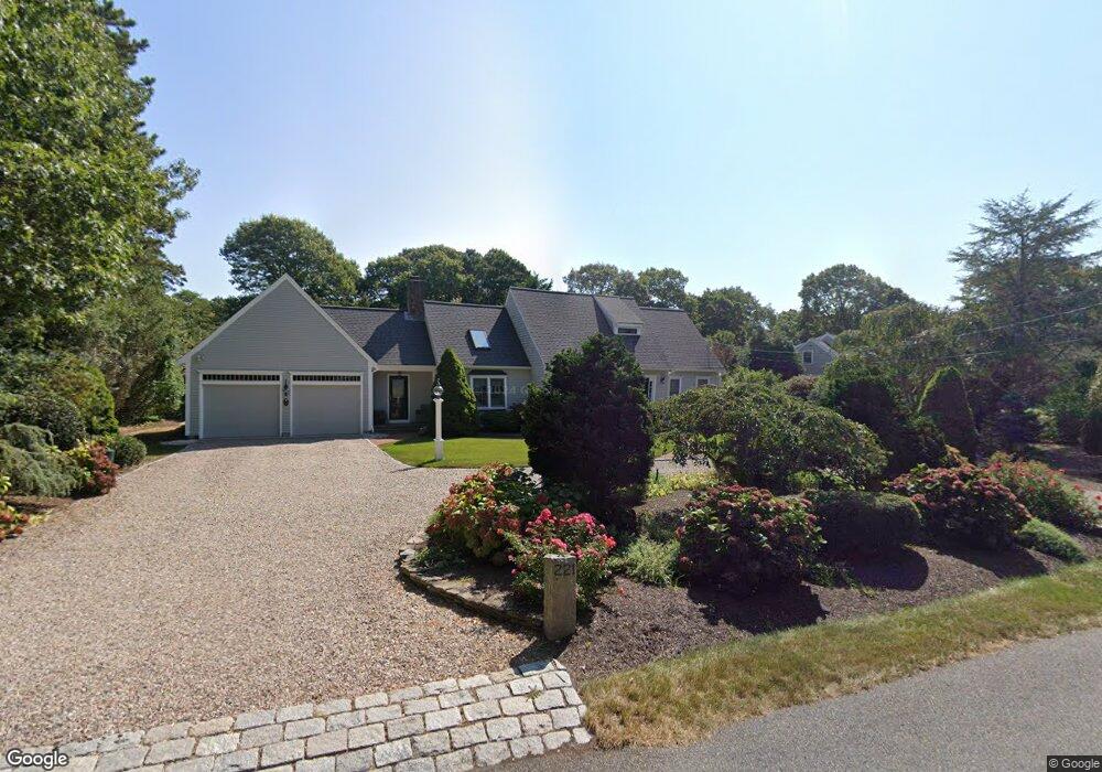
221 Clamshell Cove Rd Cotuit, MA 02635
Cotuit NeighborhoodEstimated Value: $971,000 - $1,519,000
3
Beds
3
Baths
1,967
Sq Ft
$595/Sq Ft
Est. Value
About This Home
This home is located at 221 Clamshell Cove Rd, Cotuit, MA 02635 and is currently estimated at $1,171,328, approximately $595 per square foot. 221 Clamshell Cove Rd is a home located in Barnstable County with nearby schools including Barnstable United Elementary School, West Villages Elementary School, and Barnstable Intermediate School.
Ownership History
Date
Name
Owned For
Owner Type
Purchase Details
Closed on
Nov 15, 2018
Sold by
Regan John P and Regan Tracy W
Bought by
Clamshell Cove Nt
Current Estimated Value
Purchase Details
Closed on
Apr 12, 2016
Sold by
Mary E Mcgeoch T
Bought by
Regan John P
Home Financials for this Owner
Home Financials are based on the most recent Mortgage that was taken out on this home.
Original Mortgage
$417,000
Interest Rate
3.62%
Mortgage Type
Unknown
Purchase Details
Closed on
Dec 10, 2009
Sold by
Mcgeoch Mary
Bought by
Mary E Mcgeoch T
Purchase Details
Closed on
Jun 16, 1995
Sold by
Riddle Clyde and Riddle Mary A
Bought by
Mcgeoch Norman J
Create a Home Valuation Report for This Property
The Home Valuation Report is an in-depth analysis detailing your home's value as well as a comparison with similar homes in the area
Home Values in the Area
Average Home Value in this Area
Purchase History
| Date | Buyer | Sale Price | Title Company |
|---|---|---|---|
| Clamshell Cove Nt | -- | -- | |
| Regan John P | $650,000 | -- | |
| Mary E Mcgeoch T | -- | -- | |
| Mcgeoch Norman J | $67,500 | -- |
Source: Public Records
Mortgage History
| Date | Status | Borrower | Loan Amount |
|---|---|---|---|
| Previous Owner | Regan John P | $417,000 |
Source: Public Records
Map
Nearby Homes
- 239 Clamshell Cove Rd
- 12 Tracey Rd
- 85 Clamshell Cove Rd
- 20 Mutiny Way
- 640 Poponessett Rd
- 640 Poponessett Rd
- 52 Old Dock Ln
- 11 Teal Cir
- 311 Waquoit Rd
- 35 Spinnaker Dr W
- 61 Shoestring Bay Rd
- 444 Vineyard Rd
- 140 Summersea Rd
- 6 Cedar St
- 6 Cedar St
- 1412 Main St
- 34 Rainbow Ln
- 25 Rainbow Ln
- 109 Waterway
- 36 Little Neck Ln
- 207 Clamshell Cove Rd
- 81 Crawford Rd
- 222 Clamshell Cove Rd
- 222 Clamshell Cove Rd
- 101 Crawford Rd
- 67 Crawford Rd
- 230 Clamshell Cove Rd
- 230 Clamshell Cove Rd
- 242 Clamshell Cove Rd
- 193 Clamshell Cove Rd
- 60 Clamshell Cove Rd
- 0 Clamshell Cove Rd
- 259 Clamshell Cove Rd
- 82 Crawford Rd
- 98 Crawford Rd
- 190 Clamshell Cove Rd
- 190 Clamshell Cove Rd
- 176 Clamshell Cove Rd
- 252 Clamshell Cove Rd
- 68 Crawford Rd
Your Personal Tour Guide
Ask me questions while you tour the home.