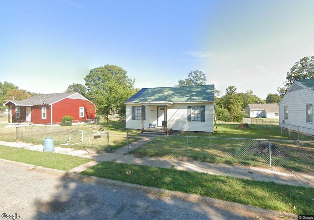
221 E Ingram St Camden, AR 71701
Estimated Value: $49,261 - $92,000
--
Bed
1
Bath
870
Sq Ft
$88/Sq Ft
Est. Value
About This Home
This home is located at 221 E Ingram St, Camden, AR 71701 and is currently estimated at $76,315, approximately $87 per square foot. 221 E Ingram St is a home located in Ouachita County with nearby schools including Harmony Grove Elementary School, Sparkman K-12 School, and Sparkman Elementary School.
Ownership History
Date
Name
Owned For
Owner Type
Purchase Details
Closed on
Sep 22, 2011
Sold by
Vaughan J F and Vaughan Jimmy
Bought by
T & T Of Camden Inc
Current Estimated Value
Home Financials for this Owner
Home Financials are based on the most recent Mortgage that was taken out on this home.
Original Mortgage
$25,500
Outstanding Balance
$17,352
Interest Rate
4.28%
Mortgage Type
Purchase Money Mortgage
Estimated Equity
$58,963
Purchase Details
Closed on
Jan 19, 2006
Bought by
Vaughan James F and Vaughan Melissa
Purchase Details
Closed on
Jan 6, 2006
Bought by
Vaughan Betty M
Create a Home Valuation Report for This Property
The Home Valuation Report is an in-depth analysis detailing your home's value as well as a comparison with similar homes in the area
Home Values in the Area
Average Home Value in this Area
Purchase History
| Date | Buyer | Sale Price | Title Company |
|---|---|---|---|
| T & T Of Camden Inc | $30,000 | -- | |
| Vaughan James F | -- | -- | |
| Vaughan Betty M | $17,000 | -- |
Source: Public Records
Mortgage History
| Date | Status | Borrower | Loan Amount |
|---|---|---|---|
| Open | T & T Of Camden Inc | $25,500 |
Source: Public Records
Tax History Compared to Growth
Tax History
| Year | Tax Paid | Tax Assessment Tax Assessment Total Assessment is a certain percentage of the fair market value that is determined by local assessors to be the total taxable value of land and additions on the property. | Land | Improvement |
|---|---|---|---|---|
| 2025 | $469 | $11,200 | $1,020 | $10,180 |
| 2024 | $426 | $7,130 | $1,020 | $6,110 |
| 2023 | $426 | $7,130 | $1,020 | $6,110 |
| 2022 | $426 | $7,130 | $1,020 | $6,110 |
| 2021 | $426 | $7,130 | $1,020 | $6,110 |
| 2020 | $420 | $6,380 | $1,020 | $5,360 |
| 2019 | $382 | $6,380 | $1,020 | $5,360 |
| 2018 | $382 | $6,380 | $1,020 | $5,360 |
| 2017 | $346 | $6,380 | $1,020 | $5,360 |
| 2016 | $382 | $6,380 | $1,020 | $5,360 |
| 2015 | $346 | $6,380 | $1,020 | $5,360 |
| 2014 | $339 | $6,250 | $1,020 | $5,230 |
Source: Public Records
Map
Nearby Homes
- 102 Shepherd Ave
- 228 E Ingram St
- 115 S Womble Ave
- 429 Maple St
- 437 Maple St
- 501 Maple Dr
- 500 E Ingram St
- Lots Jonquil
- 390 Ouachita 210 Rd
- 108 Oak
- 112 Oak St
- 295 Ouachita 45
- TBD Calhoun 272
- 180 Ouachita 404
- 161 Ouachita 406
- 18.82 acres Bradley Ferry Rd
- 423 Avery Ave SE
- 609 Lear Ave
- 321 Rictor Alley Rd SE
- 122 Madison Ave
- 219 E Ingram St
- 223 E Ingram St
- 220 E Busbee St
- 218 E Busbee St
- 222 E Busbee St
- 215 E Ingram St
- 227 E Ingram St
- 211 E Ingram St
- 231 E Ingram St
- 214 E Busbee St
- 224 E Busbee St
- 233 E Ingram St
- 228 E Busbee St
- 209 E Ingram St
- 210 E Busbee St
- 111 Shepherd Ave
- 235 E Ingram St
- 114 Tabor Ave
- 113 Shepherd Ave
- 112 Tabor Ave