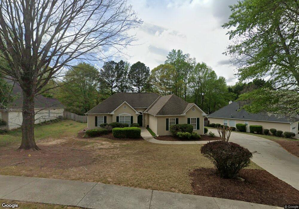
221 Kensington Trace Unit 1 Stockbridge, GA 30281
Estimated Value: $274,000 - $306,000
3
Beds
2
Baths
1,640
Sq Ft
$174/Sq Ft
Est. Value
About This Home
This home is located at 221 Kensington Trace Unit 1, Stockbridge, GA 30281 and is currently estimated at $285,131, approximately $173 per square foot. 221 Kensington Trace Unit 1 is a home located in Henry County with nearby schools including Flippen Elementary School, Eagle's Landing Middle School, and Eagle's Landing High School.
Ownership History
Date
Name
Owned For
Owner Type
Purchase Details
Closed on
Aug 23, 2004
Sold by
Green David and Green Amy
Bought by
Walker Cheryl D
Current Estimated Value
Home Financials for this Owner
Home Financials are based on the most recent Mortgage that was taken out on this home.
Original Mortgage
$154,635
Interest Rate
5.62%
Mortgage Type
VA
Create a Home Valuation Report for This Property
The Home Valuation Report is an in-depth analysis detailing your home's value as well as a comparison with similar homes in the area
Home Values in the Area
Average Home Value in this Area
Purchase History
| Date | Buyer | Sale Price | Title Company |
|---|---|---|---|
| Walker Cheryl D | $157,200 | -- |
Source: Public Records
Mortgage History
| Date | Status | Borrower | Loan Amount |
|---|---|---|---|
| Previous Owner | Walker Cheryl D | $154,635 |
Source: Public Records
Tax History Compared to Growth
Tax History
| Year | Tax Paid | Tax Assessment Tax Assessment Total Assessment is a certain percentage of the fair market value that is determined by local assessors to be the total taxable value of land and additions on the property. | Land | Improvement |
|---|---|---|---|---|
| 2025 | $3,240 | $111,440 | $16,000 | $95,440 |
| 2024 | $3,240 | $114,880 | $16,000 | $98,880 |
| 2023 | $3,457 | $118,800 | $18,000 | $100,800 |
| 2022 | $2,910 | $89,360 | $14,000 | $75,360 |
| 2021 | $2,565 | $74,800 | $14,000 | $60,800 |
| 2020 | $2,391 | $67,480 | $12,000 | $55,480 |
| 2019 | $2,186 | $62,360 | $10,000 | $52,360 |
| 2018 | $2,062 | $57,120 | $10,000 | $47,120 |
| 2016 | $1,740 | $47,760 | $8,000 | $39,760 |
| 2015 | $1,691 | $45,520 | $8,000 | $37,520 |
| 2014 | $1,552 | $41,680 | $8,000 | $33,680 |
Source: Public Records
Map
Nearby Homes
- 228 Kensington Trace
- 214 Kensington Trace
- 104 Riverside Close
- 200 Kensington Trace
- 241 Legends Trace
- 248 Brannans Walk
- 209 Brannans Walk
- 129 Breton Highlands
- 805 Cog Hill
- 205 Legends Trace
- 601 Sawgrass Walk
- 418 Abbey Springs Way
- 1016 Collingtree Ct
- 796 Rock Ln
- 907 Ellesmere Point
- 1000 Collingtree Ct
- 433 Abbey Springs Way
- 153 Rockport Dr
- 152 Rockport Dr
- 739 Bethpage Dr
- 106 Heritage Walk Unit 1
- 223 Kensington Trace
- 206 Southerness Ct Unit 2
- 104 Heritage Walk
- 208 Southerness Ct
- 208 Southerness Ct Unit II
- 224 Kensington Trace Unit 224
- 224 Kensington Trace
- 224 Kensington Trace Unit 1
- 301 Amherst Terrace
- 204 Southerness Ct Unit II
- 222 Kensington Trace
- 226 Kensington Trace Unit III
- 105 Heritage Walk
- 102 Heritage Walk
- 303 Amherst Terrace Unit III
- 202 Southerness Ct
- 210 Southerness Ct Unit II
- 220 Kensington Trace
- 103 Heritage Walk