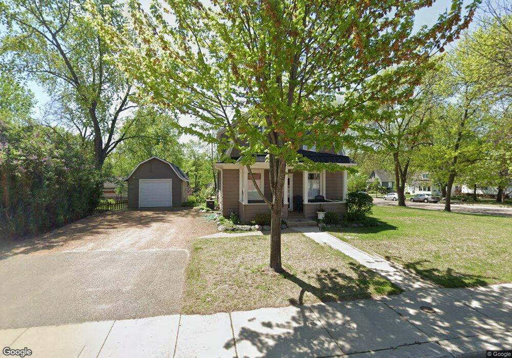
221 W 1st St Chaska, MN 55318
Estimated Value: $292,000 - $330,000
3
Beds
2
Baths
1,252
Sq Ft
$247/Sq Ft
Est. Value
About This Home
This home is located at 221 W 1st St, Chaska, MN 55318 and is currently estimated at $308,794, approximately $246 per square foot. 221 W 1st St is a home located in Carver County with nearby schools including Kisthardt Elementary School, Carver Elementary School, and Pioneer Ridge Middle School.
Ownership History
Date
Name
Owned For
Owner Type
Purchase Details
Closed on
Nov 25, 2013
Sold by
Srrp Llc
Bought by
Spalding Carl E and Spalding Lori
Current Estimated Value
Purchase Details
Closed on
Jul 15, 2013
Sold by
Spalding Carl Edwin
Bought by
Srrp Llc
Purchase Details
Closed on
Jul 27, 2001
Sold by
Foy Michael J and Foy Lorraine L
Bought by
Spalding Carl E
Create a Home Valuation Report for This Property
The Home Valuation Report is an in-depth analysis detailing your home's value as well as a comparison with similar homes in the area
Home Values in the Area
Average Home Value in this Area
Purchase History
| Date | Buyer | Sale Price | Title Company |
|---|---|---|---|
| Spalding Carl E | -- | First American Title | |
| Srrp Llc | -- | None Available | |
| Spalding Carl E | $148,000 | -- |
Source: Public Records
Tax History Compared to Growth
Tax History
| Year | Tax Paid | Tax Assessment Tax Assessment Total Assessment is a certain percentage of the fair market value that is determined by local assessors to be the total taxable value of land and additions on the property. | Land | Improvement |
|---|---|---|---|---|
| 2025 | $3,206 | $285,800 | $120,000 | $165,800 |
| 2024 | $2,998 | $265,800 | $100,000 | $165,800 |
| 2023 | $2,848 | $254,400 | $100,000 | $154,400 |
| 2022 | $2,420 | $252,800 | $57,000 | $195,800 |
| 2021 | $2,288 | $188,000 | $47,400 | $140,600 |
| 2020 | $2,284 | $186,100 | $47,400 | $138,700 |
| 2019 | $2,234 | $173,700 | $45,100 | $128,600 |
| 2018 | $2,468 | $173,700 | $45,100 | $128,600 |
| 2017 | $2,270 | $190,300 | $50,200 | $140,100 |
| 2016 | $2,334 | $168,800 | $0 | $0 |
| 2015 | $2,964 | $157,600 | $0 | $0 |
| 2014 | $2,964 | $154,700 | $0 | $0 |
Source: Public Records
Map
Nearby Homes
- 101 N Cedar St
- 215 N Walnut St
- 211 N Walnut St
- 217 N Walnut St
- 213 N Walnut St
- 215 N Maple St
- 217 Beech St
- 504 N Maple St
- 705 Ensconced Way
- 713 Ensconced Way
- 734 Ensconced Way
- 738 Ensconced Way
- 719 Ensconced Way
- 729 Ensconced Way
- 749 Ensconced Way
- 3753 Brookside Dr
- 3759 Brookside Dr
- 762 Ensconced Way
- 758 Ensconced Way
- 171 Liberty Heights Dr
- 215 W 1st St
- 115 1/2 115 1 2 S Cedar St
- 209 W 1st St
- 301 W 1st St
- 108 S Cedar St
- 115 S Cedar St
- 115 1/2 S Cedar St
- 205 W 1st St
- 110 S Cedar St
- 205 205 1st-Street-w
- 117 S Cedar St
- 307 W 1st St
- 116 S Cedar St
- 31 River Bend Place
- 201 W 1st St
- 30 River Bend Place
- 107 N Cedar St
- 29 River Bend Place
- 120 S Cedar St
- 28 River Bend Place