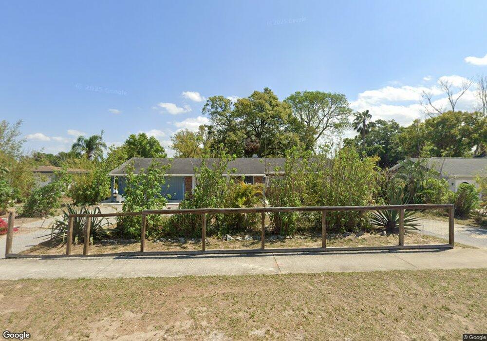
2210 John Moore Rd Brandon, FL 33511
Estimated Value: $302,399 - $381,000
3
Beds
2
Baths
1,616
Sq Ft
$211/Sq Ft
Est. Value
About This Home
This home is located at 2210 John Moore Rd, Brandon, FL 33511 and is currently estimated at $341,350, approximately $211 per square foot. 2210 John Moore Rd is a home located in Hillsborough County with nearby schools including Brooker Elementary School, Burns Middle School, and Bloomingdale High School.
Ownership History
Date
Name
Owned For
Owner Type
Purchase Details
Closed on
Jun 6, 2012
Sold by
Still Richard George
Bought by
Derosier Irmine Lumarque and Derosier Risler
Current Estimated Value
Purchase Details
Closed on
Dec 2, 1993
Sold by
Groff John R and Groff Lannis L
Bought by
Still Richard George and Still Charlene Veronica
Home Financials for this Owner
Home Financials are based on the most recent Mortgage that was taken out on this home.
Original Mortgage
$18,624
Interest Rate
7.14%
Create a Home Valuation Report for This Property
The Home Valuation Report is an in-depth analysis detailing your home's value as well as a comparison with similar homes in the area
Home Values in the Area
Average Home Value in this Area
Purchase History
| Date | Buyer | Sale Price | Title Company |
|---|---|---|---|
| Derosier Irmine Lumarque | $23,500 | Universal Land Title Llc | |
| Still Richard George | $66,500 | -- |
Source: Public Records
Mortgage History
| Date | Status | Borrower | Loan Amount |
|---|---|---|---|
| Previous Owner | Still Richard George | $18,624 |
Source: Public Records
Tax History
| Year | Tax Paid | Tax Assessment Tax Assessment Total Assessment is a certain percentage of the fair market value that is determined by local assessors to be the total taxable value of land and additions on the property. | Land | Improvement |
|---|---|---|---|---|
| 2025 | $3,843 | $195,942 | $70,686 | $125,256 |
| 2024 | $3,843 | $190,893 | $65,637 | $125,256 |
| 2023 | $3,604 | $190,260 | $60,588 | $129,672 |
| 2022 | $3,404 | $200,360 | $60,588 | $139,772 |
| 2021 | $2,981 | $144,670 | $50,490 | $94,180 |
| 2020 | $2,722 | $134,720 | $41,907 | $92,813 |
| 2019 | $2,510 | $128,206 | $35,343 | $92,863 |
| 2018 | $2,332 | $120,555 | $0 | $0 |
| 2017 | $2,125 | $103,988 | $0 | $0 |
| 2016 | $1,982 | $87,833 | $0 | $0 |
| 2015 | $1,856 | $79,848 | $0 | $0 |
| 2014 | $1,704 | $72,589 | $0 | $0 |
| 2013 | -- | $65,990 | $0 | $0 |
Source: Public Records
Map
Nearby Homes
- 2510 Knight Island Dr
- 2456 Knight Island Dr
- 101 Kiana Dr
- 2310 Medford Ln
- 2303 Green Lawn St
- 110 W Brentridge Dr
- 502 Oakhurst St
- 614 Vintage Way
- 602 Hickory Lake Dr
- 114 Barkfield St
- 516 E Anglewood Dr
- 515 E Brentridge Dr
- 606 Bama Rd
- 2210 Tanglewood Way
- 2927 Minuteman Ln
- 124 Barrington Dr
- 133 Barrington Dr
- 527 Julie Ln
- 1409 Bryan Rd
- 516 Rapid Falls Dr
- 2208 John Moore Rd
- 2212 John Moore Rd
- 2209 Malibu Dr
- 2207 Malibu Dr
- 2206 John Moore Rd
- 2207 Briana Dr
- 2205 Briana Dr
- 2209 Briana Dr
- 2205 Malibu Dr
- 2203 Briana Dr
- 2216 John Moore Rd
- 2204 John Moore Rd
- 2210 Malibu Dr
- 2215 Malibu Dr
- 2208 Malibu Dr
- 2203 Malibu Dr
- 2212 Malibu Dr
- 2206 Malibu Dr
- 2213 Briana Dr
- 2201 Briana Dr
Your Personal Tour Guide
Ask me questions while you tour the home.