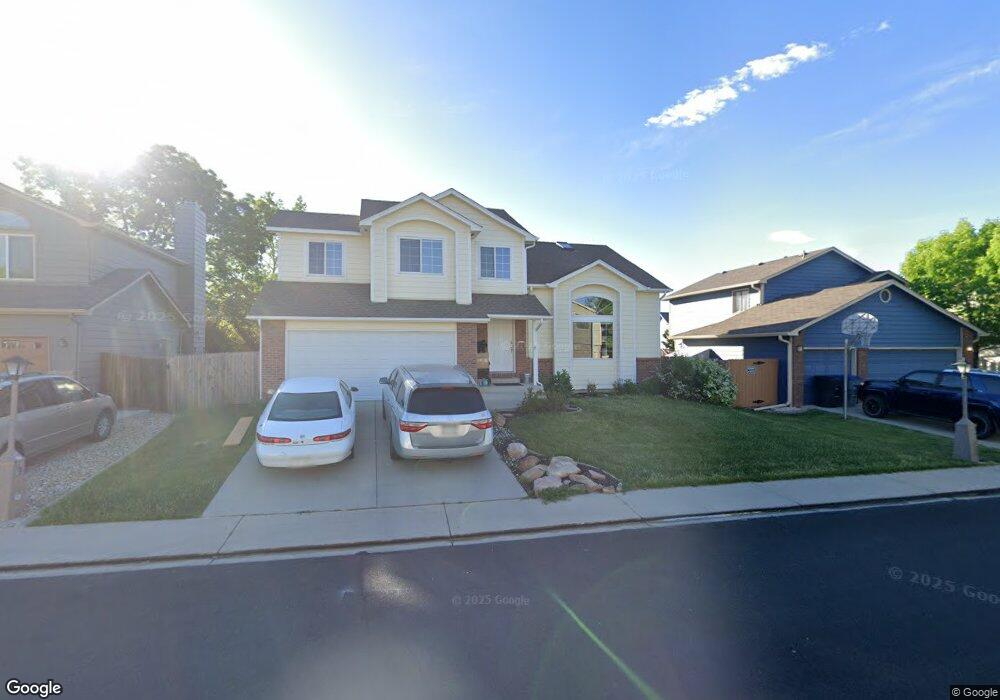
2214 Frontier St Longmont, CO 80501
Garden Acres NeighborhoodEstimated Value: $542,457 - $580,000
5
Beds
3
Baths
1,750
Sq Ft
$322/Sq Ft
Est. Value
About This Home
This home is located at 2214 Frontier St, Longmont, CO 80501 and is currently estimated at $563,114, approximately $321 per square foot. 2214 Frontier St is a home located in Boulder County with nearby schools including Sanborn Elementary School, Longs Peak Middle School, and Longmont High School.
Ownership History
Date
Name
Owned For
Owner Type
Purchase Details
Closed on
Oct 8, 2013
Sold by
Auman Robert W and Auman Diana S
Bought by
The Auman Family Trust
Current Estimated Value
Purchase Details
Closed on
Jun 21, 2003
Sold by
Auman Robert W and Auman Diana S
Bought by
Auman Robert W
Purchase Details
Closed on
May 10, 2001
Sold by
Auman William S and Auman Elaine T
Bought by
Auman Robert W
Home Financials for this Owner
Home Financials are based on the most recent Mortgage that was taken out on this home.
Original Mortgage
$193,600
Outstanding Balance
$72,183
Interest Rate
7.01%
Estimated Equity
$490,931
Purchase Details
Closed on
May 7, 2001
Sold by
Auman Robert W and Auman Diana S
Bought by
Auman Robert W
Home Financials for this Owner
Home Financials are based on the most recent Mortgage that was taken out on this home.
Original Mortgage
$193,600
Outstanding Balance
$72,183
Interest Rate
7.01%
Estimated Equity
$490,931
Purchase Details
Closed on
Mar 3, 1992
Bought by
Auman Family Trust
Purchase Details
Closed on
Apr 16, 1991
Bought by
Auman Family Trust
Create a Home Valuation Report for This Property
The Home Valuation Report is an in-depth analysis detailing your home's value as well as a comparison with similar homes in the area
Home Values in the Area
Average Home Value in this Area
Purchase History
| Date | Buyer | Sale Price | Title Company |
|---|---|---|---|
| The Auman Family Trust | -- | None Available | |
| Auman Robert W | -- | -- | |
| Auman Robert W | -- | -- | |
| Auman Robert W | -- | -- | |
| Auman Family Trust | $118,500 | -- | |
| Auman Family Trust | $106,000 | -- |
Source: Public Records
Mortgage History
| Date | Status | Borrower | Loan Amount |
|---|---|---|---|
| Open | Auman Robert W | $193,600 |
Source: Public Records
Tax History Compared to Growth
Tax History
| Year | Tax Paid | Tax Assessment Tax Assessment Total Assessment is a certain percentage of the fair market value that is determined by local assessors to be the total taxable value of land and additions on the property. | Land | Improvement |
|---|---|---|---|---|
| 2025 | $3,194 | $33,882 | $5,394 | $28,488 |
| 2024 | $3,194 | $33,882 | $5,394 | $28,488 |
| 2023 | $3,151 | $33,393 | $6,050 | $31,028 |
| 2022 | $2,818 | $28,474 | $4,448 | $24,026 |
| 2021 | $2,854 | $29,294 | $4,576 | $24,718 |
| 2020 | $2,643 | $27,213 | $3,933 | $23,280 |
| 2019 | $2,602 | $27,213 | $3,933 | $23,280 |
| 2018 | $2,199 | $23,148 | $3,528 | $19,620 |
| 2017 | $2,169 | $25,591 | $3,900 | $21,691 |
| 2016 | $1,992 | $20,840 | $4,856 | $15,984 |
| 2015 | $1,898 | $17,368 | $5,492 | $11,876 |
| 2014 | $1,622 | $17,368 | $5,492 | $11,876 |
Source: Public Records
Map
Nearby Homes
- 2160 Sumac St
- 2191 Steele St
- 2124 Kay St
- 2108 Tulip St
- 2412 Sunset Dr
- 2456 Sunset Dr
- 2410 Maplewood Cir W
- 2244 Vivian St
- 2421 Maplewood Cir W
- 1851 Trevor Cir
- 1855 Trevor Cir
- 2425 Willow Ln
- 2634 Westlake Ct
- 2078 Goldfinch Ct
- 1512 Flemming Dr
- 2615 Falcon Dr
- 1736 Trevor Ct
- 1614 Ervine Ave
- 12788 Sheramdi St
- 1835 Cambridge Dr
- 2220 Frontier St
- 2208 Frontier St
- 2215 Sherri Mar St
- 2221 Sherri Mar St
- 2209 Sherri Mar St
- 2226 Frontier St
- 2202 Frontier St
- 2213 Frontier St
- 2227 Sherri Mar St
- 2207 Frontier St
- 2219 Frontier St
- 2203 Sherri Mar St
- 2232 Frontier St
- 2225 Frontier St
- 2201 Frontier St
- 2233 Sherri Mar St
- 2231 Frontier St
- 2300 Frontier St
- 2214 Sherri Mar St
- 2212 Stuart St