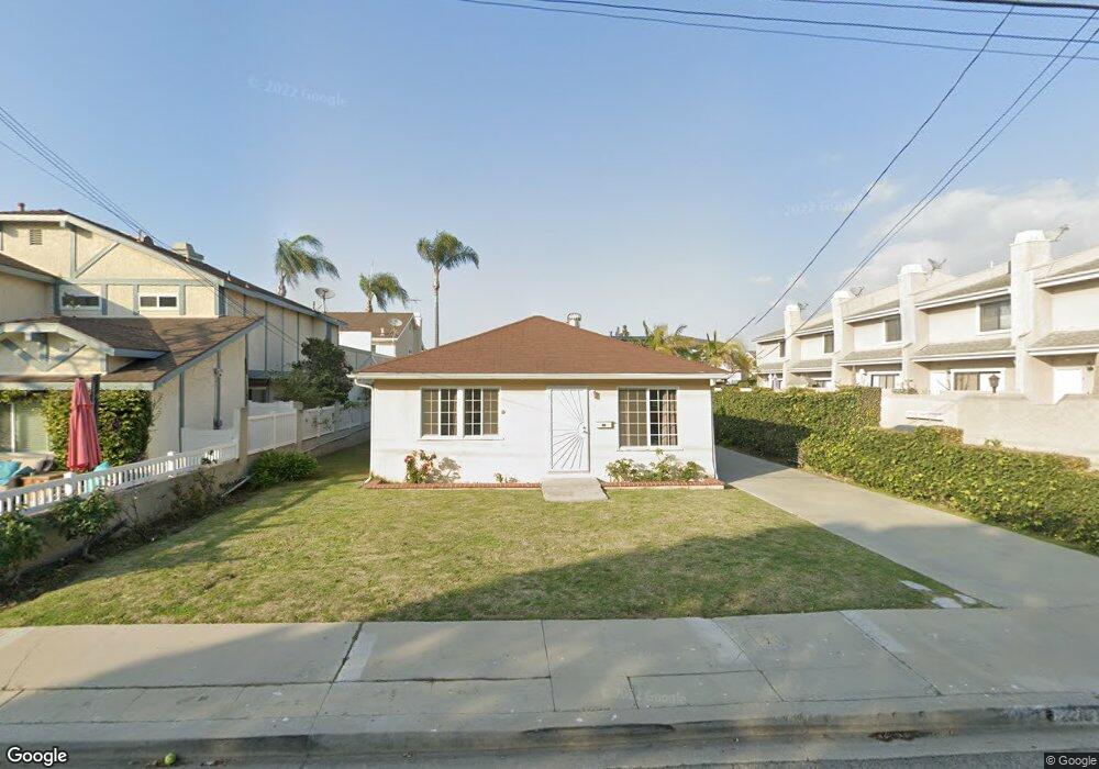
2215 Farrell Ave Unit A Redondo Beach, CA 90278
North Redondo Beach NeighborhoodEstimated Value: $1,568,661 - $1,653,000
5
Beds
3
Baths
1,985
Sq Ft
$815/Sq Ft
Est. Value
About This Home
This home is located at 2215 Farrell Ave Unit A, Redondo Beach, CA 90278 and is currently estimated at $1,617,415, approximately $814 per square foot. 2215 Farrell Ave Unit A is a home located in Los Angeles County with nearby schools including Lincoln Elementary School, Adams Middle School, and Redondo Union High School.
Ownership History
Date
Name
Owned For
Owner Type
Purchase Details
Closed on
Sep 23, 2011
Sold by
Stover Betty L
Bought by
The Betty L Stover Living Trust
Current Estimated Value
Purchase Details
Closed on
Oct 6, 1995
Sold by
Stover Betty Louise
Bought by
Stover Betty L and The Betty L Stover Living Trus
Create a Home Valuation Report for This Property
The Home Valuation Report is an in-depth analysis detailing your home's value as well as a comparison with similar homes in the area
Home Values in the Area
Average Home Value in this Area
Purchase History
| Date | Buyer | Sale Price | Title Company |
|---|---|---|---|
| The Betty L Stover Living Trust | -- | None Available | |
| Stover Betty L | -- | -- |
Source: Public Records
Tax History Compared to Growth
Tax History
| Year | Tax Paid | Tax Assessment Tax Assessment Total Assessment is a certain percentage of the fair market value that is determined by local assessors to be the total taxable value of land and additions on the property. | Land | Improvement |
|---|---|---|---|---|
| 2025 | $2,598 | $100,457 | $52,436 | $48,021 |
| 2024 | $2,598 | $98,488 | $51,408 | $47,080 |
| 2023 | $2,567 | $96,557 | $50,400 | $46,157 |
| 2022 | $2,452 | $94,664 | $49,412 | $45,252 |
| 2021 | $2,074 | $92,809 | $48,444 | $44,365 |
| 2020 | $2,298 | $92,579 | $47,948 | $44,631 |
| 2019 | $2,223 | $90,778 | $47,008 | $43,770 |
| 2018 | $2,076 | $89,013 | $46,087 | $42,926 |
| 2016 | $1,984 | $84,867 | $44,299 | $40,568 |
| 2015 | $1,961 | $83,593 | $43,634 | $39,959 |
| 2014 | $1,936 | $81,957 | $42,780 | $39,177 |
Source: Public Records
Map
Nearby Homes
- 2216 Bataan Rd Unit A
- 2224 Dufour Ave Unit A
- 2861 Pinckard Ave
- 3310 Blossom Ln
- 2411 Thomas Ave
- 2012 Manhattan Beach Blvd Unit 2
- 3202 Green Ln
- 3306 Gibson Place
- 2016 Robinson St
- 2206 Gates Ave
- 2206 Gates Ave Unit B
- 2206 Gates Ave Unit A
- 2209 Curtis Ave Unit 4
- 2404 Gates Ave Unit 5
- 1833 8th St
- 2014 Gates Ave Unit A
- 1820 9th St
- 1816 9th St
- 2021 Curtis Ave
- 2117 Voorhees Ave Unit A
- 2213 Farrell Ave Unit B
- 2213 Farrell Ave Unit A
- 2219 Farrell Ave
- 2211 Farrell Ave Unit B
- 2211 Farrell Ave Unit A
- 2221 Farrell Ave Unit B
- 2221 Farrell Ave Unit A
- 2209 Farrell Ave
- 2214 Bataan Rd
- 2216 Bataan Rd Unit B
- 2216 Bataan Rd
- 2210 Bataan Rd
- 2210 Bataan Rd Unit 2A
- 2210 Bataan Rd Unit 1A
- 2218 Bataan Rd Unit B
- 2218 Bataan Rd Unit A
- 2208 Bataan Rd Unit 2
- 2208 Bataan Rd Unit 1
- 2212 Bataan Rd Unit B
- 2212 Bataan Rd Unit A