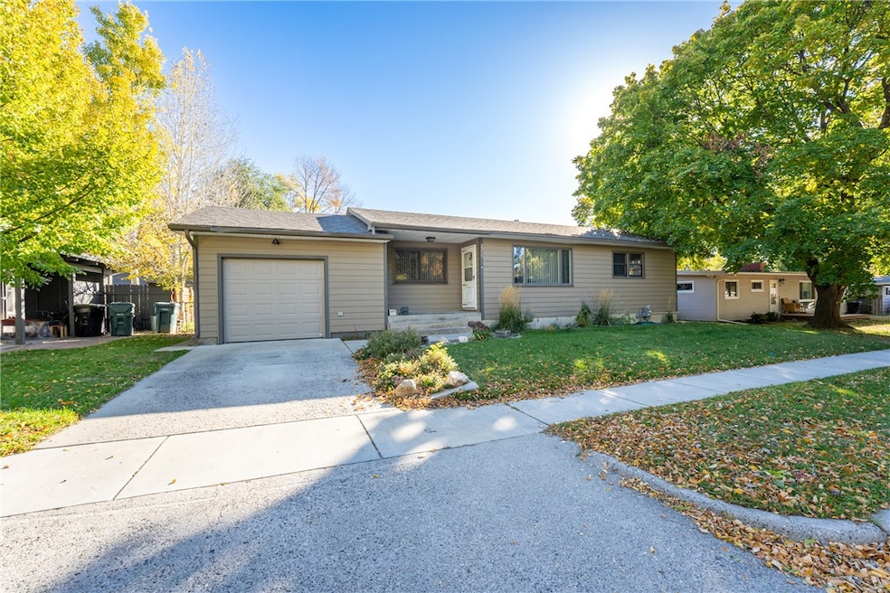
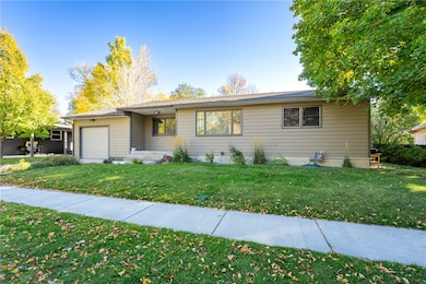
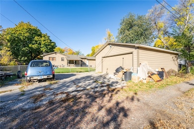
2215 Patricia Ln Billings, MT 59102
North Central Billings NeighborhoodEstimated payment $1,840/month
Highlights
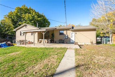
- Deck
- 3 Car Garage
- Cooling Available
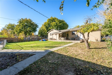
- Covered Patio or Porch
- Interior Lot
- Laundry Room
About This Home
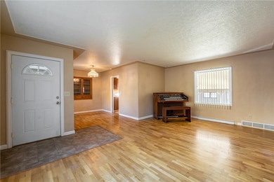
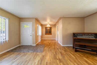
This home is located in a highly desirable Northwest Billings neighborhood, 3 bedrooms, (one non egress), 2 bath, the home is a ranch style filled with potential. Single attached garage plus an oversized double detached, covered patio, fenced yard, central air, additional parking in rear of home.
Listing Agent
Meridian Real Estate LLC Brokerage Phone: 406-855-1397 License #RRE-BRO-LIC-6024 Listed on: 10/21/2025
Home Details
Home Type
- Single Family
Est. Annual Taxes
- $2,122
Year Built
- Built in 1955
Lot Details
- 9,000 Sq Ft Lot
- Fenced
- Interior Lot
- Landscaped with Trees
- Zoning described as Mid-Century Neighborhood Residential
Parking
- 3 Car Garage
- Alley Access
- Additional Parking
Home Design
- Asphalt Roof
- Masonite
Interior Spaces
- 1,946 Sq Ft Home
- 1-Story Property
- Basement Fills Entire Space Under The House
Bedrooms and Bathrooms
- 3 Bedrooms | 2 Main Level Bedrooms
- 2 Full Bathrooms
Laundry
- Laundry Room
- Washer and Dryer Hookup
Outdoor Features
- Deck
- Covered Patio or Porch
Schools
- Poly Drive Elementary School
- Will James Middle School
- Senior High School
Utilities
- Cooling Available
- Forced Air Heating System
Community Details
- Rehberg Subdivision
Listing and Financial Details
- Assessor Parcel Number A13134
Map
Home Values in the Area
Average Home Value in this Area
Tax History
| Year | Tax Paid | Tax Assessment Tax Assessment Total Assessment is a certain percentage of the fair market value that is determined by local assessors to be the total taxable value of land and additions on the property. | Land | Improvement |
|---|---|---|---|---|
| 2025 | $2,739 | $331,300 | $56,337 | $274,963 |
| 2024 | $2,739 | $280,700 | $53,530 | $227,170 |
| 2023 | $2,747 | $280,700 | $53,530 | $227,170 |
| 2022 | $2,585 | $232,500 | $0 | $0 |
| 2021 | $2,463 | $232,500 | $0 | $0 |
| 2020 | $2,575 | $234,200 | $0 | $0 |
| 2019 | $2,457 | $234,200 | $0 | $0 |
| 2018 | $2,442 | $228,900 | $0 | $0 |
| 2017 | $2,372 | $228,900 | $0 | $0 |
| 2016 | $2,164 | $210,500 | $0 | $0 |
| 2015 | $2,116 | $210,500 | $0 | $0 |
| 2014 | $1,800 | $94,286 | $0 | $0 |
Property History
| Date | Event | Price | List to Sale | Price per Sq Ft |
|---|---|---|---|---|
| 10/21/2025 10/21/25 | For Sale | $314,900 | -- | $162 / Sq Ft |
Purchase History
| Date | Type | Sale Price | Title Company |
|---|---|---|---|
| Deed | -- | -- | |
| Deed Of Distribution | -- | None Available |
Mortgage History
| Date | Status | Loan Amount | Loan Type |
|---|---|---|---|
| Closed | -- | No Value Available |
Source: Billings Multiple Listing Service
MLS Number: 356205
APN: 03-1032-35-2-04-31-0000
Disclaimer: Certain information contained herein is derived from information provided by parties other than Homes.com. All information provided is deemed reliable, but is not guaranteed to be accurate and should be independently verified.
![]() IDX information is provided exclusively for personal, non-commercial use, and may not be used for any purpose other than to identify prospective properties consumers may be interested in purchasing. Information is deemed reliable but not guaranteed.
IDX information is provided exclusively for personal, non-commercial use, and may not be used for any purpose other than to identify prospective properties consumers may be interested in purchasing. Information is deemed reliable but not guaranteed.
- 2820 Boulder Ave
- 2516 Lyndale Ln
- 1920 Patricia Ln
- 1907 Patricia Ln
- 1825 28th St W
- 2912 Stinson Ave
- 3078 Colton Blvd
- 1903 Forest Park Dr
- 1824 Patricia Ln
- 1820 Patricia Ln
- 2717 Patricia Ln
- 0 Julianne Dr Unit 356457
- 3033 Avenue F
- 2060 Edgewood Dr
- 2422 Brentwood Ln
- 3107 Poly Dr
- 2646 Rimrock Rd
- 2800 Gregory Dr S
- 2644 Rimrock Rd
- 2730 Gregory Dr S
- 2002 Glendale Ln
- 2323 32nd St W
- 2014 Woody Dr
- 1965 Home Valley Dr
- 3635 Harvest Time Ln
- 1607 17th St W
- 2440 Village Ln
- 2220 St Johns Ave
- 3040 Central Ave
- 3315 Central Ave Unit 2
- 200 Brookshire Blvd
- 1145 Ponderosa Dr
- 1273 Yellowstone Ave Unit Great Condo wAll Util inc
- 115 Shiloh Rd
- 1203 Broadwater Ave
- 1008 Princeton Ave
- 1422 Lynn Ave Unit 1
- 1329 Lynn Ave
- 1111 Cook Ave
- 3290 Granger Ave E
