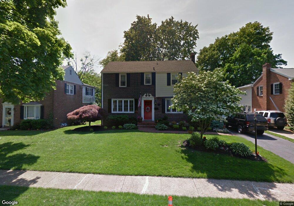
2216 Amhurst Rd Wilmington, DE 19803
Fairfax NeighborhoodEstimated Value: $429,000 - $488,000
4
Beds
3
Baths
1,835
Sq Ft
$251/Sq Ft
Est. Value
About This Home
This home is located at 2216 Amhurst Rd, Wilmington, DE 19803 and is currently estimated at $460,697, approximately $251 per square foot. 2216 Amhurst Rd is a home located in New Castle County with nearby schools including Lombardy Elementary School, Springer Middle School, and Brandywine High School.
Ownership History
Date
Name
Owned For
Owner Type
Purchase Details
Closed on
Apr 21, 2006
Sold by
White Andrew C and White Robin L
Bought by
Phillips William Daniel and Phillips Michelle
Current Estimated Value
Home Financials for this Owner
Home Financials are based on the most recent Mortgage that was taken out on this home.
Original Mortgage
$235,000
Outstanding Balance
$135,124
Interest Rate
6.37%
Mortgage Type
Fannie Mae Freddie Mac
Estimated Equity
$325,573
Purchase Details
Closed on
Feb 12, 2003
Sold by
Amorose David M and Amorose Susan M
Bought by
White Andrew C and White Robin L
Home Financials for this Owner
Home Financials are based on the most recent Mortgage that was taken out on this home.
Original Mortgage
$215,040
Interest Rate
5.98%
Mortgage Type
Stand Alone First
Create a Home Valuation Report for This Property
The Home Valuation Report is an in-depth analysis detailing your home's value as well as a comparison with similar homes in the area
Home Values in the Area
Average Home Value in this Area
Purchase History
| Date | Buyer | Sale Price | Title Company |
|---|---|---|---|
| Phillips William Daniel | $359,900 | None Available | |
| White Andrew C | $268,830 | -- |
Source: Public Records
Mortgage History
| Date | Status | Borrower | Loan Amount |
|---|---|---|---|
| Open | Phillips William Daniel | $235,000 | |
| Previous Owner | White Andrew C | $215,040 |
Source: Public Records
Tax History Compared to Growth
Tax History
| Year | Tax Paid | Tax Assessment Tax Assessment Total Assessment is a certain percentage of the fair market value that is determined by local assessors to be the total taxable value of land and additions on the property. | Land | Improvement |
|---|---|---|---|---|
| 2024 | $2,961 | $77,800 | $12,700 | $65,100 |
| 2023 | $2,706 | $77,800 | $12,700 | $65,100 |
| 2022 | $2,752 | $77,800 | $12,700 | $65,100 |
| 2021 | $2,752 | $77,800 | $12,700 | $65,100 |
| 2020 | $2,753 | $77,800 | $12,700 | $65,100 |
| 2019 | $3,173 | $77,800 | $12,700 | $65,100 |
| 2018 | $2,631 | $77,800 | $12,700 | $65,100 |
| 2017 | $2,590 | $77,800 | $12,700 | $65,100 |
| 2016 | $2,588 | $77,800 | $12,700 | $65,100 |
| 2015 | $2,381 | $77,800 | $12,700 | $65,100 |
| 2014 | $2,380 | $77,800 | $12,700 | $65,100 |
Source: Public Records
Map
Nearby Homes
- 7 Median Dr
- 2402 Wellesley Ave
- 215 Potomac Rd
- 240 Sandra Rd
- 214 Waverly Rd
- 249 Pinehurst Rd
- 319 Mcdaniel Ave
- 250 Potomac Rd
- 1111 N Hilton Rd
- 331 Spalding Rd
- 0 Concord Mall Unit DENC2076028
- 22 Bradley Dr
- 208 Hoyer Ct
- 402 Marianna Dr
- 4559 Simon Rd
- 1517 Rockland Rd Unit 103
- 1517 Rockland Rd Unit 301
- 18 Kendall Ct
- 1509 Turkey Run Rd
- 7 Dakota Ave
- 2218 Amhurst Rd
- 2214 Amhurst Rd
- 115 Fairfax Blvd
- 113 Fairfax Blvd
- 2212 Amhurst Rd
- 2220 Amhurst Rd
- 117 Fairfax Blvd
- 2217 Amhurst Rd
- 2215 Amhurst Rd
- 2219 Amhurst Rd
- 2210 Amhurst Rd
- 2213 Amhurst Rd
- 2221 Amhurst Rd
- 109 Fairfax Blvd
- 2211 Amhurst Rd
- 2208 Amhurst Rd
- 2216 Thomas Rd
- 2214 Thomas Rd
- 2218 Thomas Rd
- 106 Fairfax Blvd