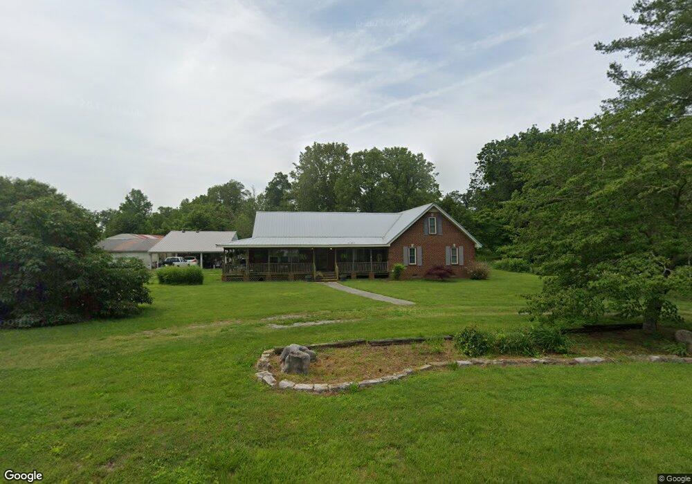
222 Cecil Laxson Rd Morrison, TN 37357
Estimated Value: $280,169 - $467,000
--
Bed
2
Baths
2,357
Sq Ft
$146/Sq Ft
Est. Value
About This Home
This home is located at 222 Cecil Laxson Rd, Morrison, TN 37357 and is currently estimated at $344,292, approximately $146 per square foot. 222 Cecil Laxson Rd is a home located in Warren County with nearby schools including Morrison Elementary School and Warren County High School.
Ownership History
Date
Name
Owned For
Owner Type
Purchase Details
Closed on
Sep 17, 2015
Sold by
Laxson Pamela
Bought by
Mansell Cathy Louise and O Pamela Laxson C
Current Estimated Value
Purchase Details
Closed on
Sep 16, 2015
Sold by
Laxson Pamela And
Bought by
Laxson Pamela And Luanne Laxson Life Estate
Purchase Details
Closed on
Aug 2, 1978
Bought by
Laxson Pamela and Laxson Luanne Laxson
Create a Home Valuation Report for This Property
The Home Valuation Report is an in-depth analysis detailing your home's value as well as a comparison with similar homes in the area
Home Values in the Area
Average Home Value in this Area
Purchase History
| Date | Buyer | Sale Price | Title Company |
|---|---|---|---|
| Mansell Cathy Louise | -- | -- | |
| Mansell Cathy Louise | -- | -- | |
| Laxson Pamela And Luanne Laxson Life Estate | -- | -- | |
| Laxson Pamela | -- | -- |
Source: Public Records
Tax History Compared to Growth
Tax History
| Year | Tax Paid | Tax Assessment Tax Assessment Total Assessment is a certain percentage of the fair market value that is determined by local assessors to be the total taxable value of land and additions on the property. | Land | Improvement |
|---|---|---|---|---|
| 2024 | $826 | $42,000 | $4,900 | $37,100 |
| 2023 | $826 | $42,000 | $4,900 | $37,100 |
| 2022 | $826 | $42,000 | $4,900 | $37,100 |
| 2021 | $826 | $42,000 | $4,900 | $37,100 |
| 2020 | $682 | $42,000 | $4,900 | $37,100 |
| 2019 | $779 | $34,675 | $4,600 | $30,075 |
| 2018 | $682 | $34,675 | $4,600 | $30,075 |
| 2017 | $682 | $34,675 | $4,600 | $30,075 |
| 2016 | $682 | $34,675 | $4,600 | $30,075 |
| 2015 | $692 | $34,675 | $4,600 | $30,075 |
| 2014 | $543 | $34,675 | $4,600 | $30,075 |
| 2013 | $543 | $27,227 | $0 | $0 |
Source: Public Records
Map
Nearby Homes
- 00 Marcrom Rd
- 0 Marcrom Rd
- 231 Tom Johnson Rd
- 0 Nanny's Rd
- 6579 Vervilla Rd
- 92 Hickory Grove Dr
- 2 Fountain Grove Rd
- 0 Oak St
- 431 S Fair St
- 10157 Manchester Hwy
- 631 W Maple St
- 0 Rock Rd
- 440 W Maple St
- 0 Hills Trace Rd
- 105 Barbara Spears Rd
- 120 Boyd St
- 200 Primrose Ln
- 511 N Main St
- 0 Finger Bluff Rd
- 0 Ramsey Rd
- 256 Cecil Laxson Rd
- 88 Cecil Laxson Rd
- 16 Cecil Laxson Rd
- 524 Cecil Laxson Rd
- 2638 Pleasant Knoll Rd
- 2926 King Rd
- 467 Marcrom Rd
- 247 Marcrom Rd
- 333 Marcrom Rd
- 415 Marcrom Rd
- 284 Boyd Ln
- 378 Marcrom Rd
- 670 Marcrom Rd Unit 628
- 336 Marcrom Rd
- 464 Marcrom Rd
- 2551 Pleasant Knoll Rd
- 381 Boyd Ln
- 300 Marcrom Rd Unit 296
- 296 Marcrom Rd
- 340 Mcclain Rd