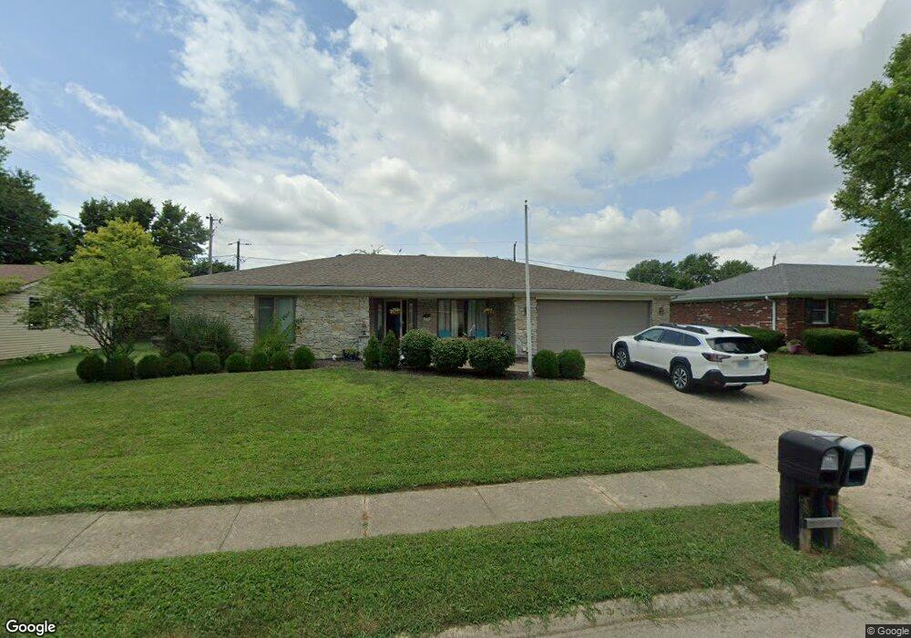
222 King Arthur Dr Franklin, IN 46131
Estimated Value: $273,000 - $286,000
3
Beds
2
Baths
1,643
Sq Ft
$168/Sq Ft
Est. Value
About This Home
This home is located at 222 King Arthur Dr, Franklin, IN 46131 and is currently estimated at $276,552, approximately $168 per square foot. 222 King Arthur Dr is a home located in Johnson County with nearby schools including Northwood Elementary School, Custer Baker Intermediate School, and Franklin Community Middle School.
Ownership History
Date
Name
Owned For
Owner Type
Purchase Details
Closed on
Jun 18, 2012
Sold by
Walls Justin and Walls Kristin M
Bought by
Duvall Carolyn F
Current Estimated Value
Home Financials for this Owner
Home Financials are based on the most recent Mortgage that was taken out on this home.
Original Mortgage
$98,000
Outstanding Balance
$67,917
Interest Rate
3.83%
Mortgage Type
New Conventional
Estimated Equity
$208,635
Purchase Details
Closed on
Feb 5, 2010
Sold by
Schultz Mary Jane
Bought by
Walls Justin and Walls Kristin M
Home Financials for this Owner
Home Financials are based on the most recent Mortgage that was taken out on this home.
Original Mortgage
$93,279
Interest Rate
5.62%
Mortgage Type
FHA
Purchase Details
Closed on
Mar 25, 2008
Sold by
Eggers Jeffrey C
Bought by
Schultz Mary Jane
Purchase Details
Closed on
Nov 16, 2006
Sold by
Prince Marlin H and Prince Virginia M
Bought by
Vanskyock Geraldine E
Create a Home Valuation Report for This Property
The Home Valuation Report is an in-depth analysis detailing your home's value as well as a comparison with similar homes in the area
Home Values in the Area
Average Home Value in this Area
Purchase History
| Date | Buyer | Sale Price | Title Company |
|---|---|---|---|
| Duvall Carolyn F | -- | First American Title Insuran | |
| Walls Justin | -- | None Available | |
| Schultz Mary Jane | -- | None Available | |
| Vanskyock Geraldine E | -- | None Available | |
| Prince Marlin H | -- | None Available |
Source: Public Records
Mortgage History
| Date | Status | Borrower | Loan Amount |
|---|---|---|---|
| Open | Duvall Carolyn F | $98,000 | |
| Previous Owner | Walls Justin | $93,279 |
Source: Public Records
Tax History Compared to Growth
Tax History
| Year | Tax Paid | Tax Assessment Tax Assessment Total Assessment is a certain percentage of the fair market value that is determined by local assessors to be the total taxable value of land and additions on the property. | Land | Improvement |
|---|---|---|---|---|
| 2025 | $2,016 | $234,100 | $17,200 | $216,900 |
| 2024 | $2,016 | $183,600 | $17,500 | $166,100 |
| 2023 | $1,985 | $180,600 | $17,500 | $163,100 |
| 2022 | $1,849 | $166,700 | $17,500 | $149,200 |
| 2021 | $1,611 | $146,000 | $16,700 | $129,300 |
| 2020 | $1,590 | $144,200 | $16,700 | $127,500 |
| 2019 | $1,478 | $134,400 | $16,700 | $117,700 |
| 2018 | $1,278 | $131,400 | $16,700 | $114,700 |
| 2017 | $1,242 | $124,200 | $16,700 | $107,500 |
| 2016 | $1,225 | $121,300 | $16,700 | $104,600 |
| 2014 | $1,171 | $111,200 | $19,500 | $91,700 |
| 2013 | $1,171 | $116,900 | $19,500 | $97,400 |
Source: Public Records
Map
Nearby Homes
- 492 Pelenor Dr
- 2146 Charles Dr
- 2090 Pelican Dr
- 2084 Pelican Dr
- 1199 Hospital Rd Unit 149
- 1338 Swan Dr
- 1397 Greenbriar Way
- 990 Canary Creek Dr
- 1283 Crabapple Rd
- 1050 Wild Ivy Trail Unit 1052
- 1343 Crabapple Rd
- 1213 Greenbriar Way
- Norway Plan at Westwind at Cumberland
- Bradford Plan at Westwind at Cumberland
- Juniper Plan at Westwind at Cumberland
- Aspen II Plan at Westwind at Cumberland
- Empress Plan at Westwind at Cumberland
- Cooper Plan at Westwind at Cumberland
- Spruce Plan at Westwind at Cumberland
- Palmetto Plan at Westwind at Cumberland
- 260 King Arthur Dr
- 287 Galahad Dr
- 257 Galahad Dr
- 118 King Arthur Dr
- 307 Galahad Dr
- 207 Galahad Dr
- 201 King Arthur Dr
- 298 King Arthur Dr
- 223 King Arthur Dr
- 267 King Arthur Dr
- 317 Galahad Dr
- 116 King Arthur Dr
- 187 Galahad Dr
- 102 Merlin Dr
- 320 King Arthur Dr
- 291 King Arthur Dr
- 337 Galahad Dr
- 117 King Arthur Dr
- 1345 Wright Ct