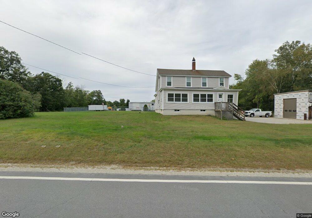
222 Whitehall Rd Hooksett, NH 03106
Estimated Value: $380,294
2
Beds
1
Bath
1,530
Sq Ft
$249/Sq Ft
Est. Value
About This Home
This home is located at 222 Whitehall Rd, Hooksett, NH 03106 and is currently estimated at $380,294, approximately $248 per square foot. 222 Whitehall Rd is a home located in Merrimack County with nearby schools including Fred C. Underhill School, Hooksett Memorial School, and David R. Cawley Middle School.
Ownership History
Date
Name
Owned For
Owner Type
Purchase Details
Closed on
Apr 25, 2019
Sold by
Whitehall Realty Ent Llc
Bought by
479 Realty Holdings Llc
Current Estimated Value
Home Financials for this Owner
Home Financials are based on the most recent Mortgage that was taken out on this home.
Original Mortgage
$200,000
Outstanding Balance
$175,836
Interest Rate
4.3%
Mortgage Type
Purchase Money Mortgage
Estimated Equity
$204,458
Purchase Details
Closed on
Sep 7, 2001
Sold by
Daigle Gilles L and Daigle Lucille Y
Bought by
Whitehall Rlty Enterpr
Home Financials for this Owner
Home Financials are based on the most recent Mortgage that was taken out on this home.
Original Mortgage
$120,000
Interest Rate
7.05%
Mortgage Type
Commercial
Create a Home Valuation Report for This Property
The Home Valuation Report is an in-depth analysis detailing your home's value as well as a comparison with similar homes in the area
Home Values in the Area
Average Home Value in this Area
Purchase History
| Date | Buyer | Sale Price | Title Company |
|---|---|---|---|
| 479 Realty Holdings Llc | $200,000 | -- | |
| Whitehall Rlty Enterpr | $160,000 | -- |
Source: Public Records
Mortgage History
| Date | Status | Borrower | Loan Amount |
|---|---|---|---|
| Open | 479 Realty Holdings Llc | $200,000 | |
| Previous Owner | Whitehall Rlty Enterpr | $120,000 |
Source: Public Records
Tax History Compared to Growth
Tax History
| Year | Tax Paid | Tax Assessment Tax Assessment Total Assessment is a certain percentage of the fair market value that is determined by local assessors to be the total taxable value of land and additions on the property. | Land | Improvement |
|---|---|---|---|---|
| 2024 | $6,699 | $395,000 | $162,200 | $232,800 |
| 2023 | $6,312 | $395,000 | $162,200 | $232,800 |
| 2022 | $6,390 | $265,700 | $124,500 | $141,200 |
| 2021 | $5,904 | $265,700 | $124,500 | $141,200 |
| 2020 | $5,981 | $265,700 | $124,500 | $141,200 |
| 2019 | $5,726 | $265,700 | $124,500 | $141,200 |
| 2018 | $5,877 | $265,700 | $124,500 | $141,200 |
| 2017 | $6,198 | $231,800 | $129,900 | $101,900 |
| 2016 | $6,117 | $231,800 | $129,900 | $101,900 |
| 2015 | $5,730 | $231,800 | $129,900 | $101,900 |
| 2014 | $5,756 | $231,800 | $129,900 | $101,900 |
| 2013 | $5,443 | $231,800 | $129,900 | $101,900 |
Source: Public Records
Map
Nearby Homes
- 2 Farrwood Dr
- 197 Whitehall Rd
- 111 Laurel Lot 35 Rd
- 30 Laurel Rd
- 125 Laurel Rd Unit 33
- 347 and 26 Whitehall Road and Chester Turnpike
- 34 Lindsay Rd
- 18 Julia Dr
- 6 Gailor Ln
- 0 N Candia Rd Unit 21 5039875
- 7 Mulberry Ln
- 22 Harmony Ln
- 286B Londonderry Turnpike Unit A
- 286 Londonderry Turnpike Unit A
- 69 Heather Cir
- 65 Marlette Ave
- 27 Martins Ferry Rd
- 843 High St Unit 13A
- 843 High St Unit 14B
- 136 Mammoth Rd Unit 628
- 3 Craneway
- 230 Whitehall Rd
- 220 Whitehall Rd
- 7 Crane Way
- 6 Farrwood Dr
- 219 Whitehall Rd
- 210 Whitehall Rd
- 223 Whitehall Rd
- 4 Farrwood Dr
- 227 Whitehall Rd
- 215 Whitehall Rd
- 208 Whitehall Rd
- 213 Whitehall Rd
- 235 Whitehall Rd
- 1 Farrwood Dr
- 5 Farrwood Dr
- 7 Farrwood Dr
- 239 Whitehall Rd
- 9 Farrwood Dr
- 231 Whitehall Rd