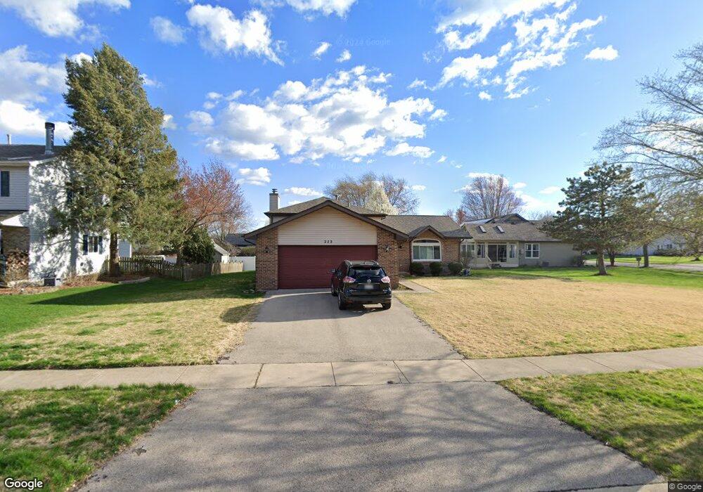
222 Whitetail Crossing Oswego, IL 60543
Northwest Oswego NeighborhoodEstimated Value: $309,000 - $350,000
3
Beds
2
Baths
1,171
Sq Ft
$286/Sq Ft
Est. Value
About This Home
This home is located at 222 Whitetail Crossing, Oswego, IL 60543 and is currently estimated at $335,122, approximately $286 per square foot. 222 Whitetail Crossing is a home located in Kendall County with nearby schools including Fox Chase Elementary School, Traughber Junior High School, and Oswego High School.
Ownership History
Date
Name
Owned For
Owner Type
Purchase Details
Closed on
Feb 3, 2021
Sold by
Mcdonald Robert J and Quartuccio Erin J
Bought by
Mcdonald Robert J and Quartuccio Erin J
Current Estimated Value
Home Financials for this Owner
Home Financials are based on the most recent Mortgage that was taken out on this home.
Original Mortgage
$150,000
Outstanding Balance
$134,549
Interest Rate
2.87%
Mortgage Type
New Conventional
Estimated Equity
$200,573
Purchase Details
Closed on
Sep 25, 2017
Sold by
Stamatopoulos Xenia K
Bought by
Mcdonald Robert
Home Financials for this Owner
Home Financials are based on the most recent Mortgage that was taken out on this home.
Original Mortgage
$156,000
Interest Rate
3.87%
Mortgage Type
New Conventional
Purchase Details
Closed on
Dec 13, 1993
Bought by
Stamatopoulos Marino P
Create a Home Valuation Report for This Property
The Home Valuation Report is an in-depth analysis detailing your home's value as well as a comparison with similar homes in the area
Home Values in the Area
Average Home Value in this Area
Purchase History
| Date | Buyer | Sale Price | Title Company |
|---|---|---|---|
| Mcdonald Robert J | -- | Ravenswoo Title Company Llc | |
| Mcdonald Robert | $195,000 | First American Title | |
| Stamatopoulos Marino P | $136,100 | -- |
Source: Public Records
Mortgage History
| Date | Status | Borrower | Loan Amount |
|---|---|---|---|
| Open | Mcdonald Robert J | $150,000 | |
| Closed | Mcdonald Robert | $156,000 | |
| Closed | Stamatopoulos Marino P | -- |
Source: Public Records
Tax History Compared to Growth
Tax History
| Year | Tax Paid | Tax Assessment Tax Assessment Total Assessment is a certain percentage of the fair market value that is determined by local assessors to be the total taxable value of land and additions on the property. | Land | Improvement |
|---|---|---|---|---|
| 2024 | $7,433 | $98,364 | $14,485 | $83,879 |
| 2023 | $6,734 | $87,825 | $12,933 | $74,892 |
| 2022 | $6,734 | $80,573 | $11,865 | $68,708 |
| 2021 | $6,619 | $76,736 | $11,300 | $65,436 |
| 2020 | $6,612 | $75,976 | $11,188 | $64,788 |
| 2019 | $6,256 | $71,177 | $11,188 | $59,989 |
| 2018 | $6,003 | $69,980 | $11,000 | $58,980 |
| 2017 | $5,611 | $60,733 | $6,623 | $54,110 |
| 2016 | $5,684 | $60,651 | $17,007 | $43,644 |
| 2015 | $5,306 | $54,641 | $15,322 | $39,319 |
| 2014 | -- | $51,548 | $14,455 | $37,093 |
| 2013 | -- | $52,069 | $14,601 | $37,468 |
Source: Public Records
Map
Nearby Homes
- 608 Clearwater Ct
- 602 Clearwater Ct Unit 2
- 403 Lake Ct
- 1721 State Route 31
- 505 Parkland Ct
- 2110 State Route 31
- 133 River Mist Dr Unit 3
- 156 River Mist Dr
- 2350 State Route 31
- 125 Presidential Blvd Unit 3248
- 338 Millstream Ln Unit 1
- 409 Fawn Dr
- 2100 Light Rd Unit 109
- 173 Dolores St
- 102 Mary St
- 5055 U S 34
- 34 N Adams St
- 435 Fawn Dr
- 514 Bentson St
- 613 Murdock Place
- 220 Whitetail Crossing
- 224 Whitetail Crossing
- 216 Deerpath Dr Unit 2
- 226 Whitetail Crossing
- 231 Whitetail Crossing
- 214 Deerpath Dr
- 229 Whitetail Crossing
- 233 Whitetail Crossing Unit 2
- 235 Whitetail Crossing
- 212 Deerpath Dr Unit 2
- 227 Whitetail Crossing
- 228 Whitetail Crossing
- 219 Whitetail Crossing
- 226 Deerpath Dr
- 221 Whitetail Crossing
- 235 Fox Chase Dr N
- 233 Fox Chase Dr N Unit 1
- 210 Deerpath Dr
- 225 Whitetail Crossing
- 223 Whitetail Crossing