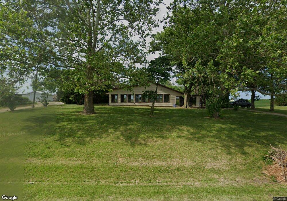
22210 N 1800th Rd Bushnell, IL 61422
Estimated Value: $124,000 - $180,000
--
Bed
--
Bath
--
Sq Ft
2.43
Acres
About This Home
This home is located at 22210 N 1800th Rd, Bushnell, IL 61422 and is currently estimated at $155,554. 22210 N 1800th Rd is a home located in McDonough County with nearby schools including Bushnell-Prairie City Elementary School, Bushnell-Prairie City Junior High School, and Bushnell-Prairie City High School.
Ownership History
Date
Name
Owned For
Owner Type
Purchase Details
Closed on
Jun 30, 2020
Sold by
Anthony Fredrick L and Anthony Karma L
Bought by
Anthony Nathan C and Anthony Aaron K
Current Estimated Value
Home Financials for this Owner
Home Financials are based on the most recent Mortgage that was taken out on this home.
Original Mortgage
$84,400
Outstanding Balance
$23,616
Interest Rate
4.02%
Mortgage Type
Future Advance Clause Open End Mortgage
Estimated Equity
$131,938
Purchase Details
Closed on
Sep 2, 2015
Sold by
Anthony Fredrick L and Anthony Karma L
Bought by
Anthony Nathan C and Anthony Aaron K
Create a Home Valuation Report for This Property
The Home Valuation Report is an in-depth analysis detailing your home's value as well as a comparison with similar homes in the area
Home Values in the Area
Average Home Value in this Area
Purchase History
| Date | Buyer | Sale Price | Title Company |
|---|---|---|---|
| Anthony Nathan C | $95,000 | None Available | |
| Anthony Nathan C | -- | None Available |
Source: Public Records
Mortgage History
| Date | Status | Borrower | Loan Amount |
|---|---|---|---|
| Open | Anthony Nathan C | $84,400 |
Source: Public Records
Tax History Compared to Growth
Tax History
| Year | Tax Paid | Tax Assessment Tax Assessment Total Assessment is a certain percentage of the fair market value that is determined by local assessors to be the total taxable value of land and additions on the property. | Land | Improvement |
|---|---|---|---|---|
| 2024 | $1,720 | $27,477 | $4,114 | $23,363 |
| 2023 | $1,650 | $27,186 | $4,070 | $23,116 |
| 2022 | $1,448 | $24,576 | $3,679 | $20,897 |
| 2021 | $1,369 | $23,529 | $3,522 | $20,007 |
| 2020 | $1,552 | $22,802 | $3,472 | $19,330 |
| 2019 | $1,622 | $20,142 | $3,618 | $16,524 |
| 2018 | $1,623 | $20,564 | $3,694 | $16,870 |
| 2017 | $0 | $20,270 | $3,641 | $16,629 |
| 2016 | $0 | $18,743 | $3,367 | $15,376 |
| 2015 | -- | $18,743 | $3,367 | $15,376 |
| 2014 | -- | $18,457 | $3,316 | $15,141 |
| 2013 | -- | $19,936 | $3,582 | $16,354 |
Source: Public Records
Map
Nearby Homes
- 14 Hillcrest Dr
- 777 Cole St
- 651 N Sperry St
- 924 N Crafford St
- 994 N Crafford St
- 1024 W Main St
- 134 W Osborne St
- 195 W Hail St
- 310 N Dean St
- 4 Hiel Dr
- 555 N Jackson St
- 425 N Jackson St
- 295 W Harris Ave
- 651 N Washington St
- 539 W Barnes St
- 22561 N Cornerstone Rd
- 18520 N 1450th Rd
- 300 S Park St
- 0 Illinois 95
- 235 N Smith St