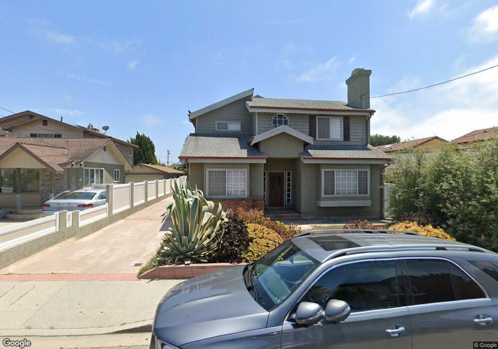
2222 Warfield Ave Unit A Redondo Beach, CA 90278
North Redondo Beach NeighborhoodEstimated Value: $1,406,762 - $1,635,000
4
Beds
3
Baths
2,300
Sq Ft
$673/Sq Ft
Est. Value
About This Home
This home is located at 2222 Warfield Ave Unit A, Redondo Beach, CA 90278 and is currently estimated at $1,548,191, approximately $673 per square foot. 2222 Warfield Ave Unit A is a home located in Los Angeles County with nearby schools including Lincoln Elementary School, Adams Middle School, and Redondo Union High School.
Ownership History
Date
Name
Owned For
Owner Type
Purchase Details
Closed on
Feb 9, 2005
Sold by
Wilk Michael and Wilk Anne Riordan
Bought by
Stahl Sandra L
Current Estimated Value
Home Financials for this Owner
Home Financials are based on the most recent Mortgage that was taken out on this home.
Original Mortgage
$170,000
Interest Rate
5.77%
Mortgage Type
Purchase Money Mortgage
Create a Home Valuation Report for This Property
The Home Valuation Report is an in-depth analysis detailing your home's value as well as a comparison with similar homes in the area
Home Values in the Area
Average Home Value in this Area
Purchase History
| Date | Buyer | Sale Price | Title Company |
|---|---|---|---|
| Stahl Sandra L | $658,500 | North American Title Co |
Source: Public Records
Mortgage History
| Date | Status | Borrower | Loan Amount |
|---|---|---|---|
| Previous Owner | Stahl Sandra L | $170,000 |
Source: Public Records
Tax History
| Year | Tax Paid | Tax Assessment Tax Assessment Total Assessment is a certain percentage of the fair market value that is determined by local assessors to be the total taxable value of land and additions on the property. | Land | Improvement |
|---|---|---|---|---|
| 2025 | $10,795 | $917,319 | $595,752 | $321,567 |
| 2024 | $10,795 | $899,333 | $584,071 | $315,262 |
| 2023 | $10,600 | $881,700 | $572,619 | $309,081 |
| 2022 | $10,416 | $864,413 | $561,392 | $303,021 |
| 2021 | $10,133 | $847,465 | $550,385 | $297,080 |
| 2019 | $9,894 | $822,330 | $534,061 | $288,269 |
| 2018 | $9,592 | $806,207 | $523,590 | $282,617 |
| 2016 | $9,277 | $774,903 | $503,259 | $271,644 |
| 2015 | $9,109 | $763,264 | $495,700 | $267,564 |
| 2014 | $8,977 | $748,313 | $485,990 | $262,323 |
Source: Public Records
Map
Nearby Homes
- 2216 Bataan Rd Unit A
- 2861 Pinckard Ave
- 3310 Blossom Ln
- 2016 Farrell Ave Unit B
- 2016 Farrell Ave Unit A
- 2813 Pinckard Ave
- 2614 Manhattan Beach Blvd
- 2005 Robinson St Unit B
- 2012 Robinson St
- 1827 9th St
- 1852 6th St
- 1819 11th St
- 2212 Gates Ave Unit B
- 1820 9th St
- 1816 9th St
- 311 Aviation Place
- 213 Aviation Place
- 1806 6th St
- 2021 Curtis Ave
- 2406 Curtis Ave
- 2222 Warfield Ave Unit B
- 2224 Warfield Ave
- 2220 Warfield Ave
- 2226 Warfield Ave
- 2218 Warfield Ave Unit B
- 2218 Warfield Ave Unit A
- 2223 Dufour Ave Unit B
- 2223 Dufour Ave Unit A
- 2216 Warfield Ave
- 2228 Warfield Ave
- 2225 Dufour Ave
- 2221 Dufour Ave Unit A
- 2219 Dufour Ave
- 2223 Warfield Ave Unit A
- 2223 Warfield Ave Unit B
- 2225 Warfield Ave
- 2227 Dufour Ave Unit B
- 2227 Dufour Ave
- 2221 Warfield Ave
- 2221 Warfield Ave Unit B
Your Personal Tour Guide
Ask me questions while you tour the home.