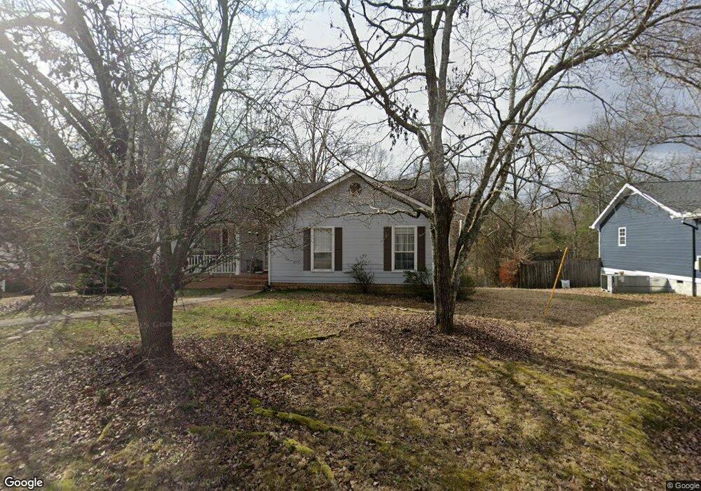
2223 N Fork Dr Soddy Daisy, TN 37379
Estimated Value: $293,000 - $332,000
3
Beds
2
Baths
1,347
Sq Ft
$232/Sq Ft
Est. Value
About This Home
This home is located at 2223 N Fork Dr, Soddy Daisy, TN 37379 and is currently estimated at $312,753, approximately $232 per square foot. 2223 N Fork Dr is a home located in Hamilton County with nearby schools including Loftis Middle School.
Ownership History
Date
Name
Owned For
Owner Type
Purchase Details
Closed on
Mar 29, 2022
Sold by
Hatfield 3 Richard L & Michelle E
Bought by
Hatfield Richard L
Current Estimated Value
Home Financials for this Owner
Home Financials are based on the most recent Mortgage that was taken out on this home.
Original Mortgage
$117,000
Interest Rate
2.9%
Mortgage Type
New Conventional
Purchase Details
Closed on
Dec 24, 1997
Sold by
Watkins James E
Bought by
Hatfield Richard L and Hatfield Michelle E
Home Financials for this Owner
Home Financials are based on the most recent Mortgage that was taken out on this home.
Original Mortgage
$92,485
Interest Rate
7.2%
Mortgage Type
FHA
Create a Home Valuation Report for This Property
The Home Valuation Report is an in-depth analysis detailing your home's value as well as a comparison with similar homes in the area
Home Values in the Area
Average Home Value in this Area
Purchase History
| Date | Buyer | Sale Price | Title Company |
|---|---|---|---|
| Hatfield Richard L | -- | Amrock | |
| Hatfield Richard L | $93,000 | First Title |
Source: Public Records
Mortgage History
| Date | Status | Borrower | Loan Amount |
|---|---|---|---|
| Previous Owner | Hatfield Richard L | $117,000 | |
| Previous Owner | Hatfield Richard L | $92,485 |
Source: Public Records
Tax History Compared to Growth
Tax History
| Year | Tax Paid | Tax Assessment Tax Assessment Total Assessment is a certain percentage of the fair market value that is determined by local assessors to be the total taxable value of land and additions on the property. | Land | Improvement |
|---|---|---|---|---|
| 2024 | $1,036 | $46,300 | $0 | $0 |
| 2023 | $1,045 | $46,300 | $0 | $0 |
| 2022 | $1,045 | $46,300 | $0 | $0 |
| 2021 | $1,045 | $46,300 | $0 | $0 |
| 2020 | $1,019 | $36,525 | $0 | $0 |
| 2019 | $1,019 | $36,525 | $0 | $0 |
| 2018 | $1,019 | $36,525 | $0 | $0 |
| 2017 | $1,019 | $36,525 | $0 | $0 |
| 2016 | $926 | $0 | $0 | $0 |
| 2015 | $926 | $33,150 | $0 | $0 |
| 2014 | $926 | $0 | $0 | $0 |
Source: Public Records
Map
Nearby Homes
- 2031 Millard Rd
- 2109 Millard Rd
- 11111 Hixson Pike
- 1818 Millard Rd
- 9429 Hackberry Ln
- 1848 Coffee Tree Ln
- 1724 Magnum Ln
- 9802 Shoreline Heights Dr
- 10160 Hunters Hollow Dr
- 2522 W Wind Dr
- 10166 Hunters Hollow Dr
- 9955 Rolling Wind Dr
- 10041 Rolling Wind Dr
- 9901 Breeze Hill Ln
- 2228 Lakesite Dr
- 2316 Lakesite Dr
- 1818 Short Leaf Ln
- 2119 Collins Ln
- 2316 Green Valley Rd
- 2033 Angler Dr
- 2219 N Fork Dr
- 2233 N Fork Dr
- 2226 N Fork Dr Unit 14
- 2228 N Fork Dr Unit 13
- 2226 N Fork Dr
- 2228 N Fork Dr
- 2224 N Fork Dr
- 2217 N Fork Dr
- 9604 Demetra Ln
- 2220 N Fork Dr
- 2218 N Fork Dr
- 9702 Ricole Trail
- 2211 N Fork Dr
- 2237 N Fork Dr
- 2234 N Fork Dr
- 2214 N Fork Dr
- 9600 Demetra Ln
- 9700 Ricole Trail
- 2125 N Fork Dr
- 9605 Demetra Ln