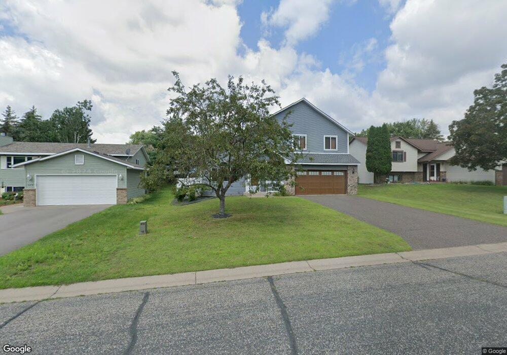
2225 Mcafee Cir Saint Paul, MN 55109
Sherwood Glen NeighborhoodEstimated Value: $382,000 - $448,000
3
Beds
3
Baths
2,064
Sq Ft
$198/Sq Ft
Est. Value
About This Home
This home is located at 2225 Mcafee Cir, Saint Paul, MN 55109 and is currently estimated at $408,405, approximately $197 per square foot. 2225 Mcafee Cir is a home located in Ramsey County with nearby schools including Weaver Elementary School, John Glenn Middle School, and St Jerome Elementary School.
Ownership History
Date
Name
Owned For
Owner Type
Purchase Details
Closed on
Sep 25, 2020
Sold by
Grundhoefer Tammi M and Grundhoefer Joseph M
Bought by
Lee Tong and Yang Yer
Current Estimated Value
Home Financials for this Owner
Home Financials are based on the most recent Mortgage that was taken out on this home.
Original Mortgage
$325,000
Interest Rate
2.8%
Mortgage Type
VA
Purchase Details
Closed on
Jun 26, 2015
Sold by
Lux Dean M and Lux Peggy S
Bought by
Grundhoefer Tammi and Grundhoefer Joseph M
Home Financials for this Owner
Home Financials are based on the most recent Mortgage that was taken out on this home.
Original Mortgage
$220,924
Interest Rate
3.5%
Mortgage Type
FHA
Create a Home Valuation Report for This Property
The Home Valuation Report is an in-depth analysis detailing your home's value as well as a comparison with similar homes in the area
Home Values in the Area
Average Home Value in this Area
Purchase History
| Date | Buyer | Sale Price | Title Company |
|---|---|---|---|
| Lee Tong | $325,000 | Titlesmart Inc | |
| Grundhoefer Tammi | $231,818 | Burnet Title | |
| Lee Tong Tong | $325,000 | -- |
Source: Public Records
Mortgage History
| Date | Status | Borrower | Loan Amount |
|---|---|---|---|
| Previous Owner | Lee Tong | $325,000 | |
| Previous Owner | Grundhoefer Tammi | $220,924 | |
| Closed | Lee Tong Tong | $325,000 |
Source: Public Records
Tax History
| Year | Tax Paid | Tax Assessment Tax Assessment Total Assessment is a certain percentage of the fair market value that is determined by local assessors to be the total taxable value of land and additions on the property. | Land | Improvement |
|---|---|---|---|---|
| 2025 | $4,966 | $397,600 | $49,200 | $348,400 |
| 2023 | $4,966 | $352,700 | $49,200 | $303,500 |
| 2022 | $4,410 | $339,700 | $49,200 | $290,500 |
| 2021 | $4,414 | $302,000 | $49,200 | $252,800 |
| 2020 | $4,388 | $308,200 | $49,200 | $259,000 |
| 2019 | $3,890 | $287,500 | $49,200 | $238,300 |
| 2018 | $3,942 | $261,700 | $49,200 | $212,500 |
| 2017 | $3,676 | $258,100 | $49,200 | $208,900 |
| 2016 | $3,352 | $0 | $0 | $0 |
| 2015 | $3,316 | $215,000 | $45,200 | $169,800 |
| 2014 | $2,746 | $0 | $0 | $0 |
Source: Public Records
Map
Nearby Homes
- 1442 Sandhurst Ave E
- 1290 Belmont Ln E
- 1261 Skillman Ave E
- 2022 English St
- 1515 Viking Dr E
- 1481 Sextant Ave E
- 1579 Grandview Ave E
- 2567 Clarence St
- 1984 Prosperity Rd
- 1705 Lark Ave
- 1855 Birmingham St
- 1800 Edward St
- 1764 English St
- 1800 E Shore Dr
- 1875 E Shore Dr Unit 302
- 1740 English St
- 1745 Duluth St
- 770 Viking Dr E
- 1856 Flandrau St
- 1669 Clarence St
- 2231 Mcafee Cir
- 2219 Mcafee Cir
- 2213 Mcafee Cir
- 2232 English St
- 2237 Mcafee Cir
- 2226 English St
- 2240 English St
- 2222 Mcafee Cir
- 2220 English St
- 2228 Mcafee Cir
- 2246 English St
- 2207 Mcafee Cir
- 2234 Mcafee Cir
- 2243 Mcafee Cir
- 2216 Mcafee Cir
- 2249 Mcafee Cir
- 2240 Mcafee Cir
- 2252 English St
- 1291 County Road B E
- 2210 Mcafee Cir
Your Personal Tour Guide
Ask me questions while you tour the home.