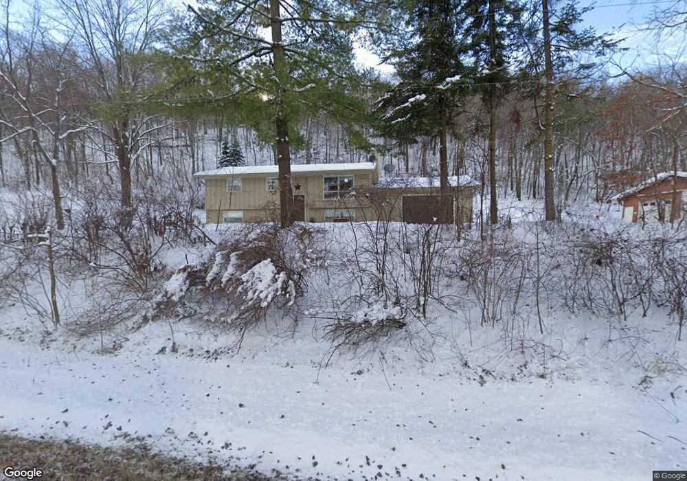
22252 282nd St Red Wing, MN 55066
Estimated Value: $435,000 - $519,000
3
Beds
2
Baths
1,013
Sq Ft
$470/Sq Ft
Est. Value
About This Home
This home is located at 22252 282nd St, Red Wing, MN 55066 and is currently estimated at $476,365, approximately $470 per square foot. 22252 282nd St is a home located in Goodhue County with nearby schools including Sunnyside Elementary School, Burnside Elementary School, and Twin Bluff Middle School.
Ownership History
Date
Name
Owned For
Owner Type
Purchase Details
Closed on
Sep 8, 2017
Sold by
Lind Mart and Lind Marsha
Bought by
Gadient Scott P and Gadient Lori L
Current Estimated Value
Purchase Details
Closed on
Nov 25, 2008
Sold by
Mcdonald John L and Mcdonald Rosalie C
Bought by
Lind Mart and Lind Marsha
Create a Home Valuation Report for This Property
The Home Valuation Report is an in-depth analysis detailing your home's value as well as a comparison with similar homes in the area
Home Values in the Area
Average Home Value in this Area
Purchase History
| Date | Buyer | Sale Price | Title Company |
|---|---|---|---|
| Gadient Scott P | $270,000 | None Available | |
| Lind Mart | -- | None Available |
Source: Public Records
Tax History Compared to Growth
Tax History
| Year | Tax Paid | Tax Assessment Tax Assessment Total Assessment is a certain percentage of the fair market value that is determined by local assessors to be the total taxable value of land and additions on the property. | Land | Improvement |
|---|---|---|---|---|
| 2025 | $2,988 | $404,000 | $155,100 | $248,900 |
| 2024 | -- | $398,700 | $155,100 | $243,600 |
| 2023 | $2,932 | $382,800 | $148,200 | $234,600 |
| 2022 | $2,678 | $356,600 | $143,700 | $212,900 |
| 2021 | $2,608 | $299,300 | $125,000 | $174,300 |
| 2020 | $2,646 | $288,600 | $127,800 | $160,800 |
| 2019 | $2,616 | $276,700 | $124,900 | $151,800 |
| 2018 | $2,152 | $261,100 | $122,100 | $139,000 |
| 2017 | $1,862 | $233,400 | $93,900 | $139,500 |
| 2016 | $1,592 | $219,700 | $93,900 | $125,800 |
| 2015 | $1,640 | $200,300 | $93,900 | $106,400 |
| 2014 | -- | $198,700 | $93,900 | $104,800 |
Source: Public Records
Map
Nearby Homes
- 1180 Hewitt Blvd
- 1181 Hewitt Blvd
- 1125 Hewitt Blvd
- 2773 Ridgeview Dr
- 998 Hewitt Blvd
- 2750 Ridgeview Dr
- 946 Briarwood Dr
- 3463 Briarview Ct
- 1978 Neal St
- 1505 Hillside Dr
- 1706 Siewert St
- 3560 Graves Dr
- 113 Burnside Ave S
- 2345 S Oak Dr
- 1632 Spruce Dr
- 1733 W 6th St
- 1728 W 6th St
- 528 Buchanan St
- 1224 Tee Up Ln
- 1715 W 5th St
- 22122 282nd St
- 28457 County 1 Blvd
- 28323 County 1 Blvd
- 28227 227th Avenue Path
- 28454 County 1 Blvd
- 28452 County 1 Blvd
- 28159 227th Avenue Path
- 28147 227th Avenue Path
- 22387 285th St
- 28456 County 1 Blvd
- 28117 227th Avenue Path
- 28580 County 1 Blvd
- 28075 County 1 Blvd
- 28671 County 1 Blvd
- 28051 County 1 Blvd
- 28681 County 1 Blvd
- 1904 Red Fox Dr
- 2857 Cougar Ct
- 1901 Red Fox Dr
- 22462 285th St