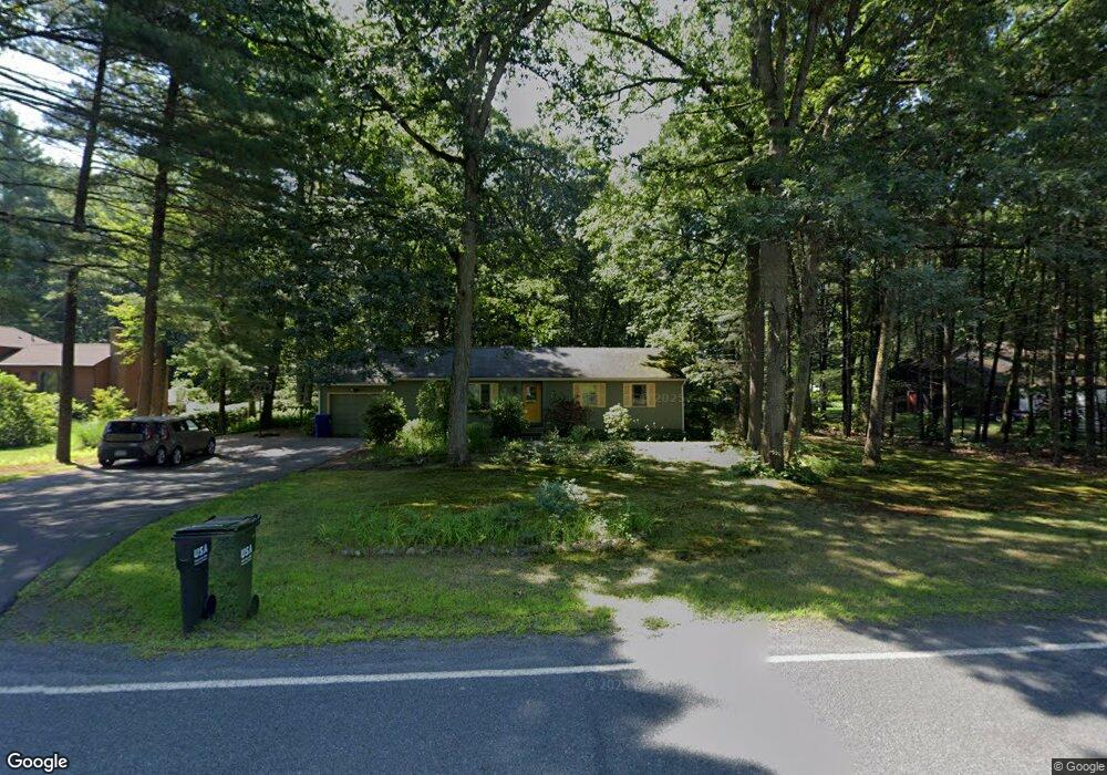
223 Plumtree Rd Sunderland, MA 01375
Estimated Value: $384,417 - $455,000
4
Beds
2
Baths
1,292
Sq Ft
$324/Sq Ft
Est. Value
About This Home
This home is located at 223 Plumtree Rd, Sunderland, MA 01375 and is currently estimated at $418,604, approximately $323 per square foot. 223 Plumtree Rd is a home located in Franklin County with nearby schools including Sunderland Elementary School and Frontier Regional School.
Ownership History
Date
Name
Owned For
Owner Type
Purchase Details
Closed on
Jan 14, 2011
Sold by
Klaus Rebecca D and Keenan Rebecca D
Bought by
Klaus Rebecca D and Klaus Kevin W
Current Estimated Value
Home Financials for this Owner
Home Financials are based on the most recent Mortgage that was taken out on this home.
Original Mortgage
$160,500
Outstanding Balance
$107,736
Interest Rate
4.46%
Mortgage Type
Purchase Money Mortgage
Estimated Equity
$310,868
Purchase Details
Closed on
Aug 22, 2003
Sold by
Antrobus Darrin A and Antrobus Douglas D
Bought by
Keenan Rebecca D
Home Financials for this Owner
Home Financials are based on the most recent Mortgage that was taken out on this home.
Original Mortgage
$178,000
Interest Rate
5.52%
Mortgage Type
Purchase Money Mortgage
Create a Home Valuation Report for This Property
The Home Valuation Report is an in-depth analysis detailing your home's value as well as a comparison with similar homes in the area
Home Values in the Area
Average Home Value in this Area
Purchase History
We collect this data history from publicly available records. To have your information removed, we recommend requesting removal directly through your county’s website.
| Date | Buyer | Sale Price | Title Company |
|---|---|---|---|
| Klaus Rebecca D | -- | -- | |
| Keenan Rebecca D | $188,000 | -- |
Source: Public Records
Mortgage History
We collect this data history from publicly available records. To have your information removed, we recommend requesting removal directly through your county’s website.
| Date | Status | Borrower | Loan Amount |
|---|---|---|---|
| Open | Keenan Rebecca D | $30,000 | |
| Open | Klaus Rebecca D | $160,500 | |
| Previous Owner | Keenan Rebecca D | $178,000 |
Source: Public Records
Tax History
| Year | Tax Paid | Tax Assessment Tax Assessment Total Assessment is a certain percentage of the fair market value that is determined by local assessors to be the total taxable value of land and additions on the property. | Land | Improvement |
|---|---|---|---|---|
| 2025 | $46 | $356,000 | $123,300 | $232,700 |
| 2024 | $4,678 | $356,000 | $123,300 | $232,700 |
| 2023 | $4,270 | $333,600 | $112,100 | $221,500 |
| 2022 | $4,287 | $291,600 | $96,100 | $195,500 |
| 2021 | $4,026 | $259,900 | $89,100 | $170,800 |
| 2020 | $5,539 | $259,800 | $89,100 | $170,700 |
| 2019 | $5,613 | $252,600 | $86,500 | $166,100 |
| 2018 | $3,695 | $246,300 | $83,000 | $163,300 |
| 2017 | $5,233 | $242,900 | $83,000 | $159,900 |
| 2016 | $3,470 | $236,700 | $81,400 | $155,300 |
| 2015 | $3,387 | $236,700 | $81,400 | $155,300 |
| 2014 | $3,309 | $236,700 | $81,400 | $155,300 |
Source: Public Records
Map
Nearby Homes
- 358 S Silver Ln
- 249 River Rd
- 45 Comins Rd
- 274 Sunderland Rd
- 10 Depot Rd
- 208 Pine St Unit 53
- 113 Juggler Meadow Rd
- 281 Leverett Rd
- 79 State Rd
- 87 Harlow Dr
- 390 State St
- 33 Bridge St
- 277 River Dr
- 691 E Pleasant St
- 13 Cider Mill Rd
- 185 Cherry Ln
- 74 N Hatfield Rd
- Lot A Kingman Rd
- Lot 1 N Hatfield Rd
- Lot 2 N Hatfield Rd
- 219 Plumtree Rd
- 231 Plumtree Rd
- 224 Plumtree Rd
- 213 Plumtree Rd
- 237 Plumtree Rd
- 220 Plumtree Rd
- 230 Plumtree Rd
- 207 Plumtree Rd
- 214 Plumtree Rd
- 241 Plumtree Rd
- 236 Plumtree Rd
- 226 Plumtree Rd
- 208 Plumtree Rd
- 229 Plumtree Rd
- 242 Plumtree Rd
- 201 Plumtree Rd
- 210 Plumtree Rd
- 247 Plumtree Rd
- 202 Plumtree Rd
- 246 Plumtree Rd
Your Personal Tour Guide
Ask me questions while you tour the home.