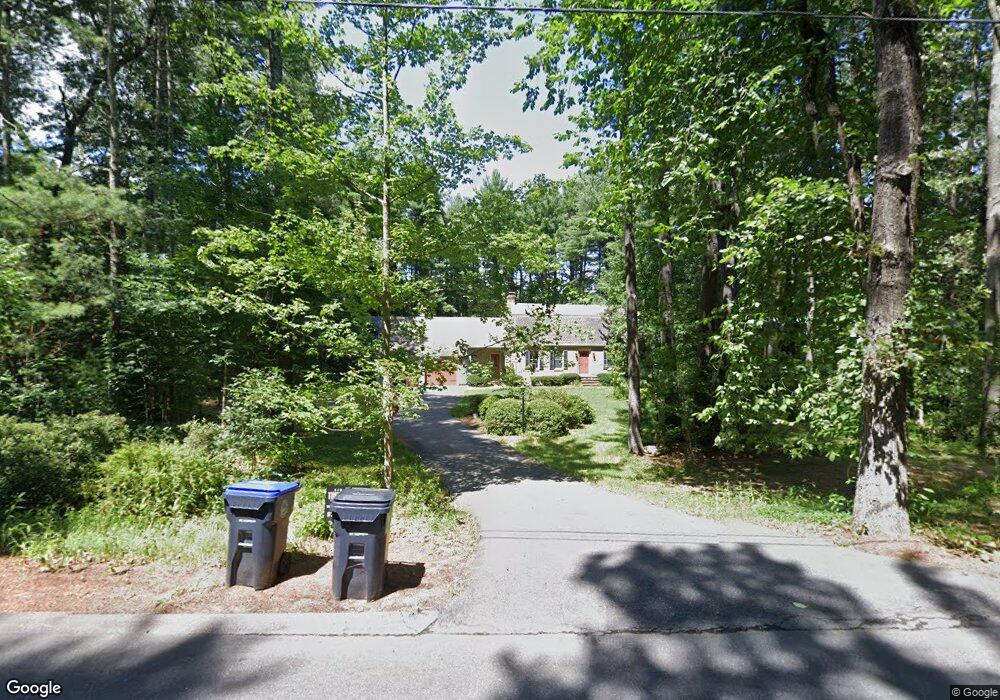
223 White Pond Rd Hudson, MA 01749
Estimated Value: $817,301 - $1,043,000
3
Beds
3
Baths
2,768
Sq Ft
$328/Sq Ft
Est. Value
About This Home
This home is located at 223 White Pond Rd, Hudson, MA 01749 and is currently estimated at $907,325, approximately $327 per square foot. 223 White Pond Rd is a home located in Middlesex County with nearby schools including David J. Quinn Middle School, Hudson High School, and Glenhaven Academy - JRI School.
Ownership History
Date
Name
Owned For
Owner Type
Purchase Details
Closed on
Sep 29, 2000
Sold by
Moorehead Bryan K and Moorehead Amy P
Bought by
Groves Candiloro C and Groves Heidi A
Current Estimated Value
Purchase Details
Closed on
Dec 9, 1997
Sold by
Sonsini Richard A and Sonsini Janet E
Bought by
Moorehead Bryan K and Moorehead Amy P
Create a Home Valuation Report for This Property
The Home Valuation Report is an in-depth analysis detailing your home's value as well as a comparison with similar homes in the area
Home Values in the Area
Average Home Value in this Area
Purchase History
| Date | Buyer | Sale Price | Title Company |
|---|---|---|---|
| Groves Candiloro C | $375,000 | -- | |
| Moorehead Bryan K | $247,000 | -- |
Source: Public Records
Mortgage History
| Date | Status | Borrower | Loan Amount |
|---|---|---|---|
| Open | Moorehead Bryan K | $265,000 | |
| Closed | Moorehead Bryan K | $37,000 | |
| Closed | Moorehead Bryan K | $275,000 |
Source: Public Records
Tax History Compared to Growth
Tax History
| Year | Tax Paid | Tax Assessment Tax Assessment Total Assessment is a certain percentage of the fair market value that is determined by local assessors to be the total taxable value of land and additions on the property. | Land | Improvement |
|---|---|---|---|---|
| 2025 | $9,881 | $711,900 | $223,200 | $488,700 |
| 2024 | $9,576 | $684,000 | $202,700 | $481,300 |
| 2023 | $8,716 | $597,000 | $195,100 | $401,900 |
| 2022 | $8,742 | $551,200 | $177,300 | $373,900 |
| 2021 | $6,967 | $500,900 | $169,100 | $331,800 |
| 2020 | $6,709 | $495,600 | $165,400 | $330,200 |
| 2019 | $7,769 | $456,200 | $165,400 | $290,800 |
| 2018 | $6,860 | $432,600 | $157,500 | $275,100 |
| 2017 | $7,539 | $430,800 | $150,200 | $280,600 |
| 2016 | $7,011 | $405,500 | $150,200 | $255,300 |
| 2015 | $6,958 | $402,900 | $150,200 | $252,700 |
| 2014 | $6,696 | $384,400 | $131,700 | $252,700 |
Source: Public Records
Map
Nearby Homes
- 3 Stonehill Rd
- 16 Minehan Ln
- 551 Sudbury St
- 618 Sudbury St
- 14 Old County Rd Unit 21
- 786 Main St
- 788 Main St
- 10 Old County Rd Unit 19
- 168 Blanchette Dr
- 10 Shoreline Dr Unit 12
- 1 Town Line Rd Unit 18
- 3 Lakeside Ave
- 3 Shore Line Dr Unit 15
- 8 Shoreline Dr Unit 11
- Stockbridge South Shore Plan at Lakemont by Toll Brothers
- Dickinson Plan at Lakemont by Toll Brothers
- Copley Plan at Lakemont by Toll Brothers
- Stockbridge Plan at Lakemont by Toll Brothers
- 3 Town Line Rd Unit 17
- 4 Gately Ave
- 225 White Pond Rd
- 219 White Pond Rd
- 2 Cranberry Ln
- 4 Cranberry Ln
- 227 White Pond Rd
- 209 White Pond Rd
- 6 Cranberry Ln
- 5 Cranberry Ln
- 213 White Pond Rd
- 7 Cranberry Ln
- 241 White Pond Rd
- 201 White Pond Rd
- 8 Cranberry Ln
- 190 White Pond Rd
- 1220 Concord Rd
- 189 White Pond Rd
- 186 White Pond Rd
- 182 White Pond Rd
- 181 White Pond Rd
- 3 Annie Terrace Dr