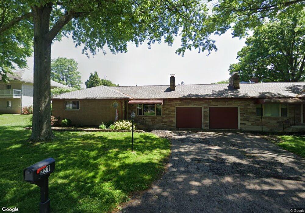
223 Winchester Rd Fairlawn, OH 44333
Estimated Value: $241,000 - $325,000
4
Beds
4
Baths
2,122
Sq Ft
$132/Sq Ft
Est. Value
About This Home
This home is located at 223 Winchester Rd, Fairlawn, OH 44333 and is currently estimated at $280,585, approximately $132 per square foot. 223 Winchester Rd is a home located in Summit County with nearby schools including Copley-Fairlawn Middle School, Copley High School, and Fairlawn Lutheran School.
Ownership History
Date
Name
Owned For
Owner Type
Purchase Details
Closed on
Nov 30, 2019
Sold by
Evans Paul S and Evans Kelly R
Bought by
Epm Holdings Llc
Current Estimated Value
Purchase Details
Closed on
Feb 7, 2011
Sold by
Jones Nancy Sue
Bought by
Evans Kelly R and Evans Paul S
Home Financials for this Owner
Home Financials are based on the most recent Mortgage that was taken out on this home.
Original Mortgage
$104,250
Interest Rate
4.84%
Mortgage Type
New Conventional
Purchase Details
Closed on
Aug 12, 1999
Sold by
Estate Of Mildred G Miller
Bought by
Jones Nancy Sue
Create a Home Valuation Report for This Property
The Home Valuation Report is an in-depth analysis detailing your home's value as well as a comparison with similar homes in the area
Home Values in the Area
Average Home Value in this Area
Purchase History
| Date | Buyer | Sale Price | Title Company |
|---|---|---|---|
| Epm Holdings Llc | -- | None Available | |
| Evans Kelly R | $139,000 | Accommodation | |
| Jones Nancy Sue | -- | -- |
Source: Public Records
Mortgage History
| Date | Status | Borrower | Loan Amount |
|---|---|---|---|
| Previous Owner | Evans Kelly R | $104,250 |
Source: Public Records
Tax History Compared to Growth
Tax History
| Year | Tax Paid | Tax Assessment Tax Assessment Total Assessment is a certain percentage of the fair market value that is determined by local assessors to be the total taxable value of land and additions on the property. | Land | Improvement |
|---|---|---|---|---|
| 2025 | $3,416 | $83,416 | $13,986 | $69,430 |
| 2024 | $3,416 | $83,416 | $13,986 | $69,430 |
| 2023 | $3,416 | $83,416 | $13,986 | $69,430 |
| 2022 | $3,382 | $68,373 | $11,463 | $56,910 |
| 2021 | $3,184 | $68,373 | $11,463 | $56,910 |
| 2020 | $3,114 | $68,370 | $11,460 | $56,910 |
| 2019 | $3,028 | $59,470 | $11,880 | $47,590 |
| 2018 | $2,969 | $59,470 | $11,880 | $47,590 |
| 2017 | $2,478 | $59,470 | $11,880 | $47,590 |
| 2016 | $2,478 | $46,320 | $9,220 | $37,100 |
| 2015 | $2,478 | $46,320 | $9,220 | $37,100 |
| 2014 | $2,470 | $46,320 | $9,220 | $37,100 |
| 2013 | $2,781 | $52,440 | $9,220 | $43,220 |
Source: Public Records
Map
Nearby Homes
- 288 Kenridge Rd
- 3143 Morewood Rd
- 342 S Miller Rd
- 3317 Morewood Rd
- 595 Moorfield Rd
- V/L White Tail Ridge Dr
- 2520 Holgate Rd
- 3354 Bancroft Rd
- 360 Marviel Dr
- 2385 Covington Rd Unit 402
- 177 Caladonia Ave
- 2375 Covington Rd Unit 311
- 2445 Chatham Rd
- 3475 Bancroft Rd
- 3404 S Smith Rd
- 3451 Stanley Rd
- 804 Miramar Ln
- 1012 Bunker Dr Unit 304
- 462 Gresham Dr
- 482 Gresham Dr
- 221 Winchester Rd Unit 223
- 2899 Morewood Rd Unit 2901
- 2903 Morewood Rd Unit 2905
- 224 Winchester Rd
- 210 Winchester Rd
- 245 Winchester Rd Unit 247
- 2939 Morewood Rd
- 2902 Morewood Rd
- 244 Winchester Rd
- 2892 Morewood Rd Unit 2894
- 200 Winchester Rd
- 2894 Morewood Rd
- 189 Winchester Rd Unit 191
- 189 Winchester Rd Unit 191
- 210 Buffington Rd
- 2951 Morewood Rd
- 2886 Morewood Rd Unit 2888
- 2934 Morewood Rd
- 208 Buffington Rd Unit 210
- 2880 Morewood Rd Unit 2882