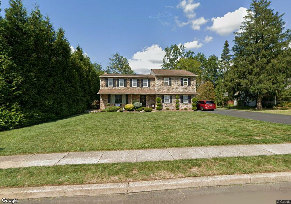
2232 Stewart Dr Hatfield, PA 19440
Estimated Value: $550,000 - $664,000
4
Beds
3
Baths
2,626
Sq Ft
$227/Sq Ft
Est. Value
About This Home
This home is located at 2232 Stewart Dr, Hatfield, PA 19440 and is currently estimated at $596,249, approximately $227 per square foot. 2232 Stewart Dr is a home located in Montgomery County with nearby schools including A. M. Kulp Elementary School, Pennfield Middle School, and North Penn Senior High School.
Ownership History
Date
Name
Owned For
Owner Type
Purchase Details
Closed on
Feb 1, 2011
Sold by
Mcgill John and Mcgill Kathleen
Bought by
Mcgill Kathleen and Mcgill John
Current Estimated Value
Home Financials for this Owner
Home Financials are based on the most recent Mortgage that was taken out on this home.
Original Mortgage
$121,000
Outstanding Balance
$82,758
Interest Rate
4.77%
Estimated Equity
$513,491
Purchase Details
Closed on
Oct 31, 2002
Sold by
Derstein Jerry R and Derstein Lela W
Bought by
Whalen Kathleen and Mcgill John
Create a Home Valuation Report for This Property
The Home Valuation Report is an in-depth analysis detailing your home's value as well as a comparison with similar homes in the area
Home Values in the Area
Average Home Value in this Area
Purchase History
| Date | Buyer | Sale Price | Title Company |
|---|---|---|---|
| Mcgill Kathleen | -- | None Available | |
| Whalen Kathleen | $230,000 | -- |
Source: Public Records
Mortgage History
| Date | Status | Borrower | Loan Amount |
|---|---|---|---|
| Open | Mcgill Kathleen | $121,000 |
Source: Public Records
Tax History Compared to Growth
Tax History
| Year | Tax Paid | Tax Assessment Tax Assessment Total Assessment is a certain percentage of the fair market value that is determined by local assessors to be the total taxable value of land and additions on the property. | Land | Improvement |
|---|---|---|---|---|
| 2025 | $6,542 | $163,420 | -- | -- |
| 2024 | $6,542 | $163,420 | -- | -- |
| 2023 | $6,262 | $163,420 | $0 | $0 |
| 2022 | $6,058 | $163,420 | $0 | $0 |
| 2021 | $5,886 | $163,420 | $0 | $0 |
| 2020 | $5,747 | $163,420 | $0 | $0 |
| 2019 | $5,651 | $163,420 | $0 | $0 |
| 2018 | $5,651 | $163,420 | $0 | $0 |
| 2017 | $5,435 | $163,420 | $0 | $0 |
| 2016 | $5,371 | $163,420 | $0 | $0 |
| 2015 | $5,156 | $163,420 | $0 | $0 |
| 2014 | $5,156 | $163,420 | $0 | $0 |
Source: Public Records
Map
Nearby Homes
- 2317 E Orvilla Rd
- 2674 Anthony Dr
- 732 Cowpath Rd
- 1226 Cabin Rd
- 9 Fortuna Dr
- 8 Fortuna Dr
- 5 Fortuna Dr
- 6 Fortuna Dr
- 1306 W Orvilla Rd
- 1315 Deer Run Rd
- 2111 Hidden Meadow Dr
- 83 Bethlehem Pike Unit 1213 FIRESTONE
- 83 Bethlehem Pike Unit 1106- MADISON PLAN
- 1744 Lydia Dr
- 2943 E Walnut St Unit 59
- 0 Fairmount St
- 401 Sadie Ave
- 381 Sydney Ave
- 373 Sydney Ln
- 375 Sydney Ln
- 2224 Stewart Dr
- 2240 Stewart Dr
- 2216 Stewart Dr
- 2248 Stewart Dr
- 2225 Stewart Dr
- 2233 Stewart Dr
- 2217 Stewart Dr
- 2208 Stewart Dr
- 2241 Stewart Dr
- 2209 Stewart Dr
- 2550 Line Lexington Rd
- 2200 Stewart Dr
- 2201 Stewart Dr
- 2207 Claremont Dr
- 2508 Line Lexington Rd
- 2504 Line Lexington Rd
- 2192 Stewart Dr
- 2500 Line Lexington Rd
- 725 Concord Way
- 2199 Claremont Dr