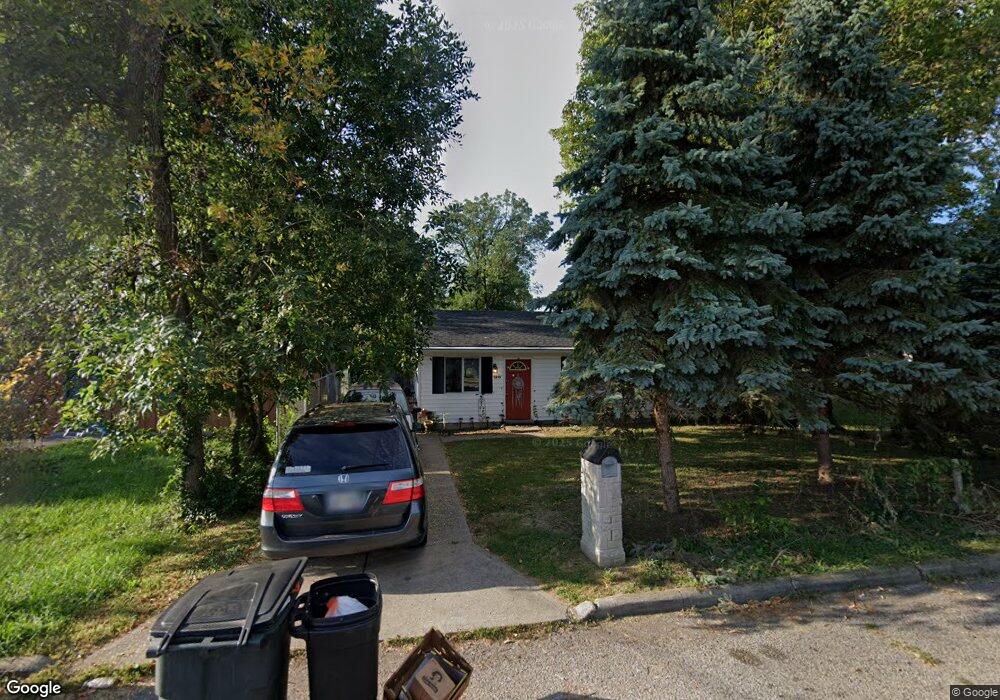
2235 Grant Ave Cincinnati, OH 45231
Mount Healthy Heights NeighborhoodEstimated Value: $144,846 - $226,000
3
Beds
1
Bath
1,147
Sq Ft
$152/Sq Ft
Est. Value
About This Home
This home is located at 2235 Grant Ave, Cincinnati, OH 45231 and is currently estimated at $174,462, approximately $152 per square foot. 2235 Grant Ave is a home located in Hamilton County with nearby schools including Mt Healthy High School, Hamilton County Mathematics and Science Academy, and Central Montessori Academy.
Ownership History
Date
Name
Owned For
Owner Type
Purchase Details
Closed on
Jun 13, 2005
Sold by
Caudill Darrell and Caudill Laura
Bought by
Caudill Melissa F
Current Estimated Value
Home Financials for this Owner
Home Financials are based on the most recent Mortgage that was taken out on this home.
Original Mortgage
$80,000
Outstanding Balance
$47,040
Interest Rate
8.22%
Mortgage Type
Fannie Mae Freddie Mac
Estimated Equity
$127,422
Purchase Details
Closed on
Oct 20, 1999
Sold by
Muennich Michael J and Muennich Dianna S
Bought by
Caudill Darrell and Caudill Laura
Home Financials for this Owner
Home Financials are based on the most recent Mortgage that was taken out on this home.
Original Mortgage
$75,200
Interest Rate
10.49%
Create a Home Valuation Report for This Property
The Home Valuation Report is an in-depth analysis detailing your home's value as well as a comparison with similar homes in the area
Home Values in the Area
Average Home Value in this Area
Purchase History
| Date | Buyer | Sale Price | Title Company |
|---|---|---|---|
| Caudill Melissa F | $100,000 | Advanced Land Title Agency L | |
| Caudill Darrell | $71,900 | Precision Land Title Agency |
Source: Public Records
Mortgage History
| Date | Status | Borrower | Loan Amount |
|---|---|---|---|
| Open | Caudill Melissa F | $80,000 | |
| Previous Owner | Caudill Darrell | $75,200 |
Source: Public Records
Tax History
| Year | Tax Paid | Tax Assessment Tax Assessment Total Assessment is a certain percentage of the fair market value that is determined by local assessors to be the total taxable value of land and additions on the property. | Land | Improvement |
|---|---|---|---|---|
| 2025 | $1,976 | $33,965 | $3,896 | $30,069 |
| 2023 | $1,860 | $33,965 | $3,896 | $30,069 |
| 2022 | $1,423 | $18,694 | $3,427 | $15,267 |
| 2021 | $1,385 | $18,694 | $3,427 | $15,267 |
| 2020 | $1,406 | $18,694 | $3,427 | $15,267 |
| 2019 | $1,367 | $16,993 | $3,115 | $13,878 |
| 2018 | $1,375 | $16,993 | $3,115 | $13,878 |
| 2017 | $1,304 | $16,993 | $3,115 | $13,878 |
| 2016 | $1,514 | $19,467 | $3,619 | $15,848 |
| 2015 | $1,526 | $19,467 | $3,619 | $15,848 |
| 2014 | $1,519 | $19,467 | $3,619 | $15,848 |
| 2013 | $1,790 | $23,454 | $4,361 | $19,093 |
Source: Public Records
Map
Nearby Homes
- 2342 Washington Ave
- 10877 Birchridge Dr
- 2071 Roosevelt Ave
- 10897 Sprucehill Dr
- 2508 Wilson Ave
- 1958 Bluehill Dr
- 2659 Roosevelt Ave
- 1931 Lotushill Dr
- 10908 Tangleberry Ct
- 10918 Newmarket Dr
- 1858 Aspenhill Dr
- 1876 Roosevelt Ave
- 1854 Windmill Way
- 2776 Klondike Ct
- 2845 Wilson Ave
- 2000 Struble Rd
- 10945 Penarth Dr
- 2936 Butterwick Dr
- 2617 Chesterhill Dr
- 10372 Pippin Ln
- 2231 Grant Ave
- 2241 Grant Ave
- 2209 Grant Ave
- 2269 Grant Ave
- 2236 Roosevelt Ave
- 2232 Roosevelt Ave
- 2238 Grant Ave
- 10856 Ruth Ave
- 2265 Grant Ave
- 2264 Roosevelt Ave
- 10835 Hamilton Ave
- 2268 Grant Ave
- 2237 Roosevelt Ave
- 2273 Grant Ave
- 2235 Wilson Ave
- 10866 Ruth Ave
- 2281 Grant Ave
- 2261 Roosevelt Ave
- 2242 Lincoln Ave
- 2269 Roosevelt Ave
Your Personal Tour Guide
Ask me questions while you tour the home.