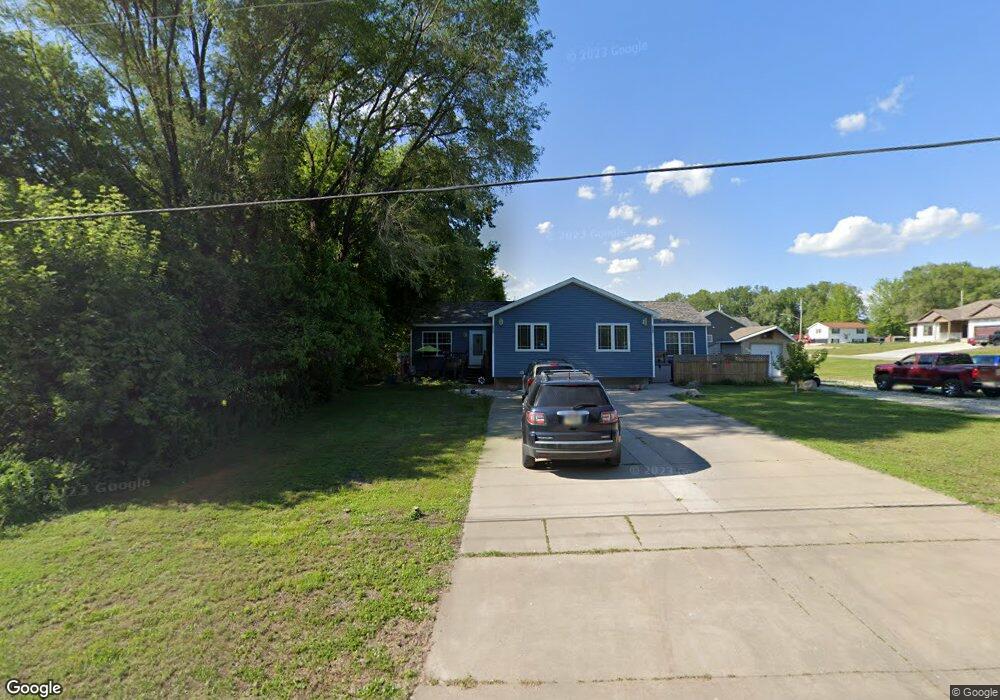
2235 Osage Ave Unit 2237 Evansdale, IA 50707
Maywood NeighborhoodEstimated Value: $219,429 - $281,000
4
Beds
2
Baths
2,208
Sq Ft
$117/Sq Ft
Est. Value
About This Home
This home is located at 2235 Osage Ave Unit 2237, Evansdale, IA 50707 and is currently estimated at $257,607, approximately $116 per square foot. 2235 Osage Ave Unit 2237 is a home located in Black Hawk County with nearby schools including Highland Elementary School, Bunger Middle School, and East High School.
Ownership History
Date
Name
Owned For
Owner Type
Purchase Details
Closed on
May 31, 2023
Sold by
City Of Waterloo Le
Bought by
Johnson Connie F
Current Estimated Value
Purchase Details
Closed on
Oct 19, 2011
Sold by
Tnj Construction Llc
Bought by
Johnson Connie F
Home Financials for this Owner
Home Financials are based on the most recent Mortgage that was taken out on this home.
Original Mortgage
$155,641
Interest Rate
4.12%
Mortgage Type
FHA
Create a Home Valuation Report for This Property
The Home Valuation Report is an in-depth analysis detailing your home's value as well as a comparison with similar homes in the area
Home Values in the Area
Average Home Value in this Area
Purchase History
| Date | Buyer | Sale Price | Title Company |
|---|---|---|---|
| Johnson Connie F | $1,000 | None Listed On Document | |
| Johnson Connie F | $160,000 | None Available |
Source: Public Records
Mortgage History
| Date | Status | Borrower | Loan Amount |
|---|---|---|---|
| Previous Owner | Johnson Connie F | $155,641 |
Source: Public Records
Tax History Compared to Growth
Tax History
| Year | Tax Paid | Tax Assessment Tax Assessment Total Assessment is a certain percentage of the fair market value that is determined by local assessors to be the total taxable value of land and additions on the property. | Land | Improvement |
|---|---|---|---|---|
| 2024 | $3,400 | $180,620 | $26,460 | $154,160 |
| 2023 | $2,942 | $183,350 | $29,190 | $154,160 |
| 2022 | $2,862 | $142,820 | $29,190 | $113,630 |
| 2021 | $2,608 | $142,820 | $29,190 | $113,630 |
| 2020 | $2,562 | $128,190 | $21,890 | $106,300 |
| 2019 | $2,562 | $128,190 | $21,890 | $106,300 |
| 2018 | $2,304 | $119,640 | $21,890 | $97,750 |
| 2017 | $2,304 | $118,730 | $21,890 | $96,840 |
| 2016 | $2,312 | $119,570 | $21,890 | $97,680 |
| 2015 | $2,312 | $119,570 | $21,890 | $97,680 |
| 2014 | $2,306 | $119,570 | $21,890 | $97,680 |
Source: Public Records
Map
Nearby Homes
- 108 Ogden Ave
- 924 Creston Ave
- 1022 Short St
- 47 Zuma St
- 244 Wema Ave
- 0 Skyview Rd Unit NBR20251892
- 421 Miner Dr
- 427 Adrian St
- 604 Ayers Ave
- 312 Skyview Rd
- 2836 Independence Ave
- 312 Glendale St
- 755 Fox Ave
- 127 Doyle Ave
- 825 Jones Rd
- 1446 Ruth St
- 1107 Central Ave
- 0 Madison Monroe Unit NBR20253026
- 901 Brookside Ave
- 1235 Independence Ave
- 119 Ogden Ave
- 121 Ogden Ave
- 122 Ogden Ave
- 2319 Osage Ave
- 1309 Wyandotte St
- 205 Ogden Ave
- 108 Bishop Ave
- 1326 Wyandotte St
- 2333 Osage Ave
- Lot 2 Bishop Ave Ave
- 2 Bishop Ave
- 1332 Wyandotte St
- 1232 Fulton St
- 206 Bishop Ave
- Lot 63 Wyandotte St
- 1226 Fulton St
- 111 Bishop Ave
- 1238 Fulton St
- 1327 Wyandotte St
- 425 N Evans Rd