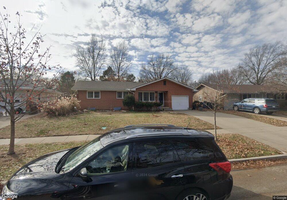
2235 Westchester Rd Lawrence, KS 66049
Estimated Value: $293,000 - $311,000
3
Beds
2
Baths
1,725
Sq Ft
$174/Sq Ft
Est. Value
About This Home
This home is located at 2235 Westchester Rd, Lawrence, KS 66049 and is currently estimated at $300,682, approximately $174 per square foot. 2235 Westchester Rd is a home located in Douglas County with nearby schools including Deerfield Elementary School, West Middle School, and Lawrence Free State High School.
Ownership History
Date
Name
Owned For
Owner Type
Purchase Details
Closed on
Sep 17, 2024
Sold by
Sorell Casey and Emmerich Casey
Bought by
Emmerich Casey
Current Estimated Value
Purchase Details
Closed on
Mar 21, 2020
Sold by
Phillips Shirley A
Bought by
Sorell Casey
Home Financials for this Owner
Home Financials are based on the most recent Mortgage that was taken out on this home.
Original Mortgage
$180,420
Interest Rate
3.4%
Mortgage Type
New Conventional
Create a Home Valuation Report for This Property
The Home Valuation Report is an in-depth analysis detailing your home's value as well as a comparison with similar homes in the area
Home Values in the Area
Average Home Value in this Area
Purchase History
| Date | Buyer | Sale Price | Title Company |
|---|---|---|---|
| Emmerich Casey | -- | None Listed On Document | |
| Sorell Casey | -- | Security 1St Title |
Source: Public Records
Mortgage History
| Date | Status | Borrower | Loan Amount |
|---|---|---|---|
| Previous Owner | Sorell Casey | $180,420 |
Source: Public Records
Tax History Compared to Growth
Tax History
| Year | Tax Paid | Tax Assessment Tax Assessment Total Assessment is a certain percentage of the fair market value that is determined by local assessors to be the total taxable value of land and additions on the property. | Land | Improvement |
|---|---|---|---|---|
| 2025 | $3,779 | $31,372 | $7,475 | $23,897 |
| 2024 | $3,779 | $30,797 | $7,475 | $23,322 |
| 2023 | $3,533 | $27,681 | $6,900 | $20,781 |
| 2022 | $3,211 | $25,026 | $6,900 | $18,126 |
| 2021 | $2,843 | $21,390 | $5,980 | $15,410 |
| 2020 | $2,828 | $21,390 | $5,980 | $15,410 |
| 2019 | $2,657 | $20,137 | $5,060 | $15,077 |
| 2018 | $2,577 | $19,401 | $4,600 | $14,801 |
| 2017 | $2,569 | $19,125 | $4,600 | $14,525 |
| 2016 | $2,316 | $18,032 | $3,680 | $14,352 |
| 2015 | $1,078 | $16,813 | $3,680 | $13,133 |
| 2014 | $1,041 | $16,399 | $3,680 | $12,719 |
Source: Public Records
Map
Nearby Homes
- 209 Yorkshire Dr
- 2416 Lancaster Dr
- 515 McDonald Dr
- 2412 Stowe Dr
- 2305 Brett Dr
- 212 N Minnesota St
- 255 N Michigan St Unit 22
- 120 Minnesota St
- 322 Birch Ln
- 1515 Pinewood Dr
- 121 Florida St
- 214 Lawrence Ave
- 307 Wisconsin St
- 1316 N 1750 Rd
- 229 Deerfield Ln
- 1757 E 1318 Rd
- 110 Glenview Dr
- 203 Summertree Ln
- 412 Michigan St
- 501 River Bend Ct
- 2229 Westchester Rd
- 2241 Westchester Rd
- 2223 Westchester Rd
- 2310 Manchester Rd
- 2303 Westchester Rd
- 2316 Manchester Rd
- 2306 Manchester Rd
- 2238 Westchester Rd
- 2232 Westchester Rd
- 2217 Westchester Rd
- 2309 Westchester Rd
- 2226 Westchester Rd
- 2322 Manchester Rd
- 2403 Danbury Place
- 2220 Westchester Rd
- 2308 Westchester Rd
- 2210 Kingston Dr
- 2302 Manchester Rd
- 2313 Westchester Rd
- 2402 Danbury Place