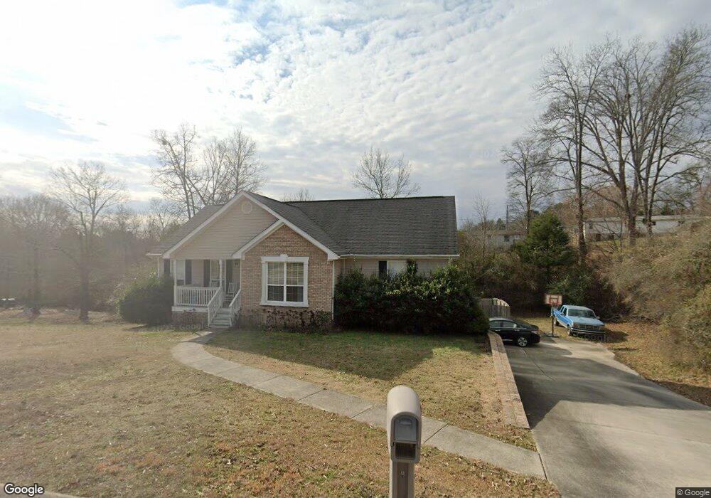
2237 N Fork Dr Soddy Daisy, TN 37379
Estimated Value: $326,000 - $362,000
3
Beds
2
Baths
1,527
Sq Ft
$225/Sq Ft
Est. Value
About This Home
This home is located at 2237 N Fork Dr, Soddy Daisy, TN 37379 and is currently estimated at $343,731, approximately $225 per square foot. 2237 N Fork Dr is a home located in Hamilton County with nearby schools including Loftis Middle School.
Ownership History
Date
Name
Owned For
Owner Type
Purchase Details
Closed on
Mar 15, 2016
Sold by
Ward Chris L and Ward Heather S
Bought by
Holcomb Robert and Holcomb Kailyn
Current Estimated Value
Home Financials for this Owner
Home Financials are based on the most recent Mortgage that was taken out on this home.
Original Mortgage
$164,524
Outstanding Balance
$130,522
Interest Rate
3.72%
Mortgage Type
New Conventional
Estimated Equity
$213,209
Purchase Details
Closed on
Jan 31, 2002
Sold by
Neal Black Construction Llc
Bought by
Ward Chris L and Ward Heather S
Home Financials for this Owner
Home Financials are based on the most recent Mortgage that was taken out on this home.
Original Mortgage
$95,900
Interest Rate
7.14%
Create a Home Valuation Report for This Property
The Home Valuation Report is an in-depth analysis detailing your home's value as well as a comparison with similar homes in the area
Home Values in the Area
Average Home Value in this Area
Purchase History
| Date | Buyer | Sale Price | Title Company |
|---|---|---|---|
| Holcomb Robert | $160,000 | None Available | |
| Ward Chris L | $119,900 | -- |
Source: Public Records
Mortgage History
| Date | Status | Borrower | Loan Amount |
|---|---|---|---|
| Open | Holcomb Robert | $164,524 | |
| Previous Owner | Ward Chris L | $95,900 | |
| Closed | Ward Chris L | $24,000 |
Source: Public Records
Tax History Compared to Growth
Tax History
| Year | Tax Paid | Tax Assessment Tax Assessment Total Assessment is a certain percentage of the fair market value that is determined by local assessors to be the total taxable value of land and additions on the property. | Land | Improvement |
|---|---|---|---|---|
| 2024 | $1,206 | $53,925 | $0 | $0 |
| 2023 | $1,215 | $53,925 | $0 | $0 |
| 2022 | $1,215 | $53,925 | $0 | $0 |
| 2021 | $1,215 | $53,925 | $0 | $0 |
| 2020 | $1,220 | $43,800 | $0 | $0 |
| 2019 | $1,220 | $43,800 | $0 | $0 |
| 2018 | $1,220 | $43,800 | $0 | $0 |
| 2017 | $1,220 | $43,800 | $0 | $0 |
| 2016 | $1,111 | $0 | $0 | $0 |
| 2015 | $1,111 | $39,850 | $0 | $0 |
| 2014 | $1,111 | $0 | $0 | $0 |
Source: Public Records
Map
Nearby Homes
- 2031 Millard Rd
- 2109 Millard Rd
- 1818 Millard Rd
- 9429 Hackberry Ln
- 11111 Hixson Pike
- 1848 Coffee Tree Ln
- 1724 Magnum Ln
- 10160 Hunters Hollow Dr
- 9802 Shoreline Heights Dr
- 10166 Hunters Hollow Dr
- 2522 W Wind Dr
- 1818 Short Leaf Ln
- 9955 Rolling Wind Dr
- 2228 Lakesite Dr
- 2316 Lakesite Dr
- 10041 Rolling Wind Dr
- 9901 Breeze Hill Ln
- 2119 Collins Ln
- 21362124 Short Leaf Ln
- 21182112 Short Leaf Ln
- 2233 N Fork Dr
- 9702 Ricole Trail
- 2226 N Fork Dr Unit 14
- 2228 N Fork Dr Unit 13
- 2226 N Fork Dr
- 2228 N Fork Dr
- 9706 Ricole Trail
- 9706 Ricole Tr
- 2247 N Fork Dr
- 2236 N Fork Dr
- 9708 Ricole Trail
- 2244 N Fork Dr
- 2234 N Fork Dr
- 8109 Standard Dr
- 9700 Ricole Trail
- 2112 Standard Dr
- 2242 N Fork Dr
- 2223 N Fork Dr
- 9710 Ricole Trail
- 9703 Ricole Trail