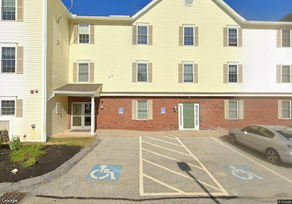
224 Main St Salem, NH 03079
Salem Center Neighborhood
--
Bed
--
Bath
24,595
Sq Ft
4.5
Acres
About This Home
This home is located at 224 Main St, Salem, NH 03079. 224 Main St is a home located in Rockingham County with nearby schools including Mary A. Fisk Elementary School, Woodbury School, and Salem High School.
Ownership History
Date
Name
Owned For
Owner Type
Purchase Details
Closed on
Aug 31, 2015
Sold by
Steve Hatem Property M
Bought by
5 S Realty Investment
Purchase Details
Closed on
Jan 21, 2010
Sold by
Jld Realty Llc
Bought by
Carney John R and Carney Jeanne F
Purchase Details
Closed on
Dec 19, 2003
Sold by
Rajh Rlty
Bought by
J K H D Rlty
Home Financials for this Owner
Home Financials are based on the most recent Mortgage that was taken out on this home.
Original Mortgage
$200,000
Interest Rate
5.96%
Mortgage Type
Commercial
Purchase Details
Closed on
Nov 30, 1999
Sold by
Hinton Evelyn M
Bought by
Rajh Rlty Llc
Create a Home Valuation Report for This Property
The Home Valuation Report is an in-depth analysis detailing your home's value as well as a comparison with similar homes in the area
Home Values in the Area
Average Home Value in this Area
Purchase History
| Date | Buyer | Sale Price | Title Company |
|---|---|---|---|
| 5 S Realty Investment | $620,000 | -- | |
| Carney John R | $402,000 | -- | |
| J K H D Rlty | $625,000 | -- | |
| Rajh Rlty Llc | $109,000 | -- |
Source: Public Records
Mortgage History
| Date | Status | Borrower | Loan Amount |
|---|---|---|---|
| Previous Owner | Rajh Rlty Llc | $450,000 | |
| Previous Owner | Rajh Rlty Llc | $503,018 | |
| Previous Owner | Rajh Rlty Llc | $150,000 | |
| Previous Owner | Rajh Rlty Llc | $200,000 |
Source: Public Records
Tax History Compared to Growth
Tax History
| Year | Tax Paid | Tax Assessment Tax Assessment Total Assessment is a certain percentage of the fair market value that is determined by local assessors to be the total taxable value of land and additions on the property. | Land | Improvement |
|---|---|---|---|---|
| 2024 | $48,310 | $2,744,900 | $760,800 | $1,984,100 |
| 2023 | $44,354 | $2,615,200 | $760,800 | $1,854,400 |
| 2022 | $41,974 | $2,615,200 | $760,800 | $1,854,400 |
| 2021 | $41,791 | $2,615,200 | $760,800 | $1,854,400 |
| 2020 | $50,765 | $2,305,400 | $693,900 | $1,611,500 |
| 2019 | $50,673 | $2,305,400 | $693,900 | $1,611,500 |
| 2018 | $49,820 | $2,305,400 | $693,900 | $1,611,500 |
| 2017 | $48,045 | $2,305,400 | $693,900 | $1,611,500 |
| 2016 | $47,099 | $2,305,400 | $693,900 | $1,611,500 |
| 2015 | $51,661 | $2,415,200 | $673,000 | $1,742,200 |
| 2014 | $50,212 | $2,415,200 | $673,000 | $1,742,200 |
| 2013 | $49,415 | $2,415,200 | $673,000 | $1,742,200 |
Source: Public Records
Map
Nearby Homes
- 8 Alta Ave
- 10 Sally Sweets Way Unit V104
- 89 End St
- 4 Therriault Ave
- 49 Millville St
- 6 Douglas Dr
- 12 Braemoor Woods Rd Unit 206
- 20 Stanwood Rd
- 55A Millville Cir
- 1 Kimball Ave
- 11 Sullivan Ct
- 27 General Pulaski Dr
- 40 Stanwood Rd Unit 9
- 17 Clinton St
- 59 Cluff Rd Unit 50
- 59 Cluff Rd Unit 7
- 59 Cluff Rd Unit 41
- 6 Lancelot Ct Unit 2
- 75 S Policy St Unit 45
- 75 S Policy St Unit 48