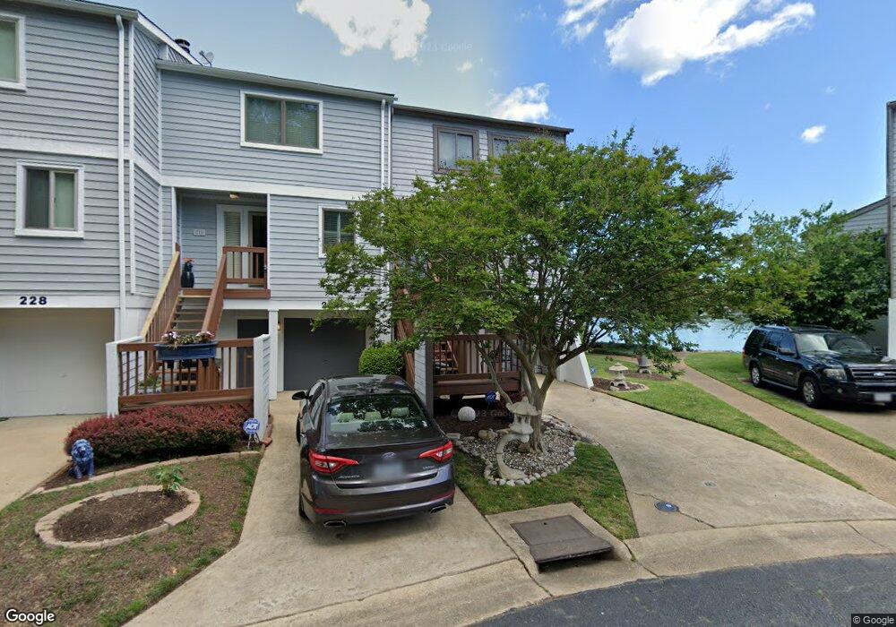
224 Mill Point Dr Hampton, VA 23669
Downtown Hampton NeighborhoodEstimated Value: $359,000 - $390,000
3
Beds
3
Baths
1,556
Sq Ft
$243/Sq Ft
Est. Value
About This Home
This home is located at 224 Mill Point Dr, Hampton, VA 23669 and is currently estimated at $377,840, approximately $242 per square foot. 224 Mill Point Dr is a home located in Hampton City with nearby schools including Capt. John Smith Elementary School, C. Alton Lindsay Middle School, and Phoebus High School.
Ownership History
Date
Name
Owned For
Owner Type
Purchase Details
Closed on
Jul 20, 2022
Sold by
Hall Lynne A
Bought by
Mccarroll Lashawn
Current Estimated Value
Home Financials for this Owner
Home Financials are based on the most recent Mortgage that was taken out on this home.
Original Mortgage
$290,700
Outstanding Balance
$278,214
Interest Rate
5.81%
Mortgage Type
New Conventional
Estimated Equity
$99,626
Purchase Details
Closed on
Jan 21, 2009
Sold by
Saville Joanne D
Bought by
Hall William W
Home Financials for this Owner
Home Financials are based on the most recent Mortgage that was taken out on this home.
Original Mortgage
$223,200
Interest Rate
5.2%
Mortgage Type
New Conventional
Purchase Details
Closed on
Sep 29, 1999
Sold by
Davidson John B
Bought by
Garrett Harry N
Home Financials for this Owner
Home Financials are based on the most recent Mortgage that was taken out on this home.
Original Mortgage
$69,250
Interest Rate
7.85%
Create a Home Valuation Report for This Property
The Home Valuation Report is an in-depth analysis detailing your home's value as well as a comparison with similar homes in the area
Home Values in the Area
Average Home Value in this Area
Purchase History
| Date | Buyer | Sale Price | Title Company |
|---|---|---|---|
| Mccarroll Lashawn | $321,000 | Old Republic Title | |
| Hall William W | $279,000 | -- | |
| Garrett Harry N | $86,600 | -- |
Source: Public Records
Mortgage History
| Date | Status | Borrower | Loan Amount |
|---|---|---|---|
| Open | Mccarroll Lashawn | $290,700 | |
| Previous Owner | Hall William W | $223,200 | |
| Previous Owner | Garrett Harry N | $69,250 |
Source: Public Records
Tax History
| Year | Tax Paid | Tax Assessment Tax Assessment Total Assessment is a certain percentage of the fair market value that is determined by local assessors to be the total taxable value of land and additions on the property. | Land | Improvement |
|---|---|---|---|---|
| 2025 | $4,373 | $383,500 | $102,400 | $281,100 |
| 2024 | $4,078 | $354,600 | $86,600 | $268,000 |
| 2023 | $3,900 | $336,200 | $86,600 | $249,600 |
| 2022 | $2,933 | $248,600 | $86,600 | $162,000 |
| 2021 | $2,953 | $227,700 | $86,600 | $141,100 |
| 2020 | $2,707 | $218,300 | $86,600 | $131,700 |
| 2019 | $2,709 | $218,500 | $86,600 | $131,900 |
| 2018 | $2,781 | $216,700 | $86,600 | $130,100 |
| 2017 | $2,781 | $0 | $0 | $0 |
| 2016 | $2,781 | $216,700 | $0 | $0 |
| 2015 | $2,781 | $0 | $0 | $0 |
| 2014 | $2,771 | $216,700 | $86,600 | $130,100 |
Source: Public Records
Map
Nearby Homes
- 329 Elm Ave
- 115 E Pembroke Ave
- 542 River St
- 314 Cooper St
- 720 River St
- 433 Cooper St
- 439 Cooper St
- 414 Harrison St
- 16 S Cypress St
- 221 Island Cove Ct Unit C
- 144 Meredith St
- 116 Linden Ave
- 217 S Armistead Ave
- 12 N Juniper St
- 1002 E Pembroke Ave
- LOT 17 Prentiss Ln
- 105 Prentiss Ln
- 138 Eberly Terrace
- 227 Dockside Dr Unit C
- 845 N King St
- 226 Mill Point Dr
- 228 Mill Point Dr
- 222 Mill Point Dr
- 230 Mill Point Dr
- 196 Mill Point Dr
- 220 Mill Point Dr
- 234 Mill Point Dr
- 218 Mill Point Dr
- 236 Mill Point Dr
- 214 Mill Point Dr
- 238 Mill Point Dr
- 229 Mill Point Dr
- 212 Mill Point Dr
- 99 Mill Point Dr
- 231 Mill Point Dr
- 211 Mill Point Dr
- 240 Mill Point Dr
- 210 Mill Point Dr
- 235 Mill Point Dr
- 209 Mill Point Dr
Your Personal Tour Guide
Ask me questions while you tour the home.