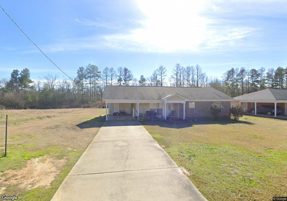
224 Phyllis Ann Dr Crystal Springs, MS 39059
Estimated Value: $126,406 - $145,000
3
Beds
2
Baths
1,261
Sq Ft
$111/Sq Ft
Est. Value
About This Home
This home is located at 224 Phyllis Ann Dr, Crystal Springs, MS 39059 and is currently estimated at $140,102, approximately $111 per square foot. 224 Phyllis Ann Dr is a home located in Copiah County with nearby schools including Crystal Springs Elementary School, Crystal Springs Middle School, and Crystal Springs High School.
Ownership History
Date
Name
Owned For
Owner Type
Purchase Details
Closed on
Oct 20, 2016
Sold by
Danny Sims Properties Llc
Bought by
Sherrod Mamie
Current Estimated Value
Home Financials for this Owner
Home Financials are based on the most recent Mortgage that was taken out on this home.
Original Mortgage
$122,000
Outstanding Balance
$101,056
Interest Rate
3.48%
Mortgage Type
USDA
Estimated Equity
$39,046
Purchase Details
Closed on
Feb 27, 2014
Bought by
Thomas Cornelious
Home Financials for this Owner
Home Financials are based on the most recent Mortgage that was taken out on this home.
Original Mortgage
$123,469
Interest Rate
4.35%
Mortgage Type
Purchase Money Mortgage
Create a Home Valuation Report for This Property
The Home Valuation Report is an in-depth analysis detailing your home's value as well as a comparison with similar homes in the area
Home Values in the Area
Average Home Value in this Area
Purchase History
| Date | Buyer | Sale Price | Title Company |
|---|---|---|---|
| Sherrod Mamie | $122,000 | Attorney | |
| Thomas Cornelious | -- | -- |
Source: Public Records
Mortgage History
| Date | Status | Borrower | Loan Amount |
|---|---|---|---|
| Open | Sherrod Mamie | $122,000 | |
| Previous Owner | Thomas Cornelious | $123,469 |
Source: Public Records
Tax History Compared to Growth
Tax History
| Year | Tax Paid | Tax Assessment Tax Assessment Total Assessment is a certain percentage of the fair market value that is determined by local assessors to be the total taxable value of land and additions on the property. | Land | Improvement |
|---|---|---|---|---|
| 2025 | $1,037 | $8,834 | $0 | $0 |
| 2024 | $1,037 | $8,615 | $0 | $0 |
| 2023 | $1,049 | $8,615 | $0 | $0 |
| 2022 | $1,060 | $8,615 | $0 | $0 |
| 2021 | $1,030 | $8,615 | $0 | $0 |
| 2020 | $1,008 | $8,314 | $0 | $0 |
| 2019 | $1,021 | $8,314 | $0 | $0 |
| 2018 | $1,008 | $8,314 | $0 | $0 |
| 2017 | $1,851 | $8,314 | $0 | $0 |
| 2016 | $1,851 | $12,050 | $0 | $0 |
| 2015 | -- | $7,884 | $0 | $0 |
| 2014 | -- | $546 | $0 | $0 |
Source: Public Records
Map
Nearby Homes
- 101 Carrie Ave
- 906 N Bennett St
- 103 Houston St
- 708 Lee Ave
- 115 Center St
- 310 Lee Ave
- 502 E Georgetown St
- 208 W Georgetown St
- 1008 Shiloh Run Dr
- 1010 Shiloh Run Dr
- 1018 Shiloh Run Dr
- 402 W Georgetown St
- 1089 Guynes Ln
- 0 Hwy 27 Unit 4128006
- 00 Mississippi 27
- 0 U S Highway 51
- 402 Newton St
- 3010 Lee Ave
- 309 S Jackson St
- 311 W Cayuga St
- 225 Phyllis Ann Dr
- 218 Phyllis Ann Dr
- 219 Phyllis Ann Dr
- 217 Phyllis Ann Dr
- 222 Phyllis Ann Dr
- 220 Phyllis Ann Dr
- 216 Phyllis Ann Dr
- 227 Phyllis Ann Dr
- 229 Phyllis Ann Dr
- 0 Phyllis Ann Dr
- 214 Phyllis Ann Dr
- 215 Phyllis Ann Dr
- 212 Phyllis Ann Dr
- 100 Carrie Ave
- 102 Carrie Ave
- 210 Phyllis Ann Dr
- 000 Phyllis Ann Dr
- 104 Carrie Ave
- 108 Carrie Ave
- 208 Phyllis Ann Dr