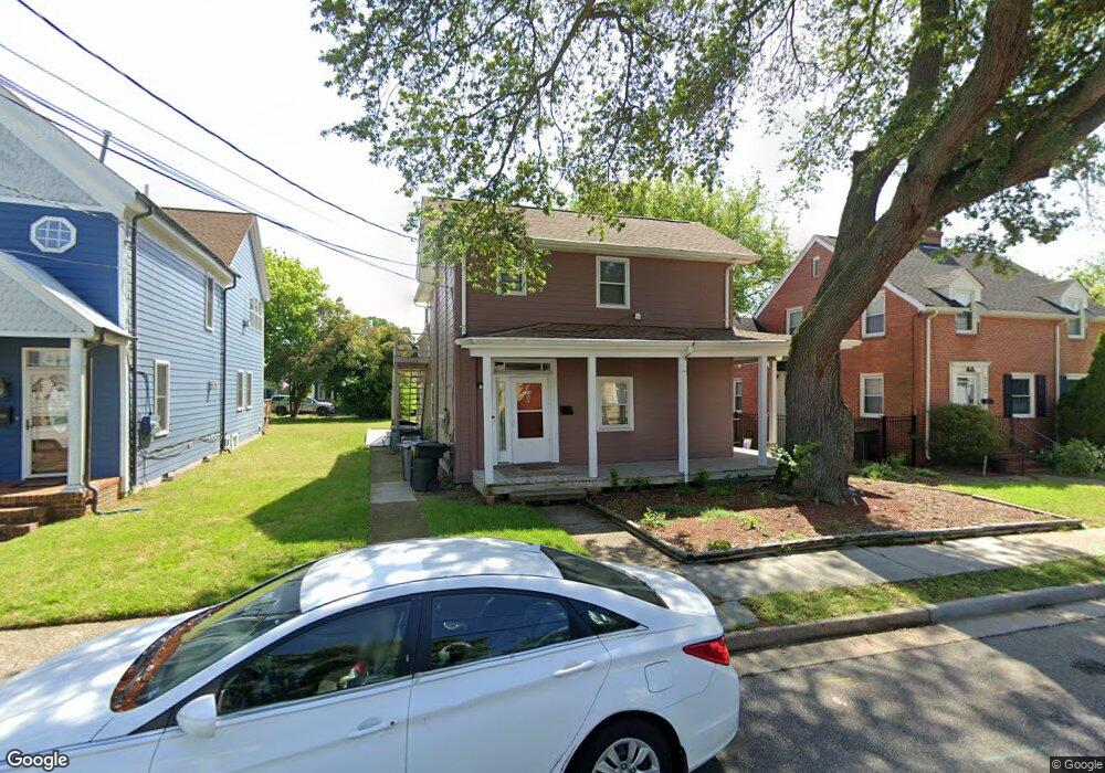
224 Washington St Hampton, VA 23669
Pasture Point NeighborhoodEstimated Value: $239,000 - $317,000
4
Beds
3
Baths
2,160
Sq Ft
$124/Sq Ft
Est. Value
About This Home
This home is located at 224 Washington St, Hampton, VA 23669 and is currently estimated at $268,000, approximately $124 per square foot. 224 Washington St is a home located in Hampton City with nearby schools including Capt. John Smith Elementary School, C. Alton Lindsay Middle School, and Phoebus High School.
Ownership History
Date
Name
Owned For
Owner Type
Purchase Details
Closed on
Oct 11, 2023
Sold by
Smith Troy
Bought by
Smith Troy and Wiggins-Smith Treganza
Current Estimated Value
Purchase Details
Closed on
Sep 9, 2016
Sold by
Good Linda and Malone Edna
Bought by
Smith Troy
Create a Home Valuation Report for This Property
The Home Valuation Report is an in-depth analysis detailing your home's value as well as a comparison with similar homes in the area
Home Values in the Area
Average Home Value in this Area
Purchase History
| Date | Buyer | Sale Price | Title Company |
|---|---|---|---|
| Smith Troy | -- | None Listed On Document | |
| Smith Troy | -- | None Available |
Source: Public Records
Tax History
| Year | Tax Paid | Tax Assessment Tax Assessment Total Assessment is a certain percentage of the fair market value that is determined by local assessors to be the total taxable value of land and additions on the property. | Land | Improvement |
|---|---|---|---|---|
| 2025 | $2,839 | $235,600 | $57,800 | $177,800 |
| 2024 | $2,697 | $234,500 | $57,800 | $176,700 |
| 2023 | $2,531 | $218,200 | $57,800 | $160,400 |
| 2022 | $2,321 | $196,700 | $52,500 | $144,200 |
| 2021 | $2,178 | $165,200 | $44,600 | $120,600 |
| 2020 | $1,717 | $138,500 | $42,500 | $96,000 |
| 2019 | $1,717 | $138,500 | $42,500 | $96,000 |
| 2018 | $1,843 | $138,500 | $42,500 | $96,000 |
| 2017 | $1,811 | $0 | $0 | $0 |
| 2016 | $1,811 | $138,500 | $0 | $0 |
| 2015 | $1,875 | $0 | $0 | $0 |
| 2014 | $1,865 | $143,600 | $42,500 | $101,100 |
Source: Public Records
Map
Nearby Homes
- 115 E Pembroke Ave
- 329 Elm Ave
- 542 River St
- 314 Cooper St
- 433 Cooper St
- 720 River St
- 439 Cooper St
- 414 Harrison St
- 221 Island Cove Ct Unit C
- 138 Eberly Terrace
- 845 N King St
- 217 S Armistead Ave
- 144 Meredith St
- 16 S Cypress St
- 925 Quash St
- 227 Dockside Dr Unit C
- 100 Eberly Terrace
- 12 N Juniper St
- 39 N Boxwood St
- 116 Linden Ave
- 228 Washington St
- 220 Washington St
- 312 Syms St
- 234 Washington St
- 316 Syms St
- 221 Washington St
- 226 Syms St
- 222 Syms St
- 302 Washington St
- 217 Washington St
- 218 Syms St
- 306 Washington St
- 301 Washington St
- 317 Syms St
- 310 Washington St
- 270 Eaton St
- 303 Washington St
- 330 Syms St
- 321 Syms St
- 292 Eaton St
Your Personal Tour Guide
Ask me questions while you tour the home.