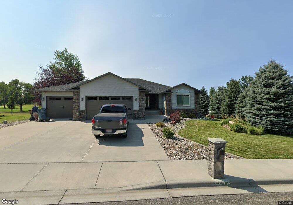
2242 W Skokie Dr Billings, MT 59105
Billings Heights NeighborhoodEstimated Value: $514,000 - $697,000
5
Beds
4
Baths
4,156
Sq Ft
$151/Sq Ft
Est. Value
About This Home
This home is located at 2242 W Skokie Dr, Billings, MT 59105 and is currently estimated at $629,319, approximately $151 per square foot. 2242 W Skokie Dr is a home located in Yellowstone County with nearby schools including Sandstone School, Castle Rock Junior High School, and Skyview High School.
Ownership History
Date
Name
Owned For
Owner Type
Purchase Details
Closed on
Jun 5, 2017
Sold by
Hill Ron S
Bought by
Hall Jeffrey S and Hall Ann
Current Estimated Value
Home Financials for this Owner
Home Financials are based on the most recent Mortgage that was taken out on this home.
Original Mortgage
$185,000
Outstanding Balance
$154,008
Interest Rate
4.05%
Mortgage Type
New Conventional
Estimated Equity
$475,311
Create a Home Valuation Report for This Property
The Home Valuation Report is an in-depth analysis detailing your home's value as well as a comparison with similar homes in the area
Home Values in the Area
Average Home Value in this Area
Purchase History
| Date | Buyer | Sale Price | Title Company |
|---|---|---|---|
| Hall Jeffrey S | -- | None Available |
Source: Public Records
Mortgage History
| Date | Status | Borrower | Loan Amount |
|---|---|---|---|
| Open | Hall Jeffrey S | $185,000 |
Source: Public Records
Tax History Compared to Growth
Tax History
| Year | Tax Paid | Tax Assessment Tax Assessment Total Assessment is a certain percentage of the fair market value that is determined by local assessors to be the total taxable value of land and additions on the property. | Land | Improvement |
|---|---|---|---|---|
| 2025 | $5,889 | $626,600 | $110,671 | $515,929 |
| 2024 | $5,889 | $601,200 | $104,310 | $496,890 |
| 2023 | $5,881 | $601,200 | $104,310 | $496,890 |
| 2022 | $5,236 | $469,300 | $0 | $0 |
| 2021 | $4,949 | $469,300 | $0 | $0 |
| 2020 | $4,896 | $444,100 | $0 | $0 |
| 2019 | $4,675 | $444,100 | $0 | $0 |
| 2018 | $4,747 | $443,800 | $0 | $0 |
| 2017 | $4,587 | $443,800 | $0 | $0 |
| 2016 | $4,172 | $406,400 | $0 | $0 |
| 2015 | $4,085 | $427,100 | $0 | $0 |
| 2014 | $3,646 | $191,807 | $0 | $0 |
Source: Public Records
Map
Nearby Homes
- Lot 1, Block 1 Greenbriar Rd
- 2164 Greenbriar Rd
- 2115 Saint Andrews Dr
- 0 Winged Foot Dr
- 00 Winged Foot Drive Lot 10
- 0 Greenbriar Block 12 Lot 5 Rd Unit 352965
- 2043 Cypress Point
- 2435 Lake Heights Dr
- 00
- 0 Greenbriar Rd
- 2049 Saint Andrews Dr
- 419 Montecito Ave
- 418 Montecito Ave
- 2143 Interlachen Dr
- 425 Montecito Ave
- 2029 Ridgeview Dr
- 0 Clubhouse Way
- LOT 3 Clubhouse Way
- LOT 4 Clubhouse Way
- 443 Montecito Ave
- 2258 W Skokie Dr
- 2226 W Skokie Dr
- 2239 W Skokie Dr
- 2255 W Skokie Dr
- 2223 W Skokie Dr
- 2274 W Skokie Dr
- 2210 W Skokie Dr
- 2271 Green Briar Rd
- 2240 E Skokie Dr
- 2283 Green Briar Rd
- 2283 Greenbriar Rd
- 2207 W Skokie Dr
- 2256 E Skokie Dr
- 2224 E Skokie Dr
- 2265 Green Briar Rd
- 2202 W Skokie Dr
- 2229 Greenbriar Rd
- 2213 Greenbriar Rd
- 2235 Greenbriar Rd
- 2208 E Skokie Dr