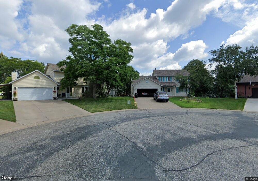
2246 Mcafee Cir Saint Paul, MN 55109
Sherwood Glen NeighborhoodEstimated Value: $406,000 - $442,000
4
Beds
4
Baths
1,056
Sq Ft
$401/Sq Ft
Est. Value
About This Home
This home is located at 2246 Mcafee Cir, Saint Paul, MN 55109 and is currently estimated at $423,809, approximately $401 per square foot. 2246 Mcafee Cir is a home located in Ramsey County with nearby schools including Weaver Elementary School, John Glenn Middle School, and St Jerome Elementary School.
Ownership History
Date
Name
Owned For
Owner Type
Purchase Details
Closed on
Dec 30, 2019
Sold by
Brenhofer Georgine Marie
Bought by
Dirie Mohamed and Egal Osman
Current Estimated Value
Home Financials for this Owner
Home Financials are based on the most recent Mortgage that was taken out on this home.
Original Mortgage
$261,600
Outstanding Balance
$231,579
Interest Rate
3.7%
Mortgage Type
Unknown
Estimated Equity
$192,230
Purchase Details
Closed on
Sep 27, 2018
Sold by
Brenhofer Randall Joseph and Brenhofer Georgine M
Bought by
Revoc Brenhofer Georgine Marie and Georgine Marie Brenhofer Revocable Livin
Create a Home Valuation Report for This Property
The Home Valuation Report is an in-depth analysis detailing your home's value as well as a comparison with similar homes in the area
Home Values in the Area
Average Home Value in this Area
Purchase History
| Date | Buyer | Sale Price | Title Company |
|---|---|---|---|
| Dirie Mohamed | $327,000 | Titlesmart Inc | |
| Revoc Brenhofer Georgine Marie | -- | None Available |
Source: Public Records
Mortgage History
| Date | Status | Borrower | Loan Amount |
|---|---|---|---|
| Open | Dirie Mohamed | $261,600 |
Source: Public Records
Tax History Compared to Growth
Tax History
| Year | Tax Paid | Tax Assessment Tax Assessment Total Assessment is a certain percentage of the fair market value that is determined by local assessors to be the total taxable value of land and additions on the property. | Land | Improvement |
|---|---|---|---|---|
| 2025 | $5,770 | $441,200 | $64,200 | $377,000 |
| 2023 | $5,770 | $404,800 | $64,200 | $340,600 |
| 2022 | $5,056 | $392,800 | $64,200 | $328,600 |
| 2021 | $4,816 | $341,700 | $64,200 | $277,500 |
| 2020 | $5,008 | $333,500 | $64,200 | $269,300 |
| 2019 | $4,298 | $323,800 | $64,200 | $259,600 |
| 2018 | $4,336 | $286,000 | $64,200 | $221,800 |
| 2017 | $4,324 | $280,900 | $64,200 | $216,700 |
| 2016 | $3,920 | $0 | $0 | $0 |
| 2015 | $3,982 | $246,200 | $58,900 | $187,300 |
| 2014 | $3,342 | $0 | $0 | $0 |
Source: Public Records
Map
Nearby Homes
- 1467 County Road B E
- 1509 Sandhurst Ave E
- 2420 Hazelwood St
- 1666 Laurie Rd E
- 1201 Frost Ave
- 1940 Barclay St
- 1018 Sextant Ave
- 1694 Laurie Rd E
- 1984 Prosperity Rd
- 1869 Birmingham St
- 1854 Barclay St
- 955 Brooks Ct
- 1937 Flandrau St
- 2020 Arcade St
- 2554 Bittersweet Ln
- 1779 Frank St
- 1849 Kennard St
- 2182 Van Dyke St
- 1740 English St
- 1875 E Shore Dr Unit 302
- 2240 Mcafee Cir
- 1340 Cope Ave E
- 2249 Mcafee Cir
- 1346 Cope Ave E
- 1332 Cope Ave E
- 2234 Mcafee Cir
- 1356 Cope Ave E
- 1326 Cope Ave E
- 2243 Mcafee Cir
- 1358 Cope Ave E
- 2228 Mcafee Cir
- 2237 Mcafee Cir
- 1318 Cope Ave E
- 1362 Cope Ave E
- 2231 Mcafee Cir
- 2222 Mcafee Cir
- 2252 English St
- 2225 Mcafee Cir
- 1308 Cope Ave E
- 2246 English St