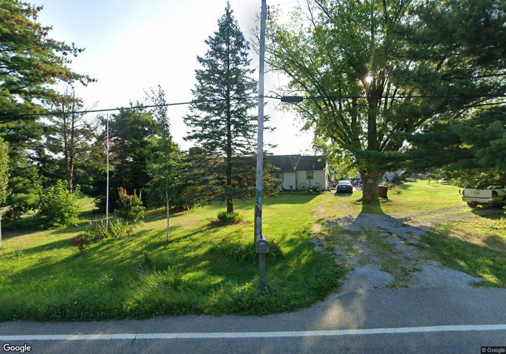
2246 Stubbs Mill Rd Lebanon, OH 45036
Salem Township NeighborhoodEstimated Value: $381,000 - $442,000
4
Beds
2
Baths
2,784
Sq Ft
$145/Sq Ft
Est. Value
About This Home
This home is located at 2246 Stubbs Mill Rd, Lebanon, OH 45036 and is currently estimated at $403,697, approximately $145 per square foot. 2246 Stubbs Mill Rd is a home located in Warren County with nearby schools including Bowman Primary School, Berry Intermediate School, and Donovan Elementary School.
Ownership History
Date
Name
Owned For
Owner Type
Purchase Details
Closed on
Oct 28, 2019
Sold by
Magness Timothy and Magness Sharleen
Bought by
Cote Stephen M
Current Estimated Value
Home Financials for this Owner
Home Financials are based on the most recent Mortgage that was taken out on this home.
Original Mortgage
$196,000
Outstanding Balance
$172,772
Interest Rate
3.7%
Mortgage Type
New Conventional
Estimated Equity
$230,925
Purchase Details
Closed on
Apr 7, 2006
Sold by
Downey Robert M and Downey Carla R
Bought by
Magness Timothy and Magness Sharleen
Home Financials for this Owner
Home Financials are based on the most recent Mortgage that was taken out on this home.
Original Mortgage
$165,300
Interest Rate
6.48%
Mortgage Type
Fannie Mae Freddie Mac
Create a Home Valuation Report for This Property
The Home Valuation Report is an in-depth analysis detailing your home's value as well as a comparison with similar homes in the area
Home Values in the Area
Average Home Value in this Area
Purchase History
| Date | Buyer | Sale Price | Title Company |
|---|---|---|---|
| Cote Stephen M | $245,000 | None Available | |
| Magness Timothy | $174,000 | Mid America Land Title |
Source: Public Records
Mortgage History
| Date | Status | Borrower | Loan Amount |
|---|---|---|---|
| Open | Cote Stephen M | $196,000 | |
| Previous Owner | Magness Timothy | $165,300 |
Source: Public Records
Tax History Compared to Growth
Tax History
| Year | Tax Paid | Tax Assessment Tax Assessment Total Assessment is a certain percentage of the fair market value that is determined by local assessors to be the total taxable value of land and additions on the property. | Land | Improvement |
|---|---|---|---|---|
| 2024 | $3,970 | $93,110 | $26,250 | $66,860 |
| 2023 | $3,393 | $71,053 | $12,705 | $58,348 |
| 2022 | $3,353 | $71,054 | $12,705 | $58,349 |
| 2021 | $3,167 | $71,054 | $12,705 | $58,349 |
| 2020 | $3,096 | $58,723 | $10,500 | $48,223 |
| 2019 | $3,114 | $58,723 | $10,500 | $48,223 |
| 2018 | $2,838 | $58,723 | $10,500 | $48,223 |
| 2017 | $3,025 | $55,846 | $10,140 | $45,707 |
| 2016 | $2,909 | $55,846 | $10,140 | $45,707 |
| 2015 | $2,930 | $55,846 | $10,140 | $45,707 |
| 2014 | $2,848 | $52,190 | $9,470 | $42,720 |
| 2013 | $2,851 | $57,830 | $10,500 | $47,330 |
Source: Public Records
Map
Nearby Homes
- 2410 Stubbs Mill Rd
- 1836 Stubbs Mill Rd
- 1405 Stubbs Mill Rd
- 2193 Phillips Rd
- 2749 Jack Rd
- 950 Larkspur Dr
- 986 Larkspur Dr
- 998 Larkspur Dr
- 985 Larkspur Dr
- 978 Yarrow Ln
- 3159 Rosemary Ct
- 3180 Sage Ct
- 378 Forge Dr
- 455 Lake Haven Ct
- 447 Lake Haven Ct
- 3206 Garden View Cir
- 3200 Garden View Cir
- 3224 Garden View Cir
- 3009 Dry Run Rd
- 905 Garden View Cir
- 2246 Stubbs Mills Rd
- .509 Stubbs Mills Rd
- 9 Stubbs Mills Rd Unit 9
- 2264 Stubbs Mill Rd
- 2216 Stubbs Mill Rd
- 2192 Stubbs Mill Rd
- 2268 Stubbs Mill Rd
- 2154 Stubbs Mill Rd
- 2352 Stubbs Mill Rd
- 2379 Stubbs Mill Rd
- 1891 Wood Rd
- 2116 Stubbs Mill Rd
- 2378 Stubbs Mill Rd
- 1921 Wood Rd
- 1937 Wood Rd
- 1843 Wood Rd
- 1961 Wood Rd
- 2094 Stubbs Mill Rd
- 2015 Wood Rd
- 1989 Wood Rd