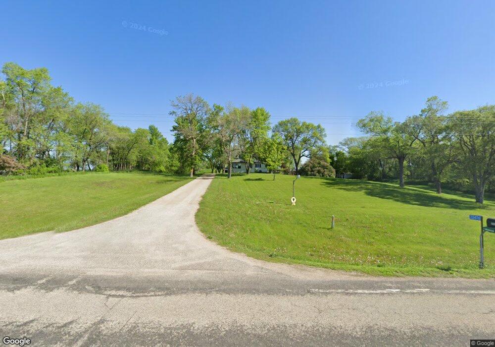
22476 County Highway 83 Battle Lake, MN 56515
Estimated Value: $299,152 - $491,000
3
Beds
3
Baths
2,193
Sq Ft
$166/Sq Ft
Est. Value
About This Home
This home is located at 22476 County Highway 83, Battle Lake, MN 56515 and is currently estimated at $363,717, approximately $165 per square foot. 22476 County Highway 83 is a home located in Otter Tail County with nearby schools including Battle Lake Elementary School and Battle Lake Secondary School.
Ownership History
Date
Name
Owned For
Owner Type
Purchase Details
Closed on
Jul 27, 2015
Sold by
Sandahl Wayne Wayne
Bought by
Drusch Nicholas and Drusch Calley
Current Estimated Value
Home Financials for this Owner
Home Financials are based on the most recent Mortgage that was taken out on this home.
Original Mortgage
$159,900
Outstanding Balance
$125,846
Interest Rate
4.05%
Estimated Equity
$237,871
Create a Home Valuation Report for This Property
The Home Valuation Report is an in-depth analysis detailing your home's value as well as a comparison with similar homes in the area
Home Values in the Area
Average Home Value in this Area
Purchase History
| Date | Buyer | Sale Price | Title Company |
|---|---|---|---|
| Drusch Nicholas | $159,900 | -- |
Source: Public Records
Mortgage History
| Date | Status | Borrower | Loan Amount |
|---|---|---|---|
| Open | Drusch Nicholas | $159,900 |
Source: Public Records
Tax History Compared to Growth
Tax History
| Year | Tax Paid | Tax Assessment Tax Assessment Total Assessment is a certain percentage of the fair market value that is determined by local assessors to be the total taxable value of land and additions on the property. | Land | Improvement |
|---|---|---|---|---|
| 2025 | $1,446 | $263,000 | $77,400 | $185,600 |
| 2024 | $1,602 | $245,800 | $70,500 | $175,300 |
| 2023 | $1,238 | $226,300 | $55,600 | $170,700 |
| 2022 | $1,162 | $123,800 | $0 | $0 |
| 2021 | $1,086 | $226,300 | $55,600 | $170,700 |
| 2020 | $1,072 | $172,400 | $39,000 | $133,400 |
| 2019 | $1,020 | $160,300 | $37,900 | $122,400 |
| 2018 | $934 | $160,300 | $37,900 | $122,400 |
| 2017 | $944 | $147,100 | $36,700 | $110,400 |
| 2016 | $876 | $139,600 | $37,100 | $102,500 |
| 2015 | $844 | $0 | $0 | $0 |
| 2014 | -- | $136,800 | $36,100 | $100,700 |
Source: Public Records
Map
Nearby Homes
- 21443 355th Ave
- TBD County Highway 83
- 23216 Oak Leaf Ln
- 407 W Holdt St
- 304 W Bowman St
- 707 Lake Shore Dr
- 304 N Washington Ave
- 201 S Madison Ave
- 405 E Summit St
- 35755 200th St
- 811 Lake Shore Dr
- 34XXX Fiske View Dr
- 303 Front St E
- 20357 State Highway 78
- TBD 190th St
- TBDx 190th St
- TBDxx 190th St
- 20710 Oakdale Rd
- TBD 340th Ave
- 23898 324th Ave
- 22320 County Highway 83
- 35491 Rolling Hills Dr
- 35491 Rolling Hills Dr
- 35455 Rolling Hills Dr
- 35519 Rolling Hills Dr
- 35409 Rolling Hills Dr
- 35403 Rolling Hills Dr
- 35293 35293 Rolling Hills Dr
- 35293 Rolling Hills Dr
- 22516 Rolling Hills Ln
- 22550 Rolling Hills Ln
- xxx Hwy 83 & 350th Ave
- 22596 Rolling Hills Ln
- 35293 Rolling Hills Dr
- 35293 Rolling Hills Dr
- 35293 Rolling Hills Dr
- 22595 Asthre Dr
- 22599 Asthre Dr
- 22634 Rolling Hills Ln
- 22625 Asthre Dr