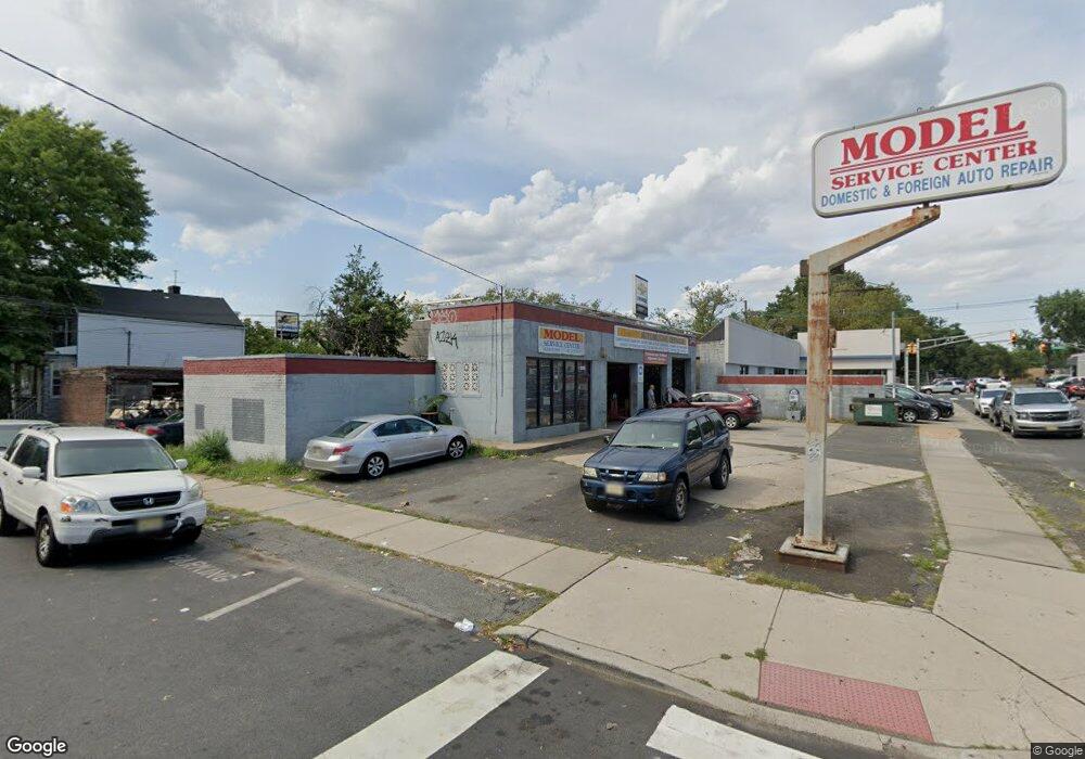
225 Mallory Ave Jersey City, NJ 07304
West Side NeighborhoodEstimated Value: $1,404,805
--
Bed
--
Bath
7,500
Sq Ft
$187/Sq Ft
Est. Value
About This Home
This home is located at 225 Mallory Ave, Jersey City, NJ 07304 and is currently estimated at $1,404,805, approximately $187 per square foot. 225 Mallory Ave is a home located in Hudson County with nearby schools including Dr. Paul Rafalides School, P.S. 33, Chaplain Charles Watters School, PS #24, and Lincoln High School.
Ownership History
Date
Name
Owned For
Owner Type
Purchase Details
Closed on
Jan 1, 2025
Sold by
Difeo Holdings Limited Partnership
Bought by
Carcomm Llc
Current Estimated Value
Purchase Details
Closed on
Mar 27, 2020
Sold by
Langman Blufarb Corporation
Bought by
Diffo Holdings Limited Partnership
Purchase Details
Closed on
Jul 22, 1975
Bought by
Langman-Blufarb Corp
Create a Home Valuation Report for This Property
The Home Valuation Report is an in-depth analysis detailing your home's value as well as a comparison with similar homes in the area
Home Values in the Area
Average Home Value in this Area
Purchase History
| Date | Buyer | Sale Price | Title Company |
|---|---|---|---|
| Carcomm Llc | -- | None Listed On Document | |
| Carcomm Llc | -- | None Listed On Document | |
| Diffo Holdings Limited Partnership | $999,999 | Trident Abstract Ttl Agcy Ll | |
| Langman-Blufarb Corp | $44,400 | -- |
Source: Public Records
Tax History Compared to Growth
Tax History
| Year | Tax Paid | Tax Assessment Tax Assessment Total Assessment is a certain percentage of the fair market value that is determined by local assessors to be the total taxable value of land and additions on the property. | Land | Improvement |
|---|---|---|---|---|
| 2025 | $26,222 | $1,174,300 | $262,700 | $911,600 |
| 2024 | $26,387 | $1,174,300 | $262,700 | $911,600 |
| 2023 | $26,387 | $1,174,300 | $262,700 | $911,600 |
| 2022 | $24,872 | $1,174,300 | $262,700 | $911,600 |
| 2021 | $18,836 | $1,174,300 | $262,700 | $911,600 |
| 2020 | $18,906 | $1,174,300 | $262,700 | $911,600 |
| 2019 | $18,084 | $1,174,300 | $262,700 | $911,600 |
| 2018 | $2,530 | $1,174,300 | $262,700 | $911,600 |
| 2017 | $13,260 | $170,000 | $150,000 | $20,000 |
| 2016 | $18,482 | $240,000 | $150,000 | $90,000 |
| 2015 | $17,957 | $240,000 | $150,000 | $90,000 |
| 2014 | $17,842 | $240,000 | $150,000 | $90,000 |
Source: Public Records
Map
Nearby Homes
- 240 Clendenny Ave Unit 5A
- 183 Lexington Ave
- 248 Clendenny Ave Unit 4
- 175 Lexington Ave
- 143 Roosevelt Ave
- 386 Union St
- 172 Mallory Ave
- 262 Clendenny Ave Unit 6
- 262 Clendenny Ave Unit 4
- 12 Miller St
- 10 Miller St
- 16 Delaware Ave
- 119 Clendenny Ave Unit 3L
- 134 Boyd Ave
- 108 Clendenny Ave
- 102 Clendenny Ave
- 277 Harrison Ave Unit B5
- 277 Harrison Ave Unit E7
- 244 Clinton Ave
- 314 Union St
- 116 Roosevelt Ave
- 118 Roosevelt Ave
- 120 Roosevelt Ave
- 221 Mallory Ave Unit 1
- 221 Mallory Ave Unit 2
- 221 Mallory Ave
- 122 Roosevelt Ave
- 100 Roosevelt Ave
- 100 Roosevelt Ave Unit 2
- 219 Mallory Ave
- 124 Roosevelt Ave
- 217 Mallory Ave
- 98 Roosevelt Ave
- 98 Roosevelt Ave Unit 1
- 98 Roosevelt Ave Unit 2
- 228 Mallory Ave
- 228 Mallory Ave Unit 2
- 215 Mallory Ave Unit 2
- 215 Mallory Ave Unit 1
- 215 Mallory Ave Unit Rear Apt