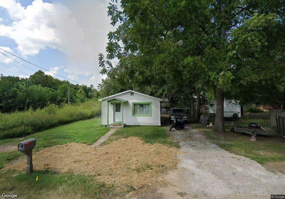
225 Morgan Ave Unit 1402082 Aurora, MO 65605
Estimated Value: $63,661 - $71,000
1
Bed
1
Bath
950
Sq Ft
$71/Sq Ft
Est. Value
About This Home
This home is located at 225 Morgan Ave Unit 1402082, Aurora, MO 65605 and is currently estimated at $67,887, approximately $71 per square foot. 225 Morgan Ave Unit 1402082 is a home located in Lawrence County with nearby schools including Pate Early Childhood Center, Robinson Intermediate School, and Robinson Elementary School.
Ownership History
Date
Name
Owned For
Owner Type
Purchase Details
Closed on
Jul 15, 2022
Sold by
Hope & Dream Properties Llc
Bought by
Reyes Antonia
Current Estimated Value
Home Financials for this Owner
Home Financials are based on the most recent Mortgage that was taken out on this home.
Original Mortgage
$33,750
Outstanding Balance
$32,109
Interest Rate
5.09%
Mortgage Type
Credit Line Revolving
Estimated Equity
$35,778
Purchase Details
Closed on
Jul 16, 2015
Sold by
Jarvis Peter H and Jarvis Ida Jane
Bought by
Hope & Dream Properties Llc
Purchase Details
Closed on
Sep 20, 2010
Sold by
Clevenger Wanda
Bought by
Jarvis Peter H and Jarvis Ida Jane
Create a Home Valuation Report for This Property
The Home Valuation Report is an in-depth analysis detailing your home's value as well as a comparison with similar homes in the area
Home Values in the Area
Average Home Value in this Area
Purchase History
| Date | Buyer | Sale Price | Title Company |
|---|---|---|---|
| Reyes Antonia | -- | None Listed On Document | |
| Hope & Dream Properties Llc | -- | None Available | |
| Jarvis Peter H | -- | -- | |
| Jarvis Peter H | -- | None Available |
Source: Public Records
Mortgage History
| Date | Status | Borrower | Loan Amount |
|---|---|---|---|
| Open | Reyes Antonia | $33,750 |
Source: Public Records
Tax History
| Year | Tax Paid | Tax Assessment Tax Assessment Total Assessment is a certain percentage of the fair market value that is determined by local assessors to be the total taxable value of land and additions on the property. | Land | Improvement |
|---|---|---|---|---|
| 2025 | $154 | $3,080 | $800 | $2,280 |
| 2024 | $144 | $2,850 | $800 | $2,050 |
| 2023 | $143 | $2,850 | $800 | $2,050 |
| 2022 | $135 | $2,700 | $800 | $1,900 |
| 2021 | $136 | $2,700 | $800 | $1,900 |
| 2020 | $121 | $2,380 | $480 | $1,900 |
| 2019 | $119 | $2,380 | $480 | $1,900 |
| 2018 | $118 | $2,380 | $480 | $1,900 |
| 2017 | $118 | $2,380 | $480 | $1,900 |
| 2016 | -- | $2,190 | $480 | $1,710 |
| 2015 | -- | $2,190 | $480 | $1,710 |
| 2014 | -- | $2,190 | $480 | $1,710 |
Source: Public Records
Map
Nearby Homes
- 225 Morgan Ave
- 123 Cofield St
- 503 Mcnatt Ave
- 111 W Cofield St
- 112 N Madison Ave
- 141 W Pleasant St
- 115 W Lee St
- 311 W Pleasant St
- 722 Wilson Ave
- 304 E Cofield St
- 216 S Elliott Ave
- 421 W College St
- 238 E Delta St
- 220 S Park Ave
- 114 E College St
- 000 Crescent St
- 512 W College St
- 504 S Lincoln Ave
- 330 W Summit St
- 312 S Oak Ave
- 223 Morgan Ave
- 227 Morgan Ave
- 227 Morgan Ave
- 227 Morgan Ave Unit 1215585
- 148 W Cofield St
- 221 Morgan Ave
- 138 Cofield St
- 138 Cofield St
- 123 W Crescent St
- 145 Cofield St
- 115 W Crescent St Unit 1208821
- 115 W Crescent St
- 141 W Cofield St
- 309 Morgan Ave
- 128 W Cofield St
- 302 Adams Ave
- 135 Cofield St
- 325 Morgan Ave
- 326 Morgan Ave
- 326 Morgan Ave
Your Personal Tour Guide
Ask me questions while you tour the home.