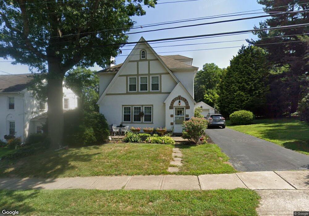
225 N Broad St Kennett Square, PA 19348
Estimated Value: $578,214 - $673,000
3
Beds
3
Baths
1,922
Sq Ft
$328/Sq Ft
Est. Value
About This Home
This home is located at 225 N Broad St, Kennett Square, PA 19348 and is currently estimated at $630,804, approximately $328 per square foot. 225 N Broad St is a home located in Chester County with nearby schools including Kennett Middle School, Kennett High School, and St. Patrick School.
Ownership History
Date
Name
Owned For
Owner Type
Purchase Details
Closed on
Dec 23, 2011
Sold by
Abbondi Richard and The Fred A Abbondi Jr & Sunday
Bought by
Cormier Andrew W and Donato Regina M
Current Estimated Value
Home Financials for this Owner
Home Financials are based on the most recent Mortgage that was taken out on this home.
Original Mortgage
$256,500
Outstanding Balance
$175,210
Interest Rate
3.98%
Mortgage Type
New Conventional
Estimated Equity
$455,594
Purchase Details
Closed on
Jun 13, 2000
Sold by
Abbondi Fred A and Abbondi Sunday M
Bought by
Abbondi Fred A and Abbondi Sunday M
Create a Home Valuation Report for This Property
The Home Valuation Report is an in-depth analysis detailing your home's value as well as a comparison with similar homes in the area
Home Values in the Area
Average Home Value in this Area
Purchase History
| Date | Buyer | Sale Price | Title Company |
|---|---|---|---|
| Cormier Andrew W | $285,000 | Commonwealth Land Title Insu | |
| Abbondi Fred A | -- | -- |
Source: Public Records
Mortgage History
| Date | Status | Borrower | Loan Amount |
|---|---|---|---|
| Open | Cormier Andrew W | $256,500 |
Source: Public Records
Tax History Compared to Growth
Tax History
| Year | Tax Paid | Tax Assessment Tax Assessment Total Assessment is a certain percentage of the fair market value that is determined by local assessors to be the total taxable value of land and additions on the property. | Land | Improvement |
|---|---|---|---|---|
| 2025 | $8,575 | $175,980 | $31,870 | $144,110 |
| 2024 | $8,575 | $175,980 | $31,870 | $144,110 |
| 2023 | $8,313 | $175,980 | $31,870 | $144,110 |
| 2022 | $7,597 | $175,980 | $31,870 | $144,110 |
| 2021 | $7,530 | $175,980 | $31,870 | $144,110 |
| 2020 | $7,403 | $175,980 | $31,870 | $144,110 |
| 2019 | $7,315 | $175,980 | $31,870 | $144,110 |
| 2018 | $5,990 | $147,550 | $31,880 | $115,670 |
| 2017 | $5,896 | $147,550 | $31,880 | $115,670 |
| 2016 | $585 | $147,550 | $31,880 | $115,670 |
| 2015 | $585 | $147,550 | $31,880 | $115,670 |
| 2014 | $585 | $147,550 | $31,880 | $115,670 |
Source: Public Records
Map
Nearby Homes
- 220 E Linden St
- 311 E State St
- 125 W State St
- 130 S Walnut St
- 503 W State St
- 228 E Mulberry St
- 501 N Walnut Rd
- 312 Walnut Court Way Unit B12
- 510 D St
- 426 S Walnut St
- 602 D St
- 621 Magnolia Ct
- 607 W Mulberry St
- 631 Magnolia Ct
- 448 N Mill Rd
- 619 W Mulberry St
- 606 Crossing Ct Unit 6
- 629 W Mulberry St
- 10102 Austin Dr
- 10101 Austin Dr
- 231 N Broad St
- 220 N Broad St
- 228 N Broad St
- 213 E Linden St
- 241 N Broad St
- 201 N Broad St
- 219 E Linden St
- 236 N Broad St
- 215 E Linden St Unit 6
- 215 E Linden St Unit 5
- 215 E Linden St Unit 4
- 215 E Linden St Unit 3
- 215 E Linden St Unit 2
- 215 E Linden St Unit 1
- 215 E Linden St
- 247 N Broad St
- 240 N Broad St
- 221 E Linden St
- 251 N Broad St
- 223 E Linden St