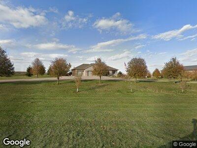
2254 210th St Alvord, IA 51230
Estimated Value: $296,000 - $513,884
--
Bed
3
Baths
1,777
Sq Ft
$228/Sq Ft
Est. Value
About This Home
This home is located at 2254 210th St, Alvord, IA 51230 and is currently estimated at $404,942, approximately $227 per square foot. 2254 210th St is a home located in Lyon County with nearby schools including West Lyon Elementary School, West Lyon Junior High School, and West Lyon High School.
Ownership History
Date
Name
Owned For
Owner Type
Purchase Details
Closed on
Mar 6, 2024
Sold by
Teunissen Randy R and Teunissen Stephanie A
Bought by
Randy R Teunissen Revocable Trust
Current Estimated Value
Create a Home Valuation Report for This Property
The Home Valuation Report is an in-depth analysis detailing your home's value as well as a comparison with similar homes in the area
Home Values in the Area
Average Home Value in this Area
Purchase History
| Date | Buyer | Sale Price | Title Company |
|---|---|---|---|
| Randy R Teunissen Revocable Trust | -- | None Listed On Document |
Source: Public Records
Mortgage History
| Date | Status | Borrower | Loan Amount |
|---|---|---|---|
| Previous Owner | Teunissen Randy R | $300,000 | |
| Previous Owner | Teunissen Randy Ray | $380,000 | |
| Previous Owner | Teunissen Randy Ray | $947,244 | |
| Previous Owner | Teunissen Randy Ray | $600,000 | |
| Previous Owner | Teunissen Randy Ray | $1,030,000 | |
| Previous Owner | Teunissen Randy R | $217,000 | |
| Previous Owner | Teunissen Randy R | $150,000 | |
| Previous Owner | Teurissen Randy R | $0 | |
| Previous Owner | Teunissen Randy R | $300,000 |
Source: Public Records
Tax History Compared to Growth
Tax History
| Year | Tax Paid | Tax Assessment Tax Assessment Total Assessment is a certain percentage of the fair market value that is determined by local assessors to be the total taxable value of land and additions on the property. | Land | Improvement |
|---|---|---|---|---|
| 2024 | $4,634 | $499,070 | $2,050 | $497,020 |
| 2023 | $4,634 | $500,080 | $2,050 | $498,030 |
| 2022 | $3,912 | $380,080 | $1,510 | $378,570 |
| 2021 | $3,912 | $380,080 | $1,510 | $378,570 |
| 2020 | $3,758 | $337,110 | $1,580 | $335,530 |
| 2019 | $3,084 | $272,628 | $0 | $0 |
| 2018 | $3,020 | $272,628 | $0 | $0 |
| 2017 | $2,464 | $226,169 | $0 | $0 |
| 2016 | $2,528 | $226,169 | $0 | $0 |
| 2015 | $2,528 | $229,970 | $0 | $0 |
| 2014 | $2,436 | $229,970 | $0 | $0 |
Source: Public Records
Map
Nearby Homes