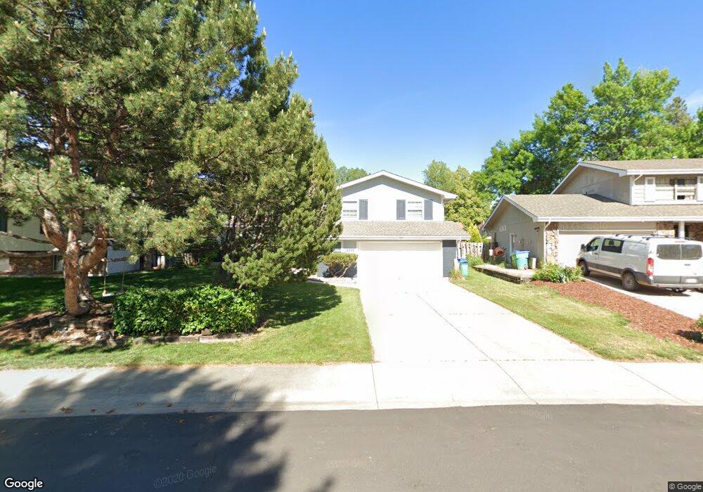
2255 Shawnee Ct Fort Collins, CO 80525
Mission Hills NeighborhoodEstimated Value: $599,000 - $638,000
3
Beds
3
Baths
1,693
Sq Ft
$366/Sq Ft
Est. Value
About This Home
This home is located at 2255 Shawnee Ct, Fort Collins, CO 80525 and is currently estimated at $620,166, approximately $366 per square foot. 2255 Shawnee Ct is a home located in Larimer County with nearby schools including O'Dea Elementary School, Lesher Middle School, and Fort Collins High School.
Ownership History
Date
Name
Owned For
Owner Type
Purchase Details
Closed on
Feb 16, 2018
Sold by
Wilcox Brody P and Wilcox Kim D
Bought by
Guerrero Rolando A
Current Estimated Value
Home Financials for this Owner
Home Financials are based on the most recent Mortgage that was taken out on this home.
Original Mortgage
$422,640
Outstanding Balance
$357,578
Interest Rate
3.95%
Mortgage Type
VA
Estimated Equity
$262,588
Purchase Details
Closed on
Jun 8, 2015
Sold by
Cook Donald L and Coook Pamela S
Bought by
Wilcox Brody P and Wilcox Kim D
Home Financials for this Owner
Home Financials are based on the most recent Mortgage that was taken out on this home.
Original Mortgage
$256,000
Interest Rate
3.82%
Mortgage Type
New Conventional
Purchase Details
Closed on
May 1, 1988
Bought by
Cook Donald L and Cook Pamela S
Create a Home Valuation Report for This Property
The Home Valuation Report is an in-depth analysis detailing your home's value as well as a comparison with similar homes in the area
Home Values in the Area
Average Home Value in this Area
Purchase History
| Date | Buyer | Sale Price | Title Company |
|---|---|---|---|
| Guerrero Rolando A | $410,000 | Land Title Guarantee Co | |
| Wilcox Brody P | $320,000 | Land Title Guarantee Company | |
| Cook Donald L | $112,000 | -- |
Source: Public Records
Mortgage History
| Date | Status | Borrower | Loan Amount |
|---|---|---|---|
| Open | Guerrero Rolando A | $422,640 | |
| Previous Owner | Wilcox Brody P | $256,000 |
Source: Public Records
Tax History Compared to Growth
Tax History
| Year | Tax Paid | Tax Assessment Tax Assessment Total Assessment is a certain percentage of the fair market value that is determined by local assessors to be the total taxable value of land and additions on the property. | Land | Improvement |
|---|---|---|---|---|
| 2025 | $2,962 | $41,259 | $3,350 | $37,909 |
| 2024 | $2,819 | $41,259 | $3,350 | $37,909 |
| 2022 | $2,261 | $30,900 | $3,475 | $27,425 |
| 2021 | $2,285 | $31,789 | $3,575 | $28,214 |
| 2020 | $2,974 | $31,782 | $3,575 | $28,207 |
| 2019 | $2,987 | $31,782 | $3,575 | $28,207 |
| 2018 | $2,434 | $26,705 | $3,600 | $23,105 |
| 2017 | $2,426 | $26,705 | $3,600 | $23,105 |
| 2016 | $2,091 | $22,909 | $3,980 | $18,929 |
| 2015 | $1,355 | $22,910 | $3,980 | $18,930 |
| 2014 | $1,086 | $19,860 | $3,980 | $15,880 |
Source: Public Records
Map
Nearby Homes
- 836 Vanderbilt Ct
- 924 Vanderbilt Ct
- 2418 Amherst St
- 2442 Amherst St
- 925 Columbia Rd Unit 523
- 925 Columbia Rd Unit 716
- 925 Columbia Rd Unit 233
- 2460 Stover St
- 1909 Pawnee Dr
- 1850 Indian Hills Cir
- 1917 S Lemay Ave
- 1113 Parkwood Dr
- 1741 Brookhaven Cir E Unit D
- 1741 Brookhaven Cir E Unit A
- 809 E Drake Rd Unit B112
- 801 E Drake Rd Unit G80
- 705 E Drake Rd Unit O35
- 705 E Drake Rd Unit Q22
- 412 Baylor St
- 1202 Niagara Dr Unit 20
- 2249 Shawnee Ct
- 2261 Shawnee Ct
- 2248 Apache Ct
- 2254 Apache Ct
- 2243 Shawnee Ct
- 2242 Apache Ct
- 2260 Apache Ct
- 2260 Shawnee Ct
- 2254 Shawnee Ct
- 2236 Apache Ct
- 2237 Shawnee Ct
- 2248 Shawnee Ct
- 2230 Apache Ct
- 901 Columbia Rd
- 843 Columbia Rd
- 907 Columbia Rd
- 2242 Shawnee Ct
- 837 Columbia Rd
- 2231 Shawnee Ct
- 2301 Amherst St