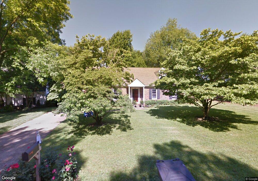
226 Gloucester St Franklin, TN 37064
Central Franklin NeighborhoodEstimated Value: $722,000 - $874,000
Studio
2
Baths
2,838
Sq Ft
$283/Sq Ft
Est. Value
About This Home
This home is located at 226 Gloucester St, Franklin, TN 37064 and is currently estimated at $802,205, approximately $282 per square foot. 226 Gloucester St is a home located in Williamson County with nearby schools including Franklin Elementary School, Freedom Intermediate School, and Freedom Middle School.
Ownership History
Date
Name
Owned For
Owner Type
Purchase Details
Closed on
May 14, 2003
Sold by
White Jennifer and White Clatie K
Bought by
Perry Brad and Perry Stacy
Current Estimated Value
Home Financials for this Owner
Home Financials are based on the most recent Mortgage that was taken out on this home.
Original Mortgage
$150,000
Outstanding Balance
$64,486
Interest Rate
5.76%
Mortgage Type
Purchase Money Mortgage
Estimated Equity
$737,719
Create a Home Valuation Report for This Property
The Home Valuation Report is an in-depth analysis detailing your home's value as well as a comparison with similar homes in the area
Home Values in the Area
Average Home Value in this Area
Purchase History
| Date | Buyer | Sale Price | Title Company |
|---|---|---|---|
| Perry Brad | $200,000 | Jack Case Wilson Title Assoc |
Source: Public Records
Mortgage History
| Date | Status | Borrower | Loan Amount |
|---|---|---|---|
| Open | Perry Brad | $150,000 |
Source: Public Records
Tax History
| Year | Tax Paid | Tax Assessment Tax Assessment Total Assessment is a certain percentage of the fair market value that is determined by local assessors to be the total taxable value of land and additions on the property. | Land | Improvement |
|---|---|---|---|---|
| 2025 | $3,563 | $202,900 | $60,000 | $142,900 |
| 2024 | $3,563 | $125,850 | $30,000 | $95,850 |
| 2023 | $3,424 | $125,850 | $30,000 | $95,850 |
| 2022 | $3,424 | $125,850 | $30,000 | $95,850 |
| 2021 | $3,424 | $125,850 | $30,000 | $95,850 |
| 2020 | $2,996 | $92,825 | $18,750 | $74,075 |
| 2019 | $2,996 | $92,825 | $18,750 | $74,075 |
| 2018 | $2,931 | $92,825 | $18,750 | $74,075 |
| 2017 | $2,530 | $81,425 | $18,750 | $62,675 |
Source: Public Records
Map
Nearby Homes
- 1108 Colonial Ct
- 310 Watercress Dr
- 718 Murfreesboro Rd
- 426 Murfreesboro Rd
- 232 Pebble Glen Dr
- 405 Luna Ct
- 639 Band Dr
- 626 Band Dr
- 419 Lewisburg Ave
- 121 Pebble View Dr
- 624 Burghley Ln
- 612 Burghley Ln
- 217 Lewisburg Ave
- 215 Lewisburg Ave
- 521 Maplegrove Dr
- 1251 Carriage Park Dr Unit 14A
- 305 4th Ave S
- 1335 Adams St
- 1609 Cabot Dr
- 811 Thatcher Way
- 224 Gloucester St
- 228 Gloucester St
- 229 Gloucester St
- 222 Gloucester St
- 225 Gloucester St
- 230 Gloucester St
- 416 Chesterfield Place
- 166 Sturbridge Dr
- 405 Chesterfield Place
- 170 Sturbridge Dr
- 219 Gloucester St
- 232 Gloucester St
- 174 Sturbridge Dr
- 162 Sturbridge Dr
- 231 Gloucester St
- 178 Sturbridge Dr
- 412 Chesterfield Place
- 401 Chesterfield Place
- 234 Gloucester St
Your Personal Tour Guide
Ask me questions while you tour the home.