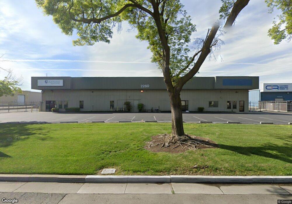
2260 Cooper Ave Unit B Merced, CA 95348
Estimated Value: $2,328,522
Studio
8
Baths
26,000
Sq Ft
$90/Sq Ft
Est. Value
About This Home
This home is located at 2260 Cooper Ave Unit B, Merced, CA 95348 and is currently estimated at $2,328,522, approximately $89 per square foot. 2260 Cooper Ave Unit B is a home located in Merced County with nearby schools including Franklin Elementary School, Tenaya Middle School, and El Capitan High School.
Ownership History
Date
Name
Owned For
Owner Type
Purchase Details
Closed on
Dec 28, 2020
Sold by
Gunstream Larry A and Crow Darryl E
Bought by
Lander David W
Current Estimated Value
Purchase Details
Closed on
Feb 28, 2008
Sold by
Crow Darryl E and Crow Janice D
Bought by
Crow Darryl E and Crow Janice D
Purchase Details
Closed on
Oct 13, 2000
Sold by
Klein Johanna Trustee and Don
Bought by
Crow Darryl and Crow Janice
Home Financials for this Owner
Home Financials are based on the most recent Mortgage that was taken out on this home.
Original Mortgage
$460,000
Interest Rate
7.67%
Mortgage Type
Seller Take Back
Create a Home Valuation Report for This Property
The Home Valuation Report is an in-depth analysis detailing your home's value as well as a comparison with similar homes in the area
Purchase History
| Date | Buyer | Sale Price | Title Company |
|---|---|---|---|
| Lander David W | $1,800,000 | Chicago Title Company | |
| Crow Darryl E | -- | None Available | |
| Crow Darryl | $750,000 | Chicago Title Co |
Source: Public Records
Mortgage History
| Date | Status | Borrower | Loan Amount |
|---|---|---|---|
| Previous Owner | Crow Darryl | $460,000 |
Source: Public Records
Tax History
| Year | Tax Paid | Tax Assessment Tax Assessment Total Assessment is a certain percentage of the fair market value that is determined by local assessors to be the total taxable value of land and additions on the property. | Land | Improvement |
|---|---|---|---|---|
| 2025 | $20,422 | $1,948,375 | $265,194 | $1,683,181 |
| 2024 | $20,422 | $1,910,173 | $259,995 | $1,650,178 |
| 2023 | $20,138 | $1,872,720 | $254,898 | $1,617,822 |
| 2022 | $19,880 | $1,836,000 | $249,900 | $1,586,100 |
| 2021 | $19,837 | $1,800,000 | $245,000 | $1,555,000 |
| 2020 | $11,719 | $1,042,995 | $75,772 | $967,223 |
| 2019 | $11,540 | $1,022,545 | $74,287 | $948,258 |
| 2018 | $10,530 | $1,002,496 | $72,831 | $929,665 |
| 2017 | $10,930 | $982,840 | $71,403 | $911,437 |
| 2016 | $10,760 | $963,569 | $70,003 | $893,566 |
| 2015 | $10,589 | $949,096 | $68,952 | $880,144 |
| 2014 | $10,359 | $930,506 | $67,602 | $862,904 |
Source: Public Records
Map
Nearby Homes
- 2790 N State Highway 59
- 2500 N State Highway 59 Unit 36
- 2500 N State Highway 59 Unit 278
- 2500 N State Highway 59 Unit 239
- 2500 N State Highway 59 Unit 18
- 2500 N State Highway 59
- 1664 W North Bear Creek Dr Unit 5
- 1656 W North Bear Creek Dr Unit 9
- 1646 W North Bear Creek Dr
- 1648 W North Bear Creek Dr
- 3157 Juneau Ct
- 1482 Autry Way
- 1541 W North Bear Creek Dr
- 1840 Cheyenne Dr
- 2085 Cabot Ave
- 2228 Drake Ave
- 1438 W 19th St
- 3533 San Isidro Ave
- 3536 San Isidro Ave
- 2052 W Solis St
- 2260 Cooper Ave
- 2260 Cooper Ave Unit F
- 2260 Cooper Ave Unit H
- 2260 Cooper Ave Unit F G
- 2250 Cooper Ave
- 2777 N State Highway 59
- 2777 N State Highway 59
- 2777 N State Highway 59 Unit D F
- 2777 N State Highway 59 Unit B
- 2777 N State Highway 59 Unit C
- 2777 N State Highway 59 Unit D
- 2777 N State Highway 59 Unit D
- 2777 N State Highway 59 Unit C
- 2777 N State Highway 59 Unit A
- 2777 N State Highway 59
- 2777 N 59 Hwy Unit `B`
- 2777 B 59 Hwy N
- 2777 D N Highway 59 Unit D
- 2320 Cooper Ave
- 2100 Cooper Ave
Your Personal Tour Guide
Ask me questions while you tour the home.