Estimated Value: $287,000 - $357,767
4
Beds
2
Baths
1,749
Sq Ft
$190/Sq Ft
Est. Value
About This Home
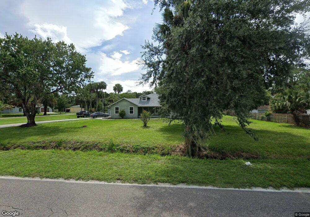
This home is located at 2260 Cox Rd, Cocoa, FL 32926 and is currently estimated at $331,942, approximately $189 per square foot. 2260 Cox Rd is a home located in Brevard County with nearby schools including Cocoa High School, Saturn Elementary School, and Space Coast Christian Academy.
Ownership History
Date
Name
Owned For
Owner Type
Purchase Details
Closed on
Aug 15, 2025
Sold by
Hurst Robin B
Bought by
Hurst Kyle M and Hurst Katelyn E
Current Estimated Value
Home Financials for this Owner
Home Financials are based on the most recent Mortgage that was taken out on this home.
Original Mortgage
$210,000
Outstanding Balance
$209,266
Interest Rate
5.8%
Mortgage Type
New Conventional
Estimated Equity
$122,676
Purchase Details
Closed on
Oct 10, 2006
Sold by
Hurst Donald Keith
Bought by
Hurst Robin B
Purchase Details
Closed on
Sep 11, 2003
Sold by
Hurst Donald Keith and Hurst Robin B
Bought by
Hurst Donald Keith and Hurst Robin B
Home Financials for this Owner
Home Financials are based on the most recent Mortgage that was taken out on this home.
Original Mortgage
$143,700
Interest Rate
6.13%
Create a Home Valuation Report for This Property
The Home Valuation Report is an in-depth analysis detailing your home's value as well as a comparison with similar homes in the area
Home Values in the Area
Average Home Value in this Area
Purchase History
| Date | Buyer | Sale Price | Title Company |
|---|---|---|---|
| Hurst Kyle M | $290,000 | American Land Title | |
| Hurst Kyle M | $290,000 | American Land Title | |
| Hurst Robin B | -- | Attorney | |
| Hurst Donald Keith | $6,600 | Gulfatlantic Title |
Source: Public Records
Mortgage History
| Date | Status | Borrower | Loan Amount |
|---|---|---|---|
| Open | Hurst Kyle M | $210,000 | |
| Closed | Hurst Kyle M | $210,000 | |
| Previous Owner | Hurst Donald Keith | $143,700 |
Source: Public Records
Tax History
| Year | Tax Paid | Tax Assessment Tax Assessment Total Assessment is a certain percentage of the fair market value that is determined by local assessors to be the total taxable value of land and additions on the property. | Land | Improvement |
|---|---|---|---|---|
| 2025 | $1,775 | $133,930 | -- | -- |
| 2024 | $1,738 | $130,160 | -- | -- |
| 2023 | $1,738 | $126,370 | $0 | $0 |
| 2022 | $1,622 | $122,690 | $0 | $0 |
| 2021 | $1,634 | $119,120 | $0 | $0 |
| 2020 | $1,575 | $117,480 | $0 | $0 |
| 2019 | $1,514 | $114,840 | $0 | $0 |
| 2018 | $1,509 | $112,700 | $0 | $0 |
| 2017 | $1,509 | $110,390 | $0 | $0 |
| 2016 | $1,519 | $108,120 | $29,040 | $79,080 |
| 2015 | $1,531 | $107,370 | $29,040 | $78,330 |
| 2014 | $1,531 | $106,520 | $24,200 | $82,320 |
Source: Public Records
Map
Nearby Homes
- 3826 Parapet Dr
- 3816 Parapet Dr
- 3813 Stonemont Dr
- 3806 Parapet Dr
- 3802 Arrowsmith Dr
- 2212 Spring Cir
- 1817 Ponderosa St
- 4005 Pinyon Dr
- 1835 Longleaf Rd
- 3728 W Malory Ct
- 3723 W Malory Ct
- 4300 James Rd
- 4630 James Rd
- 000 James Rd
- 3487 Rocky Gap Place
- 1870 Britt Rd
- TBD Rayburn Rd
- 3417 Rocky Gap Place
- 4600 Janet Rd
- 4651 N Friday Cir
Your Personal Tour Guide
Ask me questions while you tour the home.