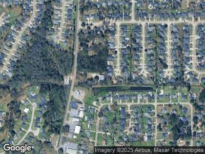
2261 Dawes Rd Mobile, AL 36695
Yorkwood NeighborhoodEstimated Value: $423,048
1
Bed
1
Bath
3,000
Sq Ft
$141/Sq Ft
Est. Value
About This Home
This home is located at 2261 Dawes Rd, Mobile, AL 36695 and is currently estimated at $423,048, approximately $141 per square foot. 2261 Dawes Rd is a home located in Mobile County with nearby schools including O'rourke Elementary School, Bernice J Causey Middle School, and Baker High School.
Ownership History
Date
Name
Owned For
Owner Type
Purchase Details
Closed on
Sep 13, 2024
Sold by
Coffee Pro Inc
Bought by
South Alabama Equipment Co Llc
Current Estimated Value
Purchase Details
Closed on
Nov 21, 2022
Sold by
Coffee Co Inc
Bought by
County Of Mobile
Purchase Details
Closed on
Mar 7, 2011
Sold by
Stewart Myra Nell
Bought by
Stewart Paul and Stewart Myra Nell
Purchase Details
Closed on
Dec 14, 1999
Sold by
Crance Gregory H and Stewart Paul A
Bought by
Coffee Pro Inc
Home Financials for this Owner
Home Financials are based on the most recent Mortgage that was taken out on this home.
Original Mortgage
$127,948
Interest Rate
7.68%
Mortgage Type
Commercial
Create a Home Valuation Report for This Property
The Home Valuation Report is an in-depth analysis detailing your home's value as well as a comparison with similar homes in the area
Home Values in the Area
Average Home Value in this Area
Purchase History
| Date | Buyer | Sale Price | Title Company |
|---|---|---|---|
| South Alabama Equipment Co Llc | $415,000 | None Listed On Document | |
| County Of Mobile | $20,040 | -- | |
| Stewart Paul | -- | None Available | |
| Coffee Pro Inc | -- | -- |
Source: Public Records
Mortgage History
| Date | Status | Borrower | Loan Amount |
|---|---|---|---|
| Previous Owner | Coffee Pro Inc | $172,000 | |
| Previous Owner | Coffee Pro Inc | $226,750 | |
| Previous Owner | Coffee Pro Inc | $127,948 |
Source: Public Records
Tax History Compared to Growth
Tax History
| Year | Tax Paid | Tax Assessment Tax Assessment Total Assessment is a certain percentage of the fair market value that is determined by local assessors to be the total taxable value of land and additions on the property. | Land | Improvement |
|---|---|---|---|---|
| 2024 | $2,168 | $44,700 | $10,520 | $34,180 |
| 2023 | $1,612 | $33,240 | $10,980 | $22,260 |
| 2022 | $1,654 | $34,100 | $11,840 | $22,260 |
| 2021 | $1,572 | $32,420 | $3,960 | $28,460 |
| 2020 | $1,358 | $32,540 | $3,960 | $28,580 |
| 2019 | $1,288 | $26,560 | $0 | $0 |
| 2018 | $1,308 | $26,960 | $0 | $0 |
| 2017 | $1,310 | $27,000 | $0 | $0 |
| 2016 | $1,327 | $27,360 | $0 | $0 |
| 2013 | $1,168 | $23,780 | $0 | $0 |
Source: Public Records
Map
Nearby Homes
- 2220 Irongate Ct
- 2201 Irongate Ct
- 2125 Spring Grove E
- 1980 Laurel Oak Ct
- 2214 Seasons Ct
- 8470 Desert Oak Ct
- 2125 Spring Grove W
- 2451 Pontchartrain Dr
- 1866 Burnham Ct
- 2523 Field Brook Cir E
- 2691 Rosebud Dr E
- 1784 Harrington Way
- 1843 Harrington Way
- 2609 Meadowview Dr
- 1830 W Rachael Dr
- 2316 Leroy Stevens Rd
- 0 Whittington Dr Unit 7544605
- 0 Walter Ct Unit 7237688
- 0 Walter Ct Unit 7008922
- 0 Walter Ct Unit 7008918
- 2261 Dawes Rd
- 2260 Irongate Ct
- 2270 Irongate Ct
- 8668 Capital Dr N
- 8678 Capital Dr N
- 2240 Irongate Ct
- 8658 Capital Dr N
- 2271 Irongate Ct
- 2320 Capital Dr
- 8648 Capital Dr N
- 2230 Irongate Ct
- 2281 Dawes Rd
- 2261 Irongate Ct
- 2251 Irongate Ct
- 2321 Capital Dr
- 8638 Capital Dr N
- 2241 Irongate Ct
- 2330 Capital Dr
- 2231 Irongate Ct
- 2225 Dawes Rd
