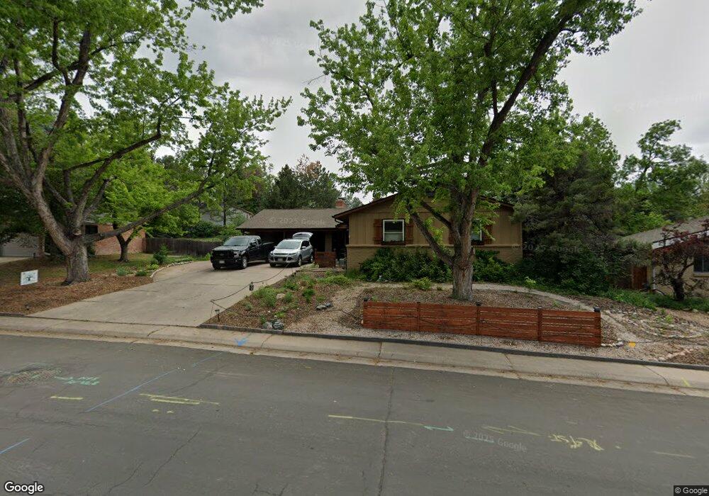
2266 W Davies Ave Littleton, CO 80120
Heritage NeighborhoodEstimated Value: $799,733 - $890,000
3
Beds
3
Baths
3,255
Sq Ft
$258/Sq Ft
Est. Value
About This Home
This home is located at 2266 W Davies Ave, Littleton, CO 80120 and is currently estimated at $839,433, approximately $257 per square foot. 2266 W Davies Ave is a home located in Arapahoe County with nearby schools including Runyon Elementary School, Euclid Middle School, and Heritage High School.
Ownership History
Date
Name
Owned For
Owner Type
Purchase Details
Closed on
Oct 18, 2013
Sold by
Evans Claire B
Bought by
Johnson Theresa
Current Estimated Value
Home Financials for this Owner
Home Financials are based on the most recent Mortgage that was taken out on this home.
Original Mortgage
$299,200
Outstanding Balance
$225,349
Interest Rate
4.56%
Mortgage Type
New Conventional
Estimated Equity
$614,084
Purchase Details
Closed on
Apr 26, 2013
Sold by
Evans Jay R and Evans Claire B
Bought by
Evans Claire B
Purchase Details
Closed on
Jul 1, 2009
Sold by
Lockard Donald F
Bought by
Evans Jay R and Evans Claire B
Purchase Details
Closed on
Jul 4, 1776
Bought by
Conversion Arapco
Create a Home Valuation Report for This Property
The Home Valuation Report is an in-depth analysis detailing your home's value as well as a comparison with similar homes in the area
Home Values in the Area
Average Home Value in this Area
Purchase History
| Date | Buyer | Sale Price | Title Company |
|---|---|---|---|
| Johnson Theresa | $352,000 | Fidelity National Title Insu | |
| Evans Claire B | -- | None Available | |
| Evans Jay R | $275,000 | Fidelity National Title Insu | |
| Conversion Arapco | -- | -- |
Source: Public Records
Mortgage History
| Date | Status | Borrower | Loan Amount |
|---|---|---|---|
| Open | Johnson Theresa | $299,200 |
Source: Public Records
Tax History Compared to Growth
Tax History
| Year | Tax Paid | Tax Assessment Tax Assessment Total Assessment is a certain percentage of the fair market value that is determined by local assessors to be the total taxable value of land and additions on the property. | Land | Improvement |
|---|---|---|---|---|
| 2024 | $4,454 | $43,557 | -- | -- |
| 2023 | $4,165 | $43,557 | $0 | $0 |
| 2022 | $3,845 | $37,871 | $0 | $0 |
| 2021 | $3,834 | $37,871 | $0 | $0 |
| 2020 | $3,534 | $35,915 | $0 | $0 |
| 2019 | $3,324 | $35,915 | $0 | $0 |
| 2018 | $2,760 | $31,694 | $0 | $0 |
| 2017 | $2,558 | $31,694 | $0 | $0 |
| 2016 | $2,256 | $26,857 | $0 | $0 |
| 2015 | $2,261 | $26,857 | $0 | $0 |
| 2014 | -- | $22,877 | $0 | $0 |
| 2013 | -- | $22,070 | $0 | $0 |
Source: Public Records
Map
Nearby Homes
- 7391 S Costilla St
- 7019 S Windermere St
- 2812 W Davies Dr
- 6921 S Bryant St
- 7132 S Bryant St Unit 232
- 1540 W Briarwood Ave
- 2418 W Euclid Ave
- 2957 W Rowland Ave
- 2979 W Rowland Place
- 7120 S Clay St
- 2443 W Sunset Dr
- 7420 S Houstoun Waring Cir
- 6483 S Sycamore St
- 6664 S Datura St
- 1705 W Hinsdale Place
- 6511 S Cedar St
- 6337 S Louthan St
- 7707 S Curtice Way Unit D
- 7070 S Lakeview St
- 2743 W Long Dr Unit B
- 2296 W Davies Ave
- 2236 W Davies Ave
- 855 Front Range Rd
- 2255 W Davies Ave
- 2316 W Davies Ave
- 2206 W Davies Ave
- 2225 W Davies Ave
- 2285 W Davies Ave
- 845 Front Range Rd
- 6987 S Hill St
- 2336 W Davies Ave
- 2305 W Davies Ave
- 875 Front Range Rd
- 2254 W Costilla Ave
- 2224 W Costilla Ave
- 7008 S Hill St
- 825 Front Range Rd
- 2204 W Costilla Ave
- 2284 W Costilla Ave
- 2335 W Davies Ave