Estimated Value: $182,000 - $234,000
--
Bed
1
Bath
1,392
Sq Ft
$148/Sq Ft
Est. Value
About This Home
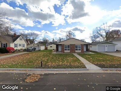
This home is located at 227-235 W Cedar St, Dike, IA 50624 and is currently estimated at $205,500, approximately $147 per square foot. 227-235 W Cedar St is a home located in Grundy County with nearby schools including Dike Elementary School, New Hartford Elementary School, and Dike-New Hartford Junior High School.
Ownership History
Date
Name
Owned For
Owner Type
Purchase Details
Closed on
Jun 27, 2014
Sold by
Hofbauer Brown William H and Hofbauer Brown Mary
Bought by
Viet Holdings Llc
Current Estimated Value
Home Financials for this Owner
Home Financials are based on the most recent Mortgage that was taken out on this home.
Original Mortgage
$100,000
Outstanding Balance
$77,842
Interest Rate
4.13%
Mortgage Type
Future Advance Clause Open End Mortgage
Estimated Equity
$136,160
Purchase Details
Closed on
Sep 14, 2007
Sold by
Fair Ridge Farm Inc
Bought by
Hofbauer Brown William H and Hofbauer Brown Mary
Home Financials for this Owner
Home Financials are based on the most recent Mortgage that was taken out on this home.
Original Mortgage
$90,000
Interest Rate
6.71%
Mortgage Type
New Conventional
Create a Home Valuation Report for This Property
The Home Valuation Report is an in-depth analysis detailing your home's value as well as a comparison with similar homes in the area
Home Values in the Area
Average Home Value in this Area
Purchase History
| Date | Buyer | Sale Price | Title Company |
|---|---|---|---|
| Viet Holdings Llc | $135,000 | None Available | |
| Hofbauer Brown William H | $113,500 | -- |
Source: Public Records
Mortgage History
| Date | Status | Borrower | Loan Amount |
|---|---|---|---|
| Open | Viet Holdings Llc | $100,000 | |
| Previous Owner | Hofbauer Brown William H | $90,000 |
Source: Public Records
Tax History Compared to Growth
Tax History
| Year | Tax Paid | Tax Assessment Tax Assessment Total Assessment is a certain percentage of the fair market value that is determined by local assessors to be the total taxable value of land and additions on the property. | Land | Improvement |
|---|---|---|---|---|
| 2024 | $3,268 | $194,880 | $24,380 | $170,500 |
| 2023 | $3,268 | $194,880 | $24,380 | $170,500 |
| 2022 | $2,944 | $162,000 | $22,500 | $139,500 |
| 2021 | $2,944 | $162,000 | $22,500 | $139,500 |
| 2020 | $2,760 | $150,120 | $22,500 | $127,620 |
| 2019 | $2,582 | $140,540 | $0 | $0 |
| 2018 | $2,428 | $140,540 | $0 | $0 |
| 2017 | $2,428 | $135,410 | $0 | $0 |
| 2016 | $2,432 | $135,410 | $0 | $0 |
| 2015 | $2,432 | $126,430 | $0 | $0 |
| 2014 | $2,326 | $126,430 | $0 | $0 |
Source: Public Records
Map
Nearby Homes
- 138 E Elder St
- 607 4th St Unit North unit
- 617 4th St Unit middle unit
- 4515 Grundy Rd
- 28708 215th St
- 0000 S Ave
- Field 3 S Ave
- Field 4 S Ave
- Field 2 S Ave
- 215 Blue Spruce Dr
- 217 Blue Spruce Dr
- 219 Blue Spruce Dr
- 101 Pine Ridge Rd
- 103 Pine Ridge Rd
- 221 Blue Spruce Dr
- 107 Pine Ridge Rd
- 105 Pine Ridge Rd
- 109 Pine Ridge Rd
- 111 Pine Ridge Rd
- 225 Blue Spruce Dr