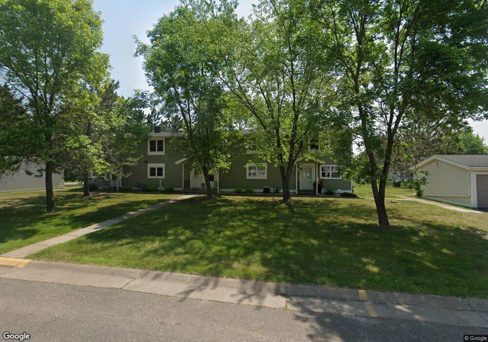
227 Mitchell Cir Unit 53C Duluth, MN 55811
Kenwood NeighborhoodEstimated Value: $223,000 - $240,000
3
Beds
2
Baths
1,104
Sq Ft
$211/Sq Ft
Est. Value
About This Home
This home is located at 227 Mitchell Cir Unit 53C, Duluth, MN 55811 and is currently estimated at $232,406, approximately $210 per square foot. 227 Mitchell Cir Unit 53C is a home located in St. Louis County with nearby schools including Lowell Elementary School, Lincoln Park Middle School, and Denfeld High School.
Ownership History
Date
Name
Owned For
Owner Type
Purchase Details
Closed on
Mar 9, 2007
Sold by
Tofte John and Tofte Nancy
Bought by
Carlson Daniel Robert and Carlson Hermine Lynette
Current Estimated Value
Home Financials for this Owner
Home Financials are based on the most recent Mortgage that was taken out on this home.
Original Mortgage
$92,000
Outstanding Balance
$61,071
Interest Rate
8.2%
Mortgage Type
Unknown
Estimated Equity
$171,335
Create a Home Valuation Report for This Property
The Home Valuation Report is an in-depth analysis detailing your home's value as well as a comparison with similar homes in the area
Home Values in the Area
Average Home Value in this Area
Purchase History
| Date | Buyer | Sale Price | Title Company |
|---|---|---|---|
| Carlson Daniel Robert | $115,000 | Absolute Title & Abstract Co |
Source: Public Records
Mortgage History
| Date | Status | Borrower | Loan Amount |
|---|---|---|---|
| Open | Carlson Daniel Robert | $92,000 |
Source: Public Records
Tax History
| Year | Tax Paid | Tax Assessment Tax Assessment Total Assessment is a certain percentage of the fair market value that is determined by local assessors to be the total taxable value of land and additions on the property. | Land | Improvement |
|---|---|---|---|---|
| 2024 | $29 | $214,800 | $21,900 | $192,900 |
| 2023 | $25 | $197,000 | $21,900 | $175,100 |
| 2022 | $25 | $167,100 | $21,200 | $145,900 |
| 2021 | $25 | $130,900 | $20,400 | $110,500 |
| 2020 | $25 | $130,900 | $20,400 | $110,500 |
| 2019 | $25 | $116,100 | $18,400 | $97,700 |
| 2018 | $25 | $107,700 | $18,000 | $89,700 |
| 2017 | $25 | $107,700 | $18,000 | $89,700 |
| 2016 | $1,258 | $101,800 | $21,400 | $80,400 |
| 2015 | $1,102 | $67,800 | $12,200 | $55,600 |
| 2014 | $1,102 | $67,800 | $12,200 | $55,600 |
Source: Public Records
Map
Nearby Homes
- 2360 Apple Ridge Dr
- 1944 Chinook Dr
- 1802 Rice Lake Rd
- 2718 Northridge Dr
- 1524 W Arrowhead Rd
- 1804 Rice Lake Rd
- 1145 Como Ave Unit 1
- 20xx Stanford Ave
- 1950 Middle Ln
- 205 Bluff's Ridge Ct
- 29 W Ideal St
- 35 W Ideal St
- 1722 North Rd
- 1205 W Arrowhead Rd
- 1030 Missouri Ave
- 1011 W Arrowhead Rd
- 817 Maple Bend Dr
- 1910 Ponderosa Ave
- 616 Maple Bend Dr
- 908 E Skyline Pkwy
- 225 Mitchell Cir
- 221 Mitchell Cir Unit 52B
- 223 Mitchell Cir
- 219 Mitchell Cir Unit 52C
- 219 Mitchell Cir Unit 5
- 229 Mitchell Cir
- 220 Mitchell Cir Unit 51F
- 231 Mitchell Cir
- 218 Mitchell Cir
- 216 Mitchell Cir Unit 51D
- 214 Mitchell Cir
- 212 Mitchell Cir Unit 51B
- 305 305 Kelly Cr
- 305 Kelly Cir Unit 1B
- 143 Madison Ave
- 307 Kelly Cir Unit 1A
- 303 Kelly Cir Unit 1C
- 309 Kelly Cir Unit 2D
- 309 309 Kelly Cr
- 309 Kelly Cir
Your Personal Tour Guide
Ask me questions while you tour the home.