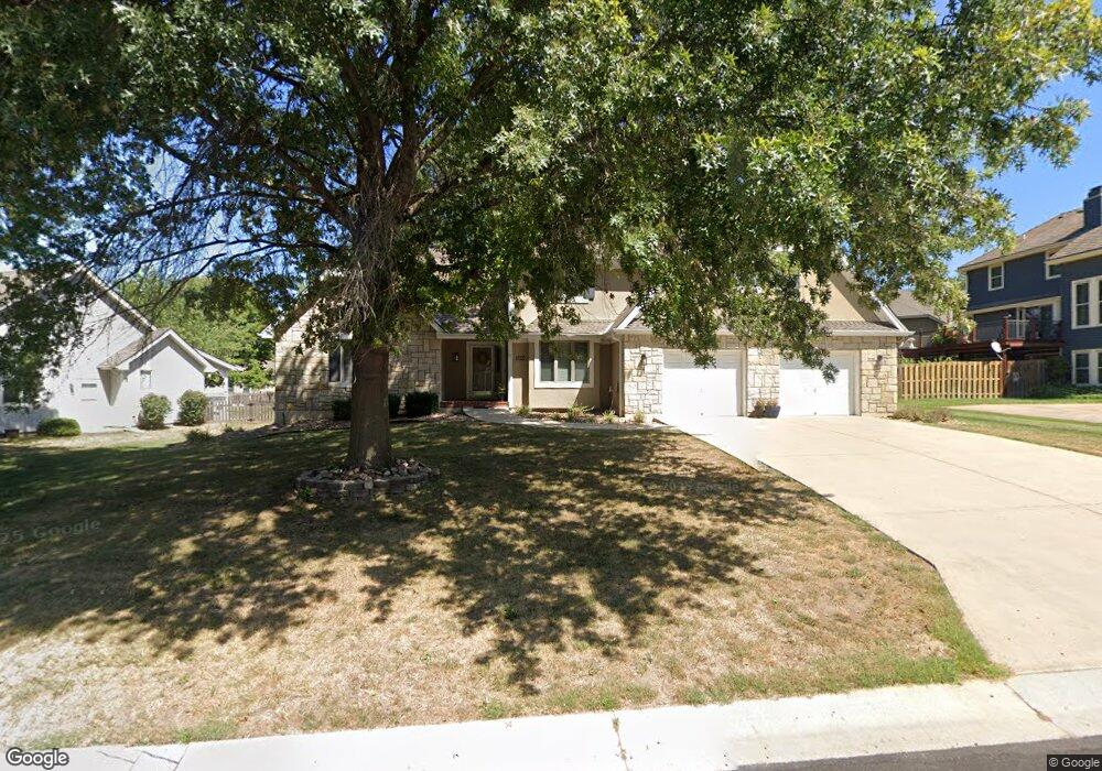
2270 NW Summerfield Dr Lees Summit, MO 64081
Estimated Value: $460,000 - $481,000
3
Beds
4
Baths
2,583
Sq Ft
$181/Sq Ft
Est. Value
About This Home
This home is located at 2270 NW Summerfield Dr, Lees Summit, MO 64081 and is currently estimated at $467,000, approximately $180 per square foot. 2270 NW Summerfield Dr is a home located in Jackson County with nearby schools including Cedar Creek Elementary School, Bernard C. Campbell Middle School, and Lee's Summit North High School.
Ownership History
Date
Name
Owned For
Owner Type
Purchase Details
Closed on
Jul 8, 2021
Sold by
Moehle Linda Kay
Bought by
Kates Ashley Lauren and Kates Jacobs
Current Estimated Value
Home Financials for this Owner
Home Financials are based on the most recent Mortgage that was taken out on this home.
Original Mortgage
$314,204
Outstanding Balance
$285,091
Interest Rate
2.9%
Mortgage Type
FHA
Estimated Equity
$181,909
Purchase Details
Closed on
Nov 9, 2010
Sold by
Moehle William H
Bought by
Moehle Linda Kay
Purchase Details
Closed on
May 31, 2000
Sold by
Rooks Wayne E and Rooks Evelyn
Bought by
Lees Landing Properties Llc
Home Financials for this Owner
Home Financials are based on the most recent Mortgage that was taken out on this home.
Original Mortgage
$165,000
Interest Rate
8.17%
Create a Home Valuation Report for This Property
The Home Valuation Report is an in-depth analysis detailing your home's value as well as a comparison with similar homes in the area
Home Values in the Area
Average Home Value in this Area
Purchase History
| Date | Buyer | Sale Price | Title Company |
|---|---|---|---|
| Kates Ashley Lauren | -- | None Available | |
| Moehle Linda Kay | -- | None Available | |
| Lees Landing Properties Llc | -- | Stewart Title |
Source: Public Records
Mortgage History
| Date | Status | Borrower | Loan Amount |
|---|---|---|---|
| Open | Kates Ashley Lauren | $314,204 | |
| Previous Owner | Lees Landing Properties Llc | $165,000 |
Source: Public Records
Tax History Compared to Growth
Tax History
| Year | Tax Paid | Tax Assessment Tax Assessment Total Assessment is a certain percentage of the fair market value that is determined by local assessors to be the total taxable value of land and additions on the property. | Land | Improvement |
|---|---|---|---|---|
| 2025 | $4,247 | $67,648 | $14,750 | $52,898 |
| 2024 | $4,217 | $58,824 | $7,535 | $51,289 |
| 2023 | $4,217 | $58,824 | $7,535 | $51,289 |
| 2022 | $4,417 | $54,720 | $6,227 | $48,493 |
| 2021 | $4,509 | $54,720 | $6,227 | $48,493 |
| 2020 | $4,548 | $54,663 | $6,227 | $48,436 |
| 2019 | $4,424 | $54,663 | $6,227 | $48,436 |
| 2018 | $4,149 | $47,575 | $5,420 | $42,155 |
| 2017 | $3,979 | $47,575 | $5,420 | $42,155 |
| 2016 | $3,979 | $45,163 | $5,111 | $40,052 |
| 2014 | $3,915 | $43,557 | $5,097 | $38,460 |
Source: Public Records
Map
Nearby Homes
- 813 NW High Point Dr
- 2257 NW Summerfield Dr
- 2436 NW Valley View Dr
- 2501 NW Shady Bend Ln
- 2503 NW Windwood Dr
- 2536 NW Bent Tree Cir
- 130 NW Ambersham Dr
- 2209 NW Wellington Ct
- 505 NW Ambersham Dr
- 2007 NW Chipman Rd
- 2508 NW Bent Tree Cir
- 2122 NW Ashurst Dr
- 2110 NW Ashurst Dr
- 13004 E 99th St
- 2090 NW O'Brien Rd
- 2086 NW O'Brien Rd
- 361 NW Patch Ct
- Monterey Plan at Reserve at Woodside Ridge
- Oakleigh Plan at Reserve at Woodside Ridge
- Ashland Plan at Reserve at Woodside Ridge
- 2274 NW Summerfield Dr
- 900 NW Falcon Dr
- 904 NW Falcon Dr
- 2280 NW Summerfield Dr
- 2265 NW Summerfield Dr
- 2312 NW Summerfield Dr
- 2269 NW Summerfield Dr
- 2273 NW Summerfield Dr
- 2261 NW Summerfield Dr
- 908 NW Falcon Dr
- 2320 NW Summerfield Dr
- 2277 NW Summerfield Dr
- 2281 NW Summerfield Dr
- 905 NW Falcon Dr
- 1000 NW Springdale Dr
- 2285 NW Summerfield Dr
- 901 NW Falcon Dr
- 821 NW High Point Dr
- 2289 NW Summerfield Dr
- 817 NW High Point Dr