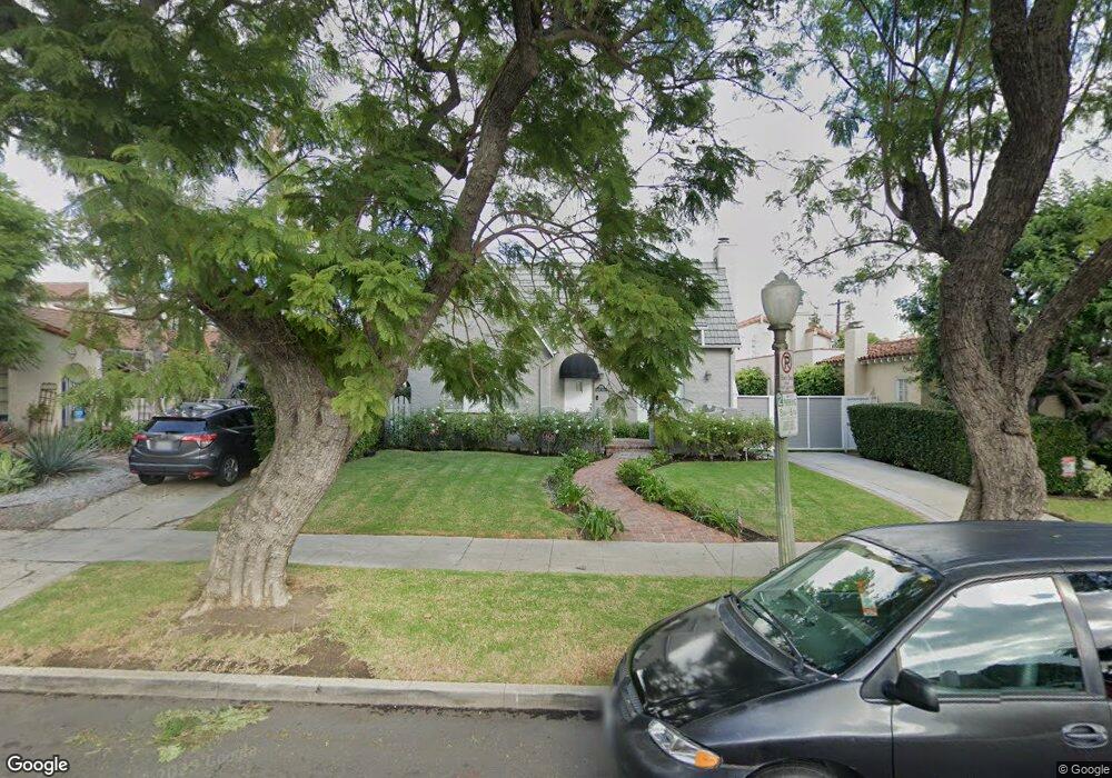
2270 Pelham Ave Los Angeles, CA 90064
West Los Angeles NeighborhoodEstimated Value: $2,076,217 - $2,195,000
3
Beds
2
Baths
1,698
Sq Ft
$1,266/Sq Ft
Est. Value
About This Home
This home is located at 2270 Pelham Ave, Los Angeles, CA 90064 and is currently estimated at $2,149,554, approximately $1,265 per square foot. 2270 Pelham Ave is a home located in Los Angeles County with nearby schools including Daniel Webster Middle School, Westwood Charter School, and Ralph Waldo Emerson Community Charter Middle School.
Ownership History
Date
Name
Owned For
Owner Type
Purchase Details
Closed on
Aug 12, 2016
Sold by
Galperson Robert
Bought by
Galperson Robert and Galperson Jennifer
Current Estimated Value
Home Financials for this Owner
Home Financials are based on the most recent Mortgage that was taken out on this home.
Original Mortgage
$956,000
Outstanding Balance
$753,789
Interest Rate
3.12%
Mortgage Type
Adjustable Rate Mortgage/ARM
Estimated Equity
$1,395,765
Purchase Details
Closed on
Dec 26, 2014
Sold by
Galperson Robert
Bought by
Galperson Robert T and Galperson Jennifer
Home Financials for this Owner
Home Financials are based on the most recent Mortgage that was taken out on this home.
Original Mortgage
$949,500
Interest Rate
3.62%
Mortgage Type
Adjustable Rate Mortgage/ARM
Purchase Details
Closed on
Nov 10, 2010
Sold by
Fener Jonathan
Bought by
Galperson Robert and Galperson Jennifer
Home Financials for this Owner
Home Financials are based on the most recent Mortgage that was taken out on this home.
Original Mortgage
$949,600
Interest Rate
4.87%
Mortgage Type
New Conventional
Purchase Details
Closed on
Sep 15, 2005
Sold by
Rosenstock Harvey J
Bought by
Fener Jonathan and Fener Robyn
Home Financials for this Owner
Home Financials are based on the most recent Mortgage that was taken out on this home.
Original Mortgage
$896,000
Interest Rate
5.5%
Mortgage Type
Purchase Money Mortgage
Purchase Details
Closed on
Mar 5, 2001
Sold by
Troutman Stanley M
Bought by
Rosenstock Harvey J and Rosenstock Wendi J
Home Financials for this Owner
Home Financials are based on the most recent Mortgage that was taken out on this home.
Original Mortgage
$440,000
Interest Rate
7%
Purchase Details
Closed on
Sep 1, 1998
Sold by
Troutman Stanley M
Bought by
Troutman Stanley M and Troutman Patt L
Purchase Details
Closed on
May 27, 1998
Sold by
Troutman Stanley M
Bought by
Troutman Stanley M and Troutman Patt L
Create a Home Valuation Report for This Property
The Home Valuation Report is an in-depth analysis detailing your home's value as well as a comparison with similar homes in the area
Home Values in the Area
Average Home Value in this Area
Purchase History
| Date | Buyer | Sale Price | Title Company |
|---|---|---|---|
| Galperson Robert | -- | Lawyers Title | |
| Galperson Robert | -- | None Available | |
| Galperson Robert T | -- | Lawyers Title | |
| Robert & Jennifer Galperson 2010 Trust | -- | Accommodation | |
| Galperson Robert | $1,187,500 | Equity Title Los Angeles | |
| Fener Jonathan | $1,280,000 | Equity Title Company | |
| Rosenstock Harvey J | $620,000 | Lawyers Title Company | |
| Troutman Stanley M | -- | -- | |
| Troutman Stanley M | -- | -- | |
| Troutman Stanley M | -- | -- |
Source: Public Records
Mortgage History
| Date | Status | Borrower | Loan Amount |
|---|---|---|---|
| Open | Galperson Robert | $956,000 | |
| Closed | Galperson Robert T | $949,500 | |
| Closed | Galperson Robert | $949,600 | |
| Previous Owner | Fener Jonathan | $896,000 | |
| Previous Owner | Rosenstock Harvey J | $440,000 | |
| Closed | Rosenstock Harvey J | $50,000 |
Source: Public Records
Tax History
| Year | Tax Paid | Tax Assessment Tax Assessment Total Assessment is a certain percentage of the fair market value that is determined by local assessors to be the total taxable value of land and additions on the property. | Land | Improvement |
|---|---|---|---|---|
| 2025 | $18,178 | $1,521,387 | $1,217,113 | $304,274 |
| 2024 | $18,178 | $1,491,557 | $1,193,249 | $298,308 |
| 2023 | $17,827 | $1,462,311 | $1,169,852 | $292,459 |
| 2022 | $16,998 | $1,433,639 | $1,146,914 | $286,725 |
| 2021 | $16,790 | $1,405,529 | $1,124,426 | $281,103 |
| 2019 | $16,286 | $1,363,842 | $1,091,076 | $272,766 |
| 2018 | $16,172 | $1,337,101 | $1,069,683 | $267,418 |
| 2016 | $15,472 | $1,285,182 | $1,028,147 | $257,035 |
| 2015 | $15,244 | $1,265,879 | $1,012,704 | $253,175 |
| 2014 | $15,291 | $1,241,083 | $992,867 | $248,216 |
Source: Public Records
Map
Nearby Homes
- 10591 Ayres Ave
- 2027 Pelham Ave
- 10636 Ayres Ave
- 2115 Holmby Ave
- 2234 Midvale Ave
- 10575 Cushdon Ave
- 1948 Malcolm Ave Unit 305
- 2323 S Beverly Glen Blvd Unit 9
- 1951 Malcolm Ave Unit 206
- 1909 Pelham Ave Unit 111
- 2112 Linnington Ave
- 2175 S Beverly Glen Blvd Unit 201
- 10585 Esther Ave
- 2113 Midvale Ave
- 1935 Malcolm Ave Unit 102
- 1944 Glendon Ave Unit 209
- 2240 S Beverly Glen Blvd Unit 103
- 10765 Esther Ave
- 1964 Thayer Ave
- 10915 Ayres Ave
- 2276 Pelham Ave
- 2266 Pelham Ave
- 2264 Pelham Ave
- 2280 Pelham Ave
- 2260 Pelham Ave
- 2273 Manning Ave
- 2269 Manning Ave
- 2258 Pelham Ave
- 2279 Manning Ave
- 2286 Pelham Ave
- 2265 Manning Ave
- 10701 Tennessee Ave
- 2283 Manning Ave
- 2261 Manning Ave
- 2273 Pelham Ave
- 2269 Pelham Ave
- 2250 Pelham Ave
- 2289 Manning Ave
- 2277 Pelham Ave
- 2283 Pelham Ave
Your Personal Tour Guide
Ask me questions while you tour the home.