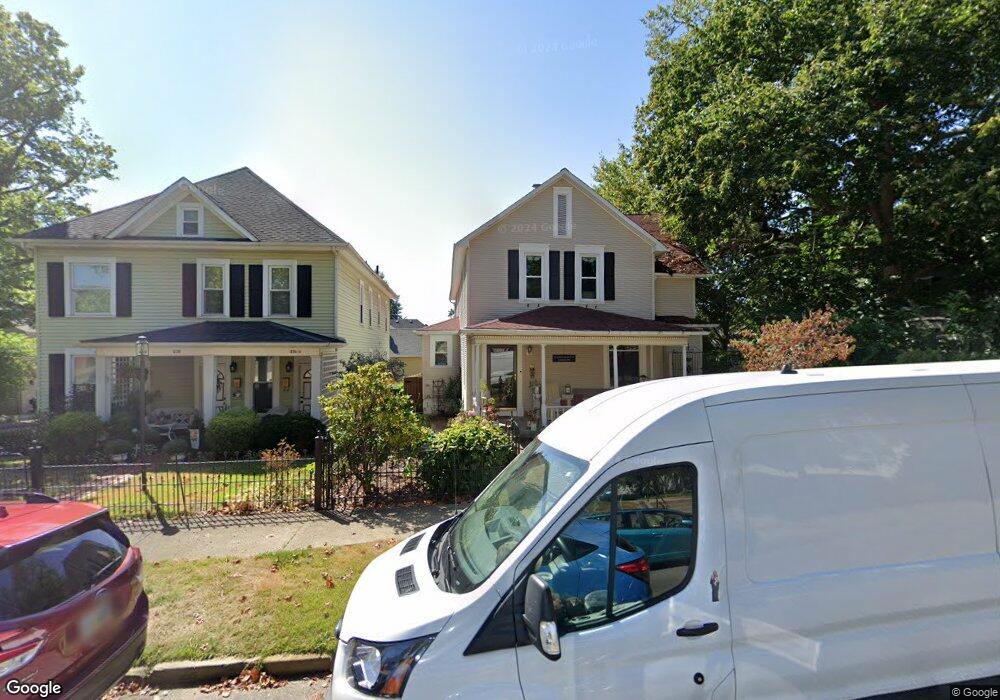
228 E Mulberry St Lancaster, OH 43130
Estimated Value: $290,000 - $377,000
4
Beds
2
Baths
2,230
Sq Ft
$152/Sq Ft
Est. Value
About This Home
This home is located at 228 E Mulberry St, Lancaster, OH 43130 and is currently estimated at $338,160, approximately $151 per square foot. 228 E Mulberry St is a home located in Fairfield County with nearby schools including Thomas Ewing Junior High School, Lancaster High School, and St Mary Elementary School.
Ownership History
Date
Name
Owned For
Owner Type
Purchase Details
Closed on
Jan 2, 2023
Sold by
Pearsall Cynthia S
Bought by
Cynthia S Pearsall Revocable Trust
Current Estimated Value
Purchase Details
Closed on
Dec 30, 2022
Sold by
Arthur E Pearsall Revocable Trust
Bought by
Pearsall Cynthia S
Purchase Details
Closed on
Jan 22, 2016
Sold by
Pearsall Arthur E and Pearsall Cynthia S
Bought by
Pearsall Arthur E
Purchase Details
Closed on
Feb 20, 2002
Sold by
Scheffler David L
Bought by
Pearsall Arthur E and Pearsall Cynthia S
Home Financials for this Owner
Home Financials are based on the most recent Mortgage that was taken out on this home.
Original Mortgage
$184,000
Interest Rate
7.14%
Mortgage Type
New Conventional
Purchase Details
Closed on
Jan 1, 1990
Purchase Details
Closed on
Nov 1, 1987
Purchase Details
Closed on
Mar 1, 1987
Create a Home Valuation Report for This Property
The Home Valuation Report is an in-depth analysis detailing your home's value as well as a comparison with similar homes in the area
Home Values in the Area
Average Home Value in this Area
Purchase History
| Date | Buyer | Sale Price | Title Company |
|---|---|---|---|
| Cynthia S Pearsall Revocable Trust | -- | -- | |
| Pearsall Cynthia S | -- | -- | |
| Pearsall Arthur E | -- | None Available | |
| Pearsall Arthur E | $230,000 | -- | |
| -- | $115,000 | -- | |
| -- | $80,000 | -- | |
| -- | $51,500 | -- |
Source: Public Records
Mortgage History
| Date | Status | Borrower | Loan Amount |
|---|---|---|---|
| Previous Owner | Pearsall Arthur E | $184,000 |
Source: Public Records
Tax History Compared to Growth
Tax History
| Year | Tax Paid | Tax Assessment Tax Assessment Total Assessment is a certain percentage of the fair market value that is determined by local assessors to be the total taxable value of land and additions on the property. | Land | Improvement |
|---|---|---|---|---|
| 2024 | $8,568 | $95,310 | $13,890 | $81,420 |
| 2023 | $3,469 | $95,310 | $13,890 | $81,420 |
| 2022 | $3,365 | $92,140 | $13,890 | $78,250 |
| 2021 | $2,805 | $71,960 | $11,570 | $60,390 |
| 2020 | $2,820 | $71,960 | $11,570 | $60,390 |
| 2019 | $2,555 | $71,960 | $11,570 | $60,390 |
| 2018 | $2,477 | $65,070 | $15,910 | $49,160 |
| 2017 | $2,479 | $66,270 | $17,360 | $48,910 |
| 2016 | $2,414 | $66,270 | $17,360 | $48,910 |
| 2015 | $2,408 | $64,150 | $17,360 | $46,790 |
| 2014 | $2,294 | $64,150 | $17,360 | $46,790 |
| 2013 | $2,294 | $64,150 | $17,360 | $46,790 |
Source: Public Records
Map
Nearby Homes
- 115 E Wheeling St
- 405 N Broad St
- 154 E Main St
- 404 E 6th Ave
- 708 N High St
- 534 E Wheeling St
- 311 E Allen St
- 545 E Main St
- 515 N Columbus St
- 538 E 6th Ave
- 608 E Mulberry St
- 0 N Columbus St
- 230 Lake St
- 629 E Wheeling St
- 521 E Allen St
- 571 E Chestnut St
- 0 N Memorial Dr
- 441 E Locust St
- 0 Slocum Ave
- 220 E Fair Ave
- 230 E Mulberry St
- 256 E Mulberry St
- 250 N Pearl Ave
- 257 N Pearl Ave
- 302 E Mulberry St
- 218 E Mulberry St
- 212 E Mulberry St
- 251 N Pearl Ave
- 251 N Pearl Ave
- 248 N Pearl Ave
- 306 E Mulberry St
- 228 N High St
- 249 N Pearl Ave
- 246 N Pearl Ave
- 222 N High St
- 232 N High St
- 225 E Wheeling St
- 223 E Wheeling St
- 312 E Mulberry St
- 221 E Wheeling St